Snow Observations List
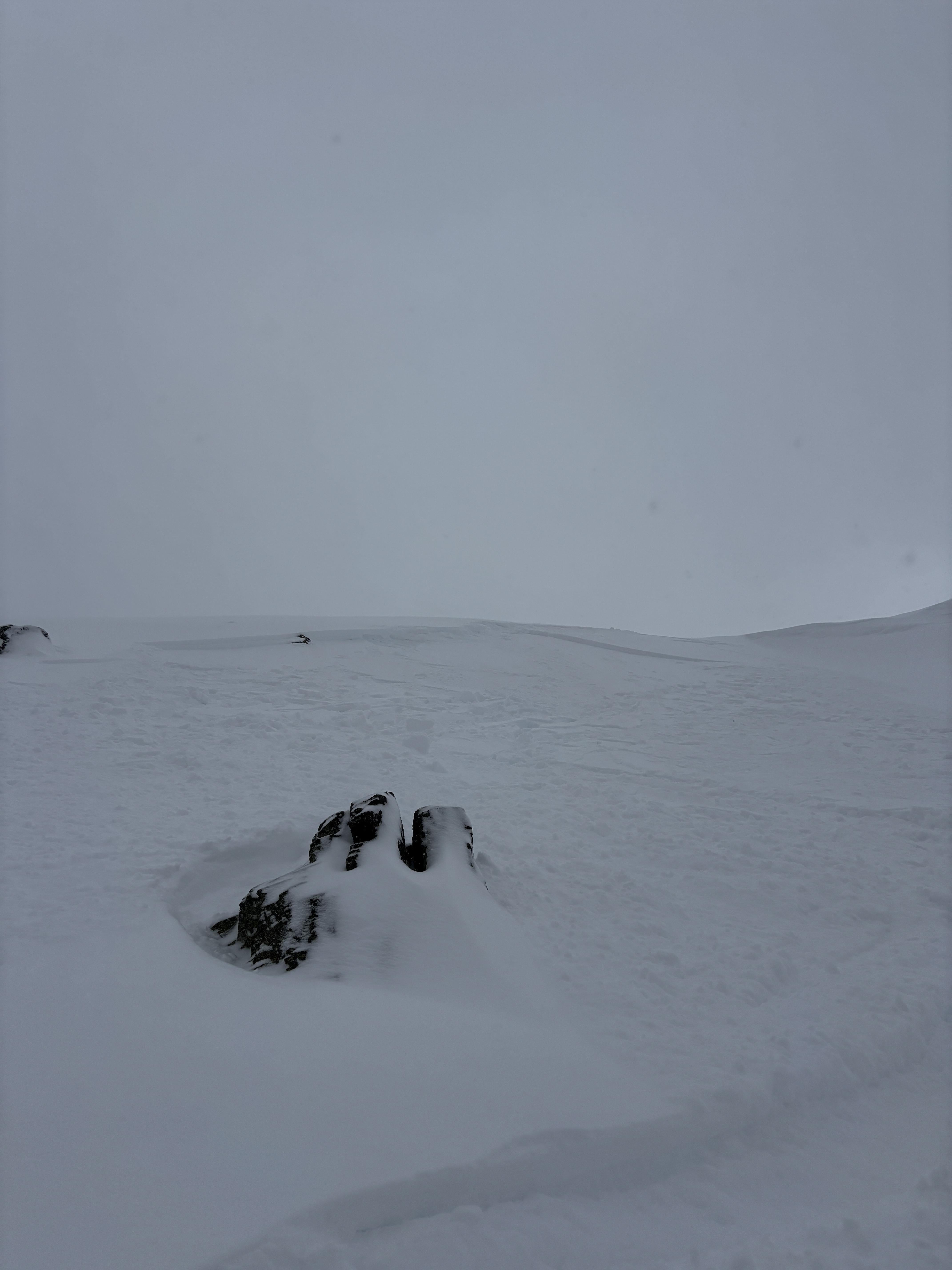
On the summit of Peets Hill we saw a fresh natural wind slab avalanche, around 1130 this morning. West aspect, 5055’ elevation. Relatively harmless to a cat or small dog C1, R2. We also saw similar slides on a slope lower on the hill. Photos attached.
Cold east winds were forming drifts on top of old drifts from previous east wind events. In some spots these old drifts have made the slope steeper than the usual slope of the ground below, essentially creating new/temporary avalanche start zones. The avalanche potential size is currently small, but with the right amount of snow, and probably east wind, there is potential for avalanches that could be large enough to bury or injure a cat (C2) or even a large dog (C3).
In some places my paws punched through into weak sugary snow below, so with big storm or loading event there might be potential for a persistent slab that could hurt a human in a few areas where slopes are steeper than 30 degrees.
HS was shoulder deep on a small border collie where not drifted. There were some old ski tracks as well which looked like more fun to trench through than just walking on the trail.
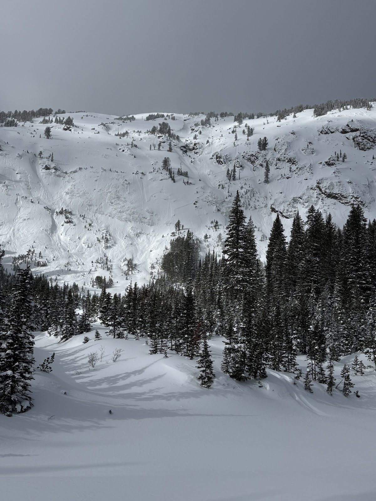
Full Snow Observation Report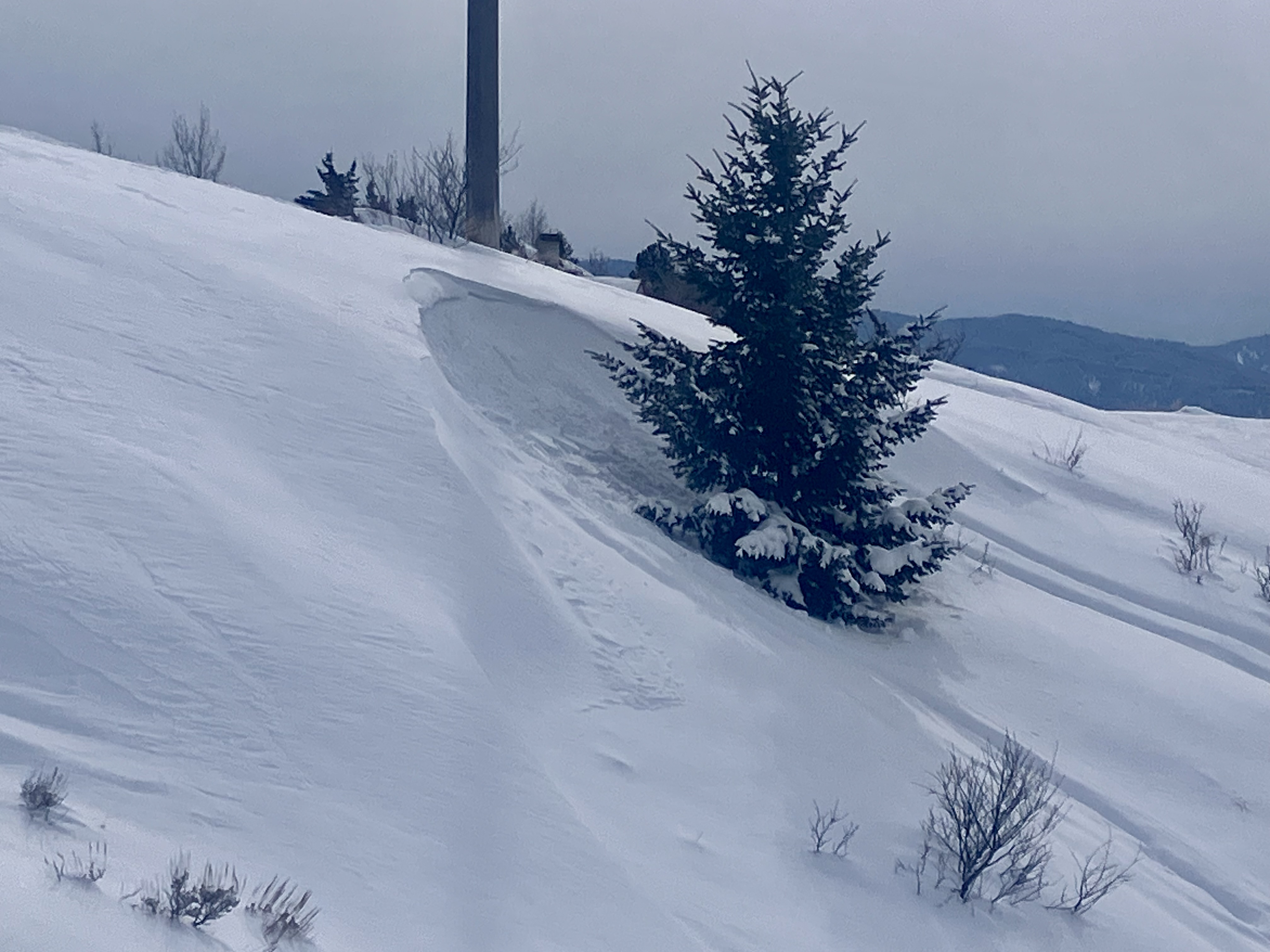

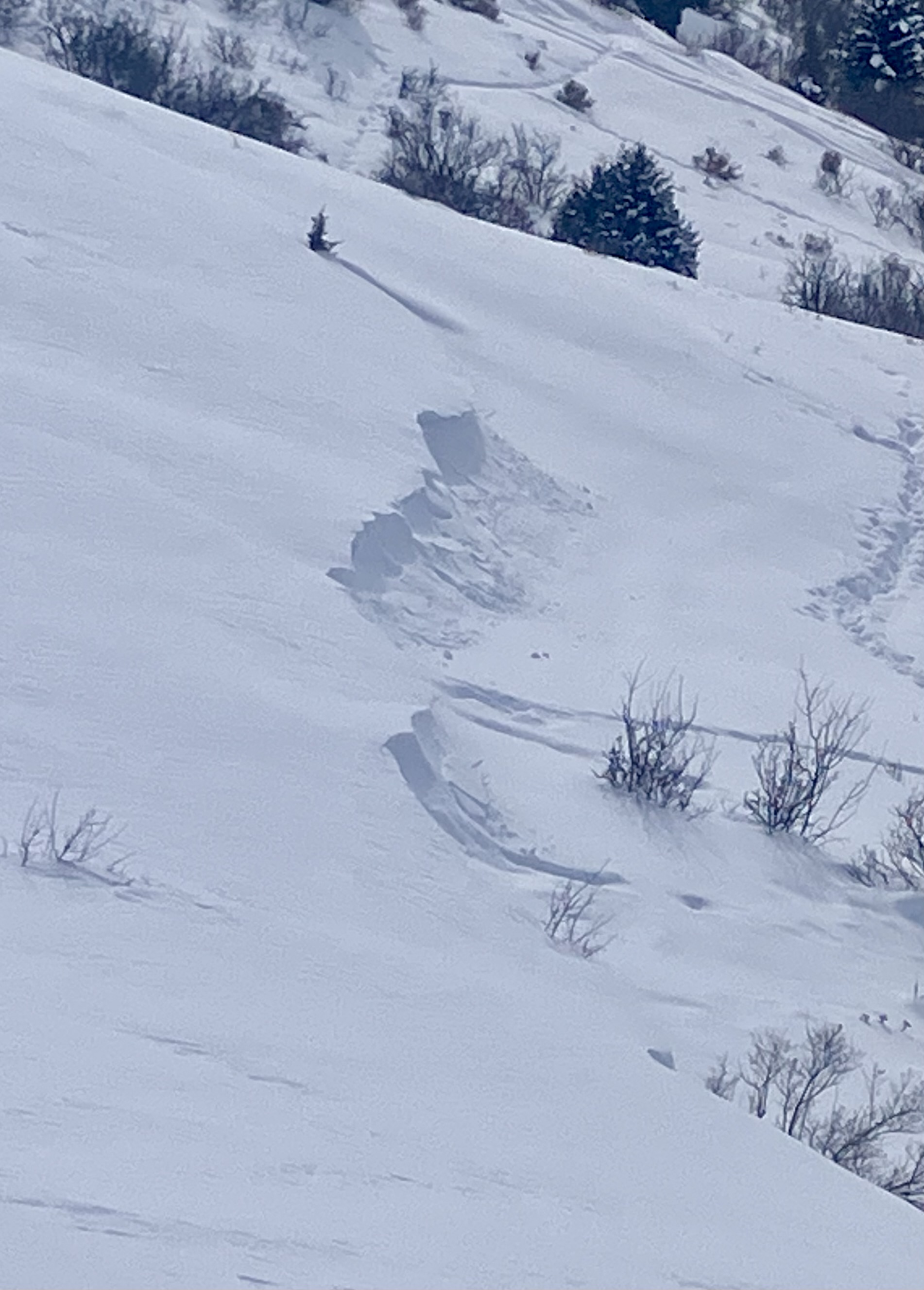
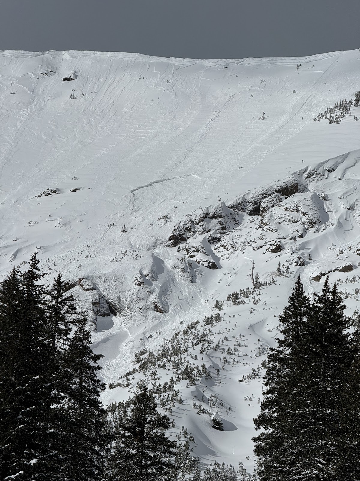
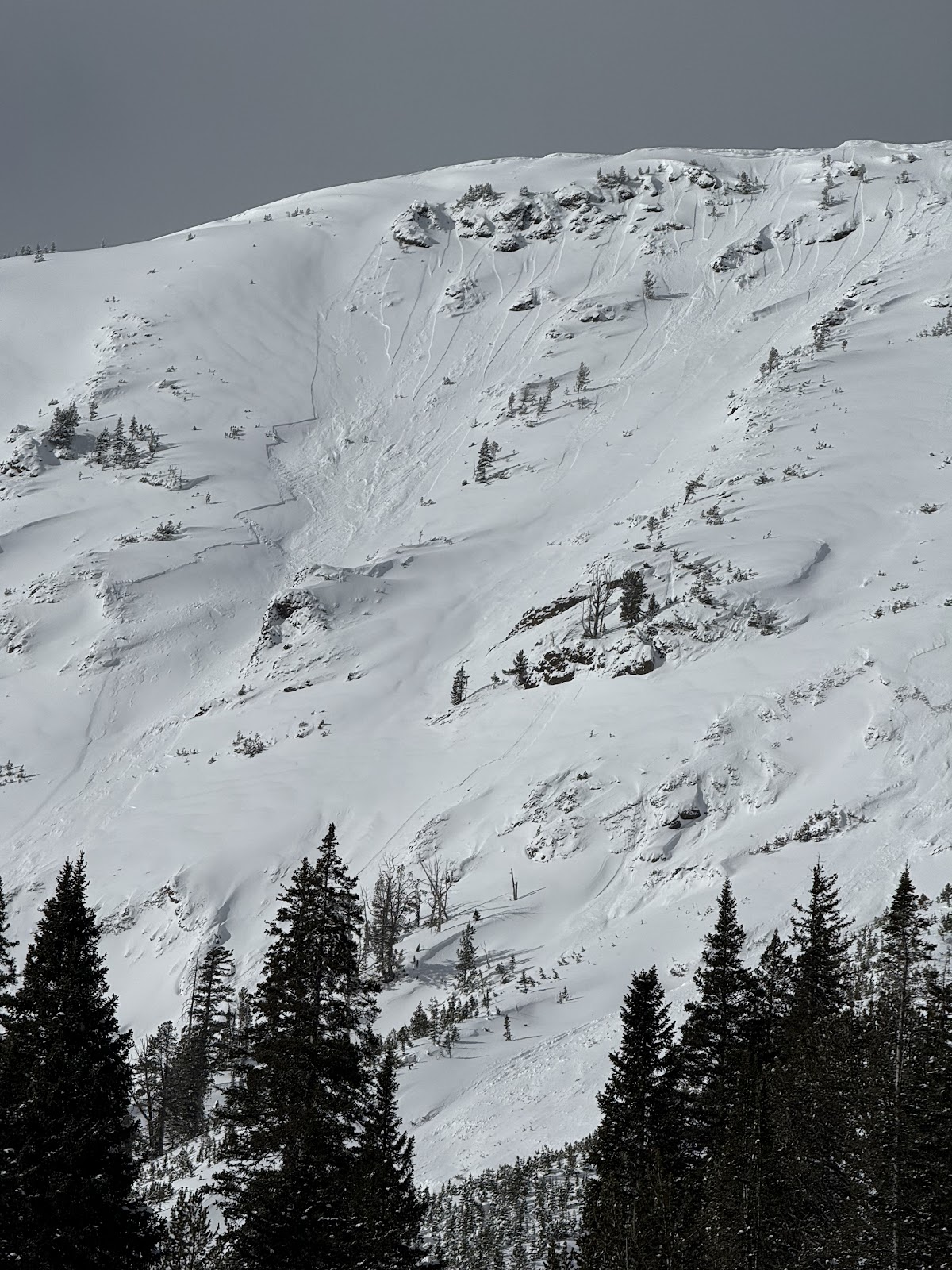
Toured the ramp this morning. We found a lot of snow covering the skin track from yesterday. Little to no wind affect near the ridge, however we did find the occasional deep, slightly stiff drift on more northerly/easterly aspects. While skiing a se facing slope, we found cracking and some cohesion in the new snow. This was mostly on very steep and rocky terrain features. The most notable of these was about 20’ wide, the bottom part of the new slab only moved about 6” before stopping, while the upper foot of the slab ran the full face. Most steep chutes we skinned near had a debris pile at the bottom (running full path).
Full Snow Observation ReportLevel one avalanche class dug multiple pits. ECTN x3 45-60cm down and one ECTP #16 on the same layer below recent storms 50cm down. Height of snow ranges from 155-200cm around Bradley meadows.
Full Snow Observation ReportWe toured into Beehive Basin up and over to Bear Basin down through Spanky's to the valley bottom. A foot of low-density new snow fell with very little wind. The skiing was excellent, and stability was good (for now). The new snow was not behaving cohesively (like a slab) in the terrain we visited, and loose snow avalanches or sluffs were our primary concern. We triggered some loose snow avalanches that quickly picked up speed. These would cause skiers and riders problems in steep or technical terrain but were relatively harmless in open/ non-technical terrain.
Snowpit analysis in the upper-elevation southwest-facing terrain revealed no significant instability, with ECTN scores in the teens and 20s, and no failure at the January layer of near-surface facets. Up and over the ridge on an east-facing slope was also relatively stable (and deep - 230 cm). We did get a repeatable ECTP29 75 cm down from the surface, but no failure on the January surface hoar layer.
We felt comfortable traveling in and around avalanche terrain using our safe travel practices (one at a time on the steeps, beacon, shovel, probe) and staying mindful of the loose snow avalanches.
WE ARE IN A PERIOD OF DYNAMIC WEATHER. WIND or more new snow will change stability, making conditions more dangerous. Pay close attention to signs of increasing instability, such as avalanche activity and shooting cracks.
Finally, because every party needs a pooper... be cautious around tree wells. Non-avalanche-related snow immersion accidents are a very real threat right now.
Full Snow Observation Report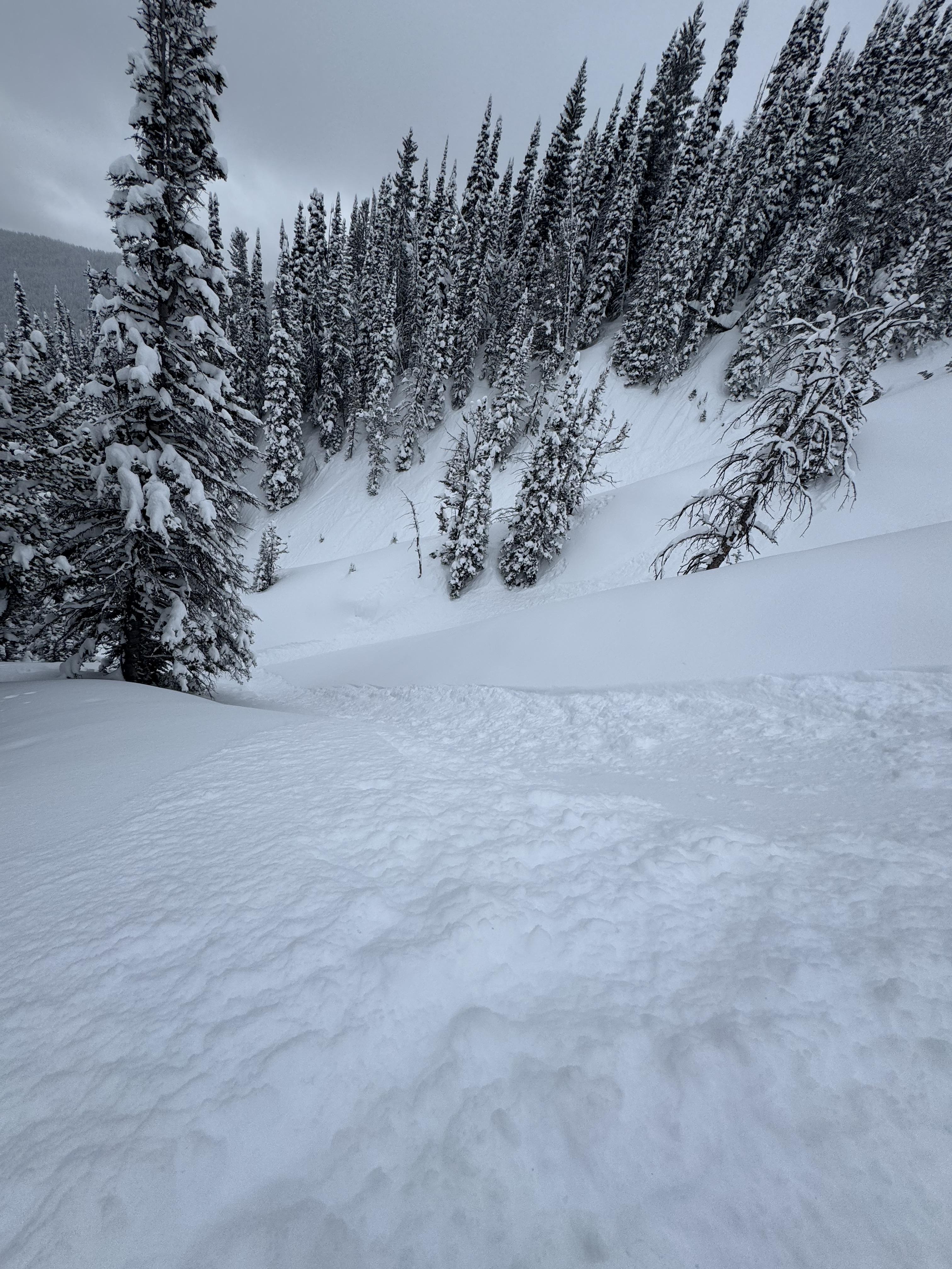

We toured from Gallatin River up to 8000'. Generally strong, deep, snowpack. We did not look at north-facing snow at the lowest elevations - that could be weak but doesn't have much of a load. Pretty amazing to have such good coverage all the way down the to river level.
Full Snow Observation Report

Got an early start on a tour in the Northern Madison range, exploring subalpine terrain.
We observed approximately 15-20” of fresh snow which was unconsolidated, and didn’t observe any wind affected areas, even at mountain tops and ridge tops. Also did not see any cracking as we broke trail and skied over test convexities. The snow was quite light as well, and new snow appeared to be right side up.
Snow pit results were unremarkable on a SE aspect at 9k feet.
Lots of snow available for transport!
Full Snow Observation Report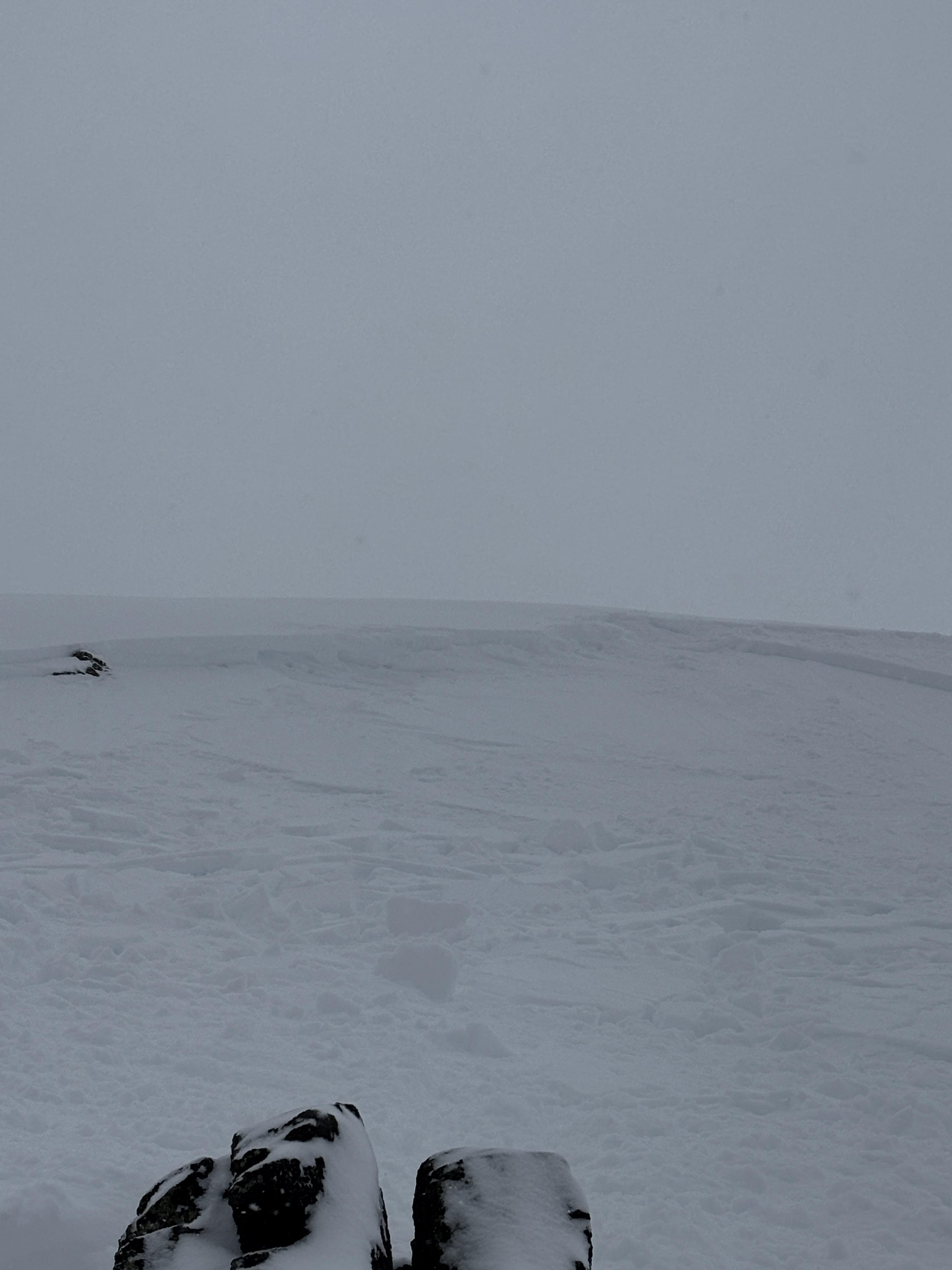
11:40
8017ft
147 SE
HST 85cm
25 degrres
ECTN 14 20 down
CT 11 q1 20 down
ECTN 19 20 down
CT5 q2 20down
12:10
8129ft
33 NE
HST 165 cm
10 Degrees
ECTN 26 34 down
CT 16 Q1 32 down
ECTN 19 30 down
SS-ASc-R1-D.5-I
310 Degrees NW
8129ft
Full Snow Observation Report

From IG message: “Buck ridge, snowmobile triggered avalanche. Propagated storm slab.”
Full Snow Observation Report
After taking a heavy landing on top of a pillow just off the highway past lolo pass road, I looked back up and could visibly see some layer distinction about 8-12” deep. This is the same weakish layer we found in our column test, where we got ect16 just below robs knob. This was on a north facing aspect.
Full Snow Observation Report
In Hayden Creek, we saw many D1-D1.5 wind slab avalanches seen on leeward slopes- east and northeast slopes at and above treeline. We observed cracking in wind loaded areas above treeline. Dug a pit and did a quick ECT on E facing terrain at 9750ft. HS 190-210. ECTN6 30cm deep. No dirt layer.
Full Snow Observation Report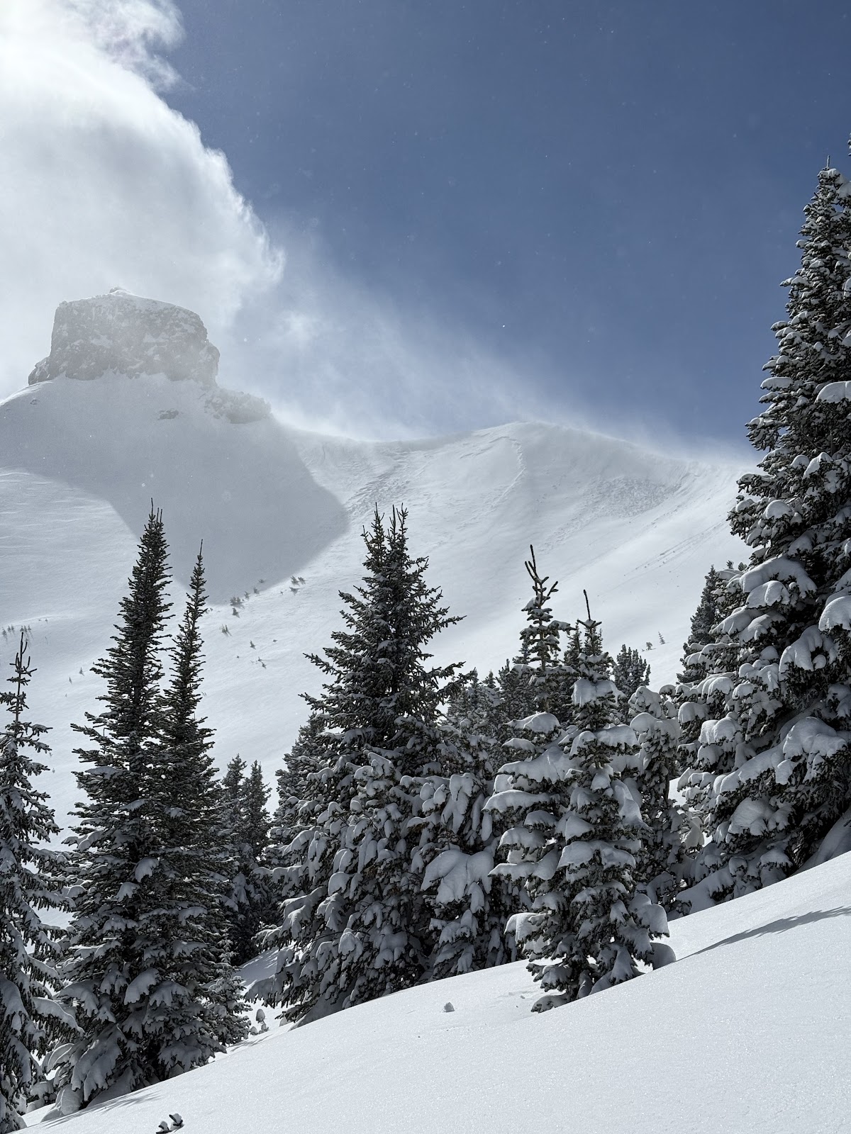
Today we saw a D1 dry loose in the Ghost Couloir. It ran 200 feet. We also felt one small collapse on a south facing slope. No other avalanches observed.
Full Snow Observation ReportAvalanche in Lionhead. Broke on wind slab then triggered persistent slab underneath.
Full Snow Observation ReportHowdy gents! Some pals and I skied the the Throne today. 4-8" of low-med density snow, mostly unaffected by wind. South wind was blowing on and off at 5-15mph throughout the day across the ESE face, and swirling N wind down in the runout below Naya Nuki. Not much for wind transport and we felt good skiing the steep N facing trees and the open snowfield on the NE face. No cohesion noted and storm snow seemed to be bonding well to the underlying varied surface. We did avoid the NE Couloir off the throne as the top appeared to be slabbing up with an isolated S windload. No obvious signs of instability otherwise and fantastic skiing. That said, if the wind starts to ramp up, all bets are off the table in my mind. Washboards on the road in were f@ckin' brutal, but the parking lot was easy/ semi plowed.
cheers, Turnage
(406) 580-3636
Full Snow Observation ReportSkied Ellis yesterday, good snow but quite busy. Dug a pit at ~8000’, ENE aspect. No failure in ECT with snowpack from 130-140cm. Bit of a crust/layer ~ 30cm below surface on open, exposed slopes but not present in forest. Minor wind impact on top slopes, zero wind impact below ~7800’.
4-6’’ wind slabs cracking on test slopes on W aspects at upper elevations today
Full Snow Observation ReportSledded up storm castle. Spent the majority of the day skinning and skiing NE to NW aspects. Found debris from multiple R1-D1 wind slabs from earlier this week. Found widespread but inconsistent wind slabs (2"- 6" thick) at elevations 6700' to 8400'. Throughout the day cracking and collapsing was noticed multiple times on areas of stiffer snow. Snow quality changed dramatically from powder turns to thick wind crust with no visual surface difference.
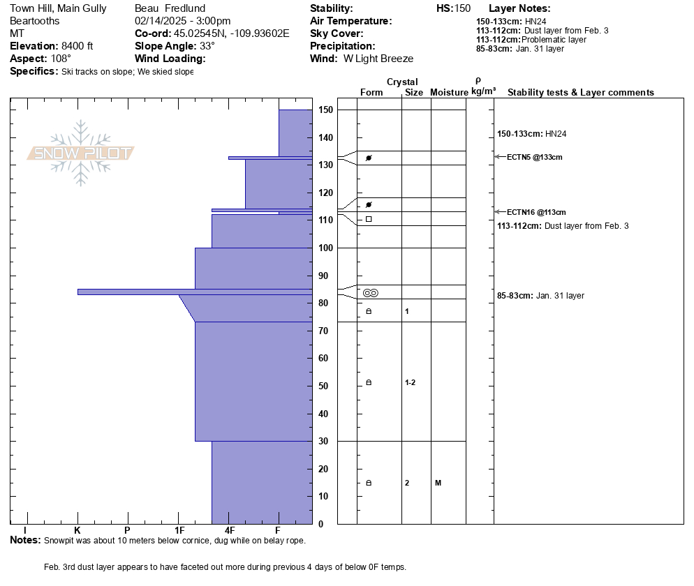
Full Snow Observation ReportRecent snowpits attached from mid elevation E, and SE aspects near Cooke City.
Of note, it appears that the Feb. 3 dust layer, perhaps has become weaker/ more faceted with the recent below 0F temps of the last 4 days. Will continue to monitor this layer of concern as the weekend storm progresses.
Full Snow Observation Report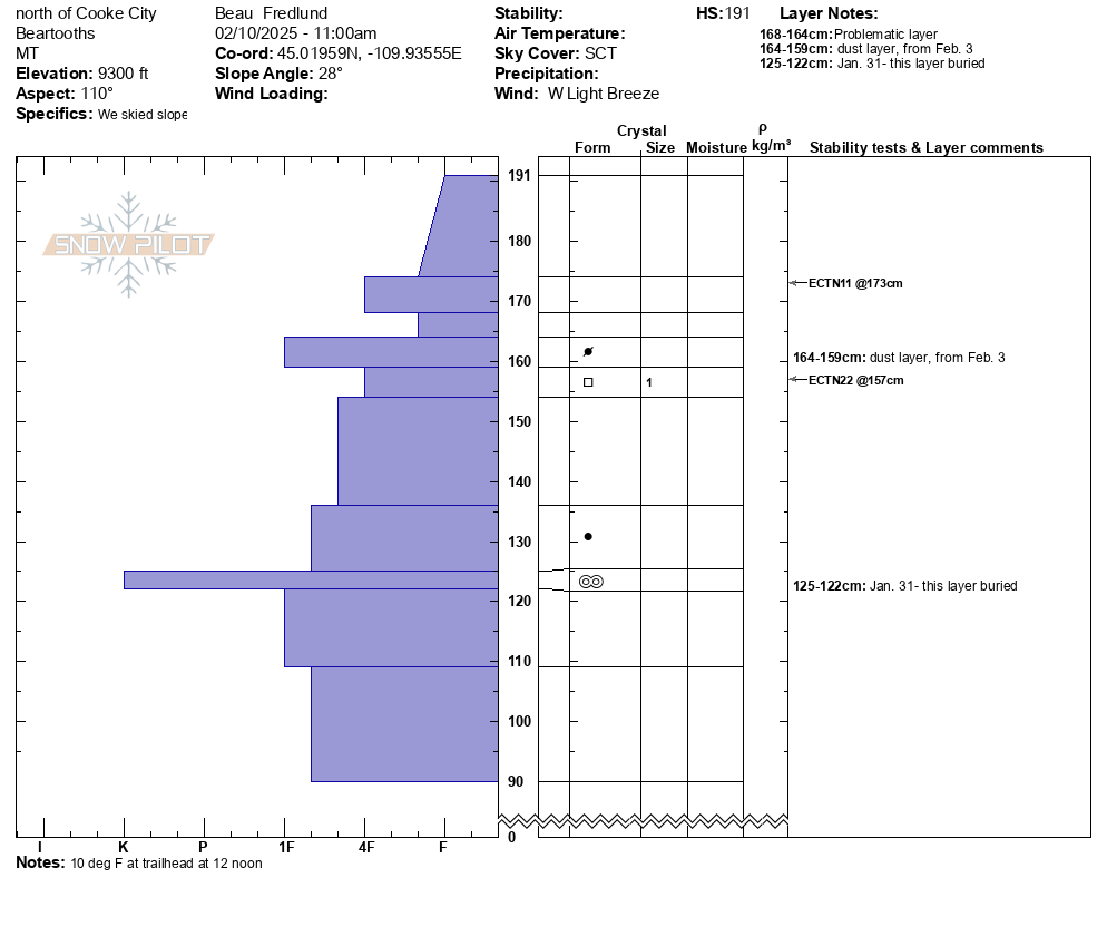
We toured into Specimen Creek today and rode on E-SE and W aspects. Though more snow exists in this location than is typical, the snowpack here is still shallow and weak.
Our snow profile on a W aspect at 8100' showed us some of the weakest snow structure we had seen this season. Sugary, large-grained facets and depth hoar spilled out of the pit wall at the ground. In this location, a 6" slab sits atop this weak snow, but was not cohesive enough to get unstable test results (HS: 90, ECTX).
Outside of very weak structure, no other signs of instability like cracking, collapsing or recent avalanches were spotted.
While the state of the snowpack now provides better coverage and riding than usual, expect to see a jump in avalanche danger on these shallow, weak slopes when/if they receive another good round of snowfall.
Full Snow Observation Report

We snowmobiled and skiied around the northern bridgers yesterday. Found lots of wind effect. Most faces had been wind scoured, some protected south facing slopes were wind loaded. Noted a few small natural slides, one other group reported to us that they popped a wind slab on a south facing slope. We bailed on our bigger objectives and found some decent snow in a sheltered south facing chute, we did not experience any instability on this but I'm sure on other slopes we would have seen wind slabs. A thicker wind crust was developing in most areas. Snow pack seemed really solid and deep, except near cliffs and hidden rock piles, were we found facets to the ground.
Full Snow Observation Report