Snow Observations List
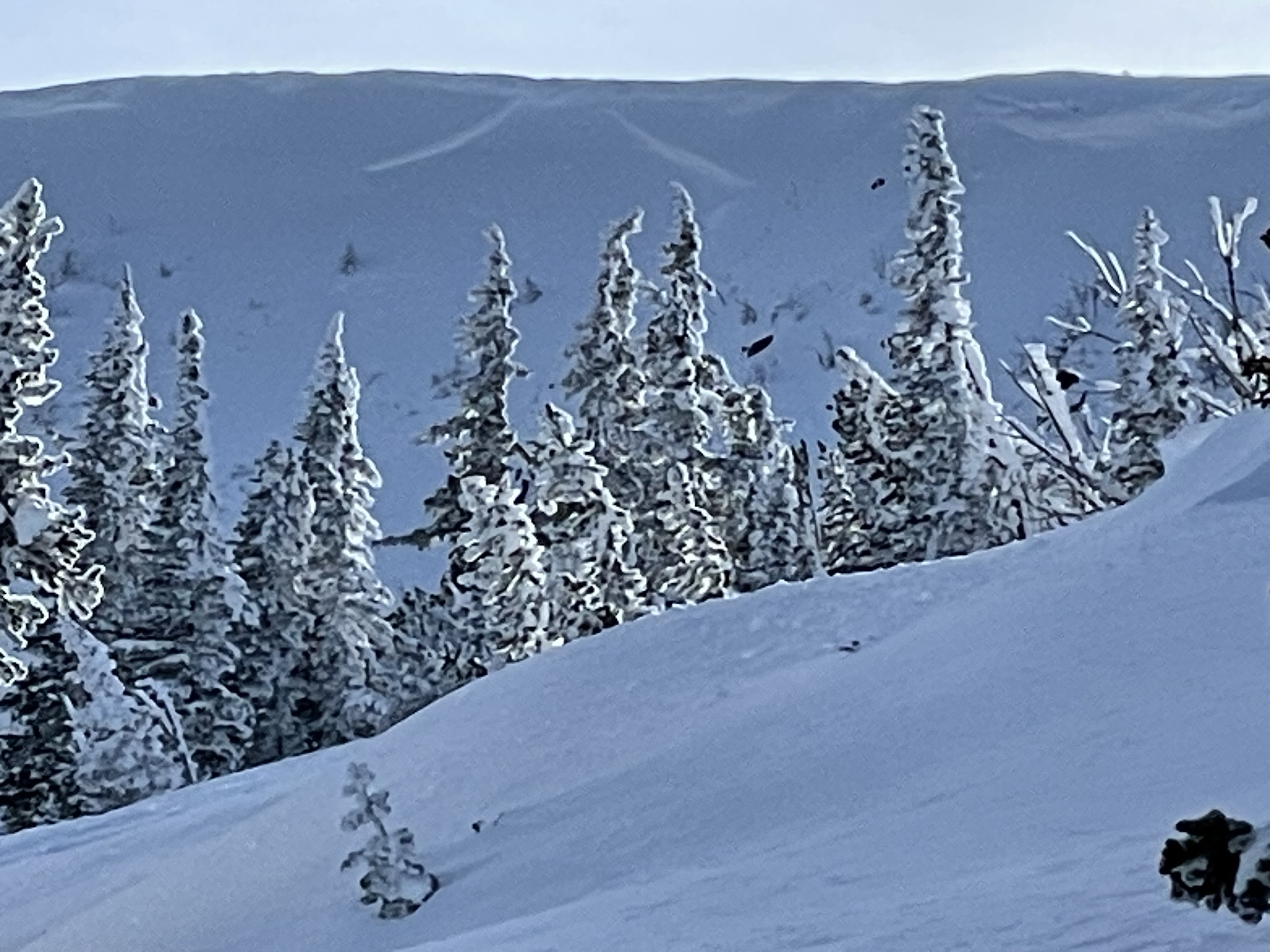
From IG message: "We remotely triggered this hillside in Taylor's fork yesterday [2/21] from the Ridgeline above it. We were looking for a safe spot to drop down when it released below us. Circled around for some pictures. The snow was pretty shallow, only 2-3 feet deep, and slid to the ground. South facing slope"
Full Snow Observation Report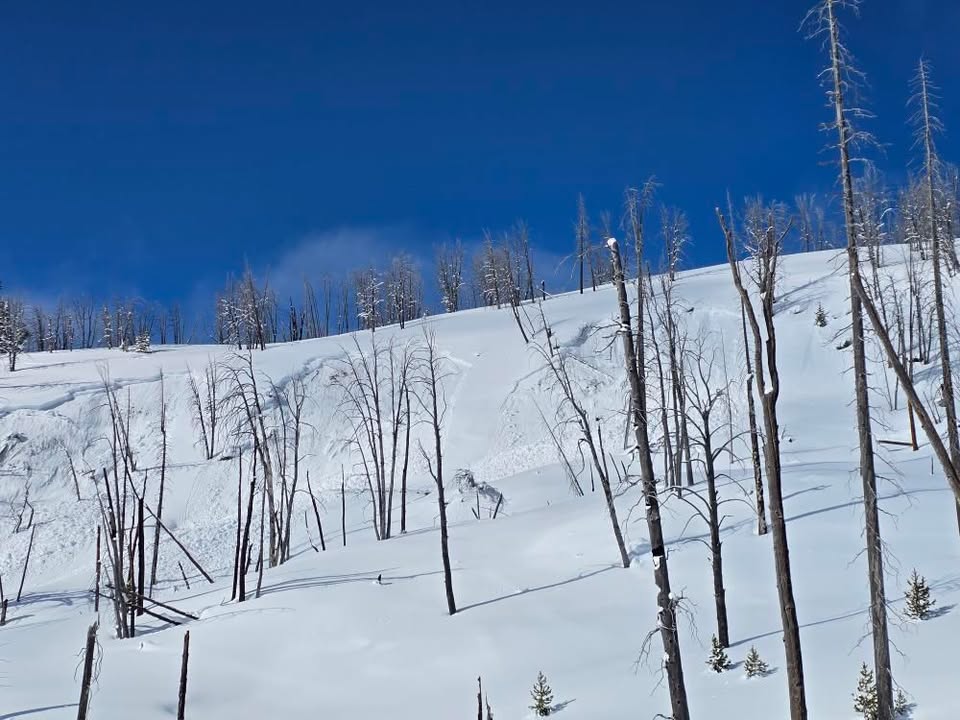
Observation up in Big Belts North of Baldy, by the Hut meadow. 8600FT, 22 Deg Slope, NorthEast Slope. Open Meadow.
46.46385, -111.24431
Snow Depth, 225Cm+
Windy as hell. Thur - Sunday 40-70MPH above treeline from SW to W to South.
ECTN20 @195CM. Slabby Conditions from wind deposition but generally right side up snow.
Significant crowns in vicinity 2-6ft deep 200ft lengths in the steep E Facing bowls nearby.
Full Snow Observation Report
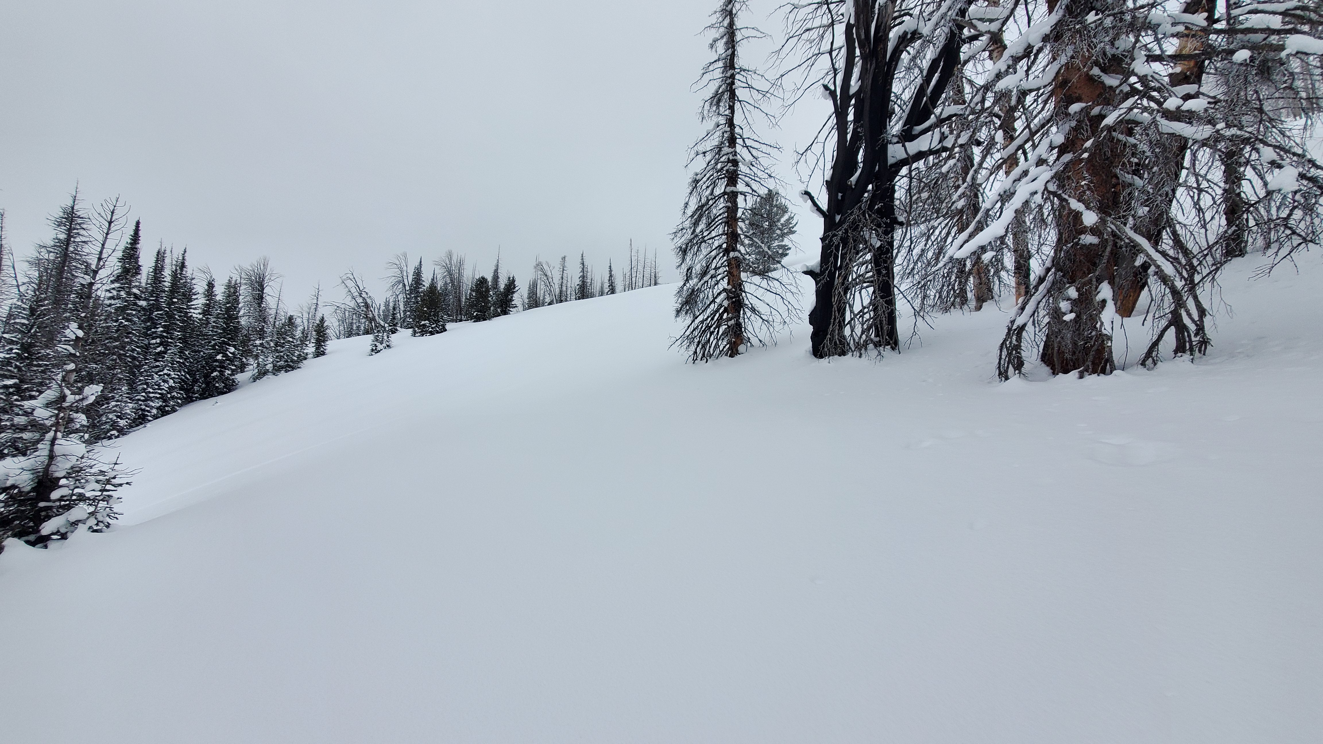
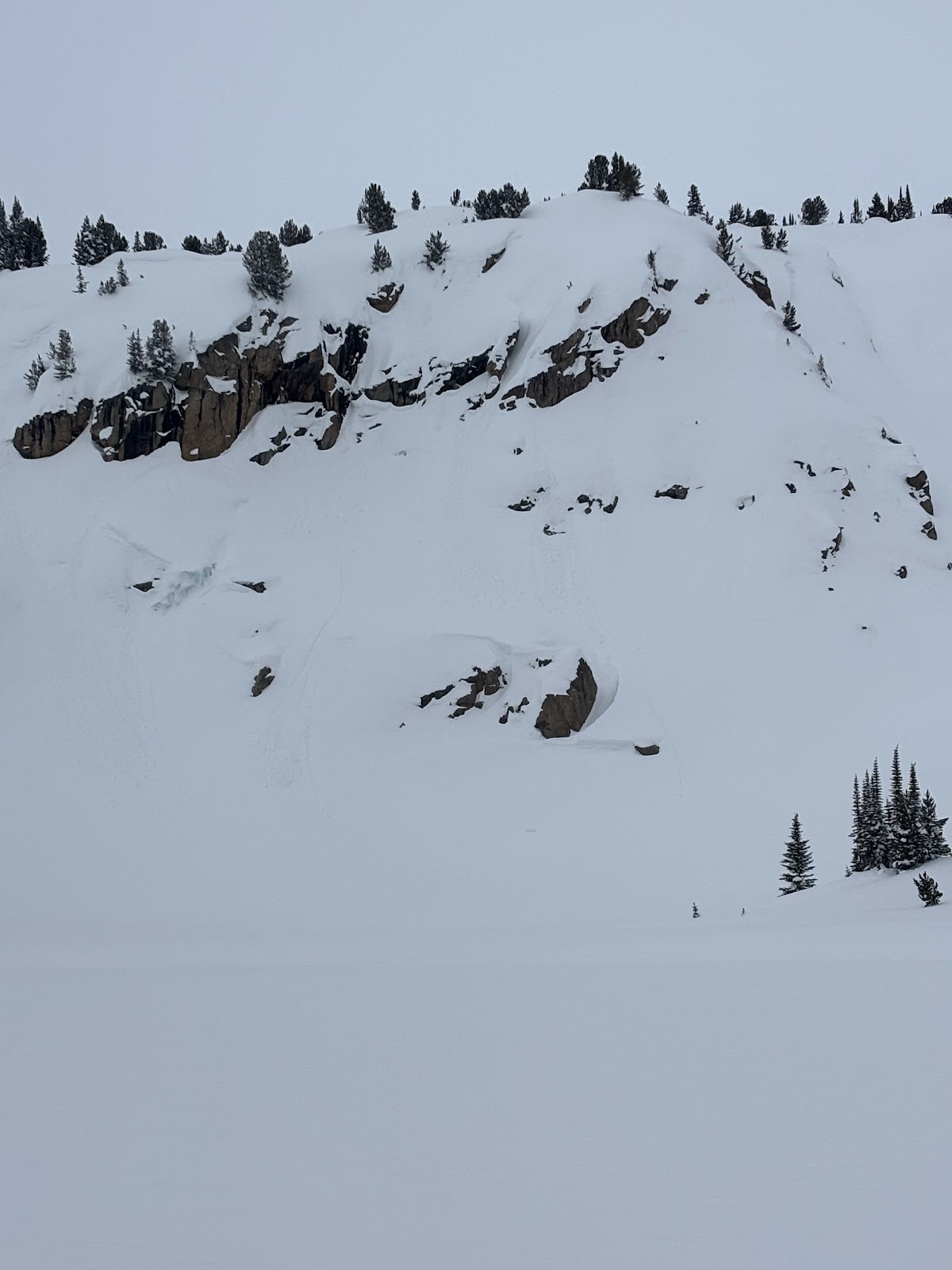
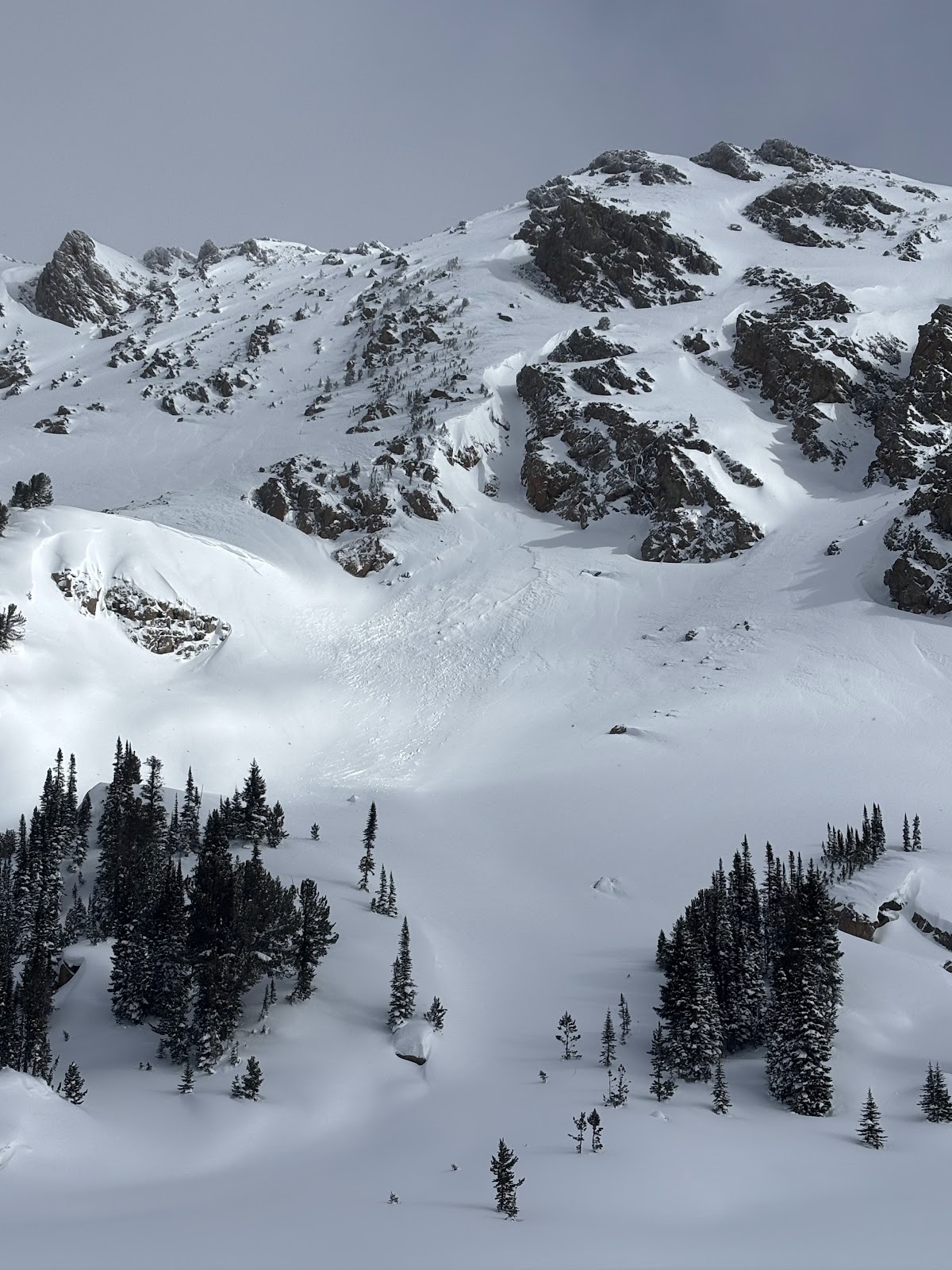
Clear skies, sunshine and great visibility today allowed us to cover a lot of ground in the Southern Madisons. We traveled up the Taylor Fork to the weather station in Sunlight Basin, over to the head of Carrot Basin, through Sage Basin and up and over into Cub and Cabin Creeks.
Winds were light all day and only picked up later in the afternoon, gusting moderately from the south in the parking lot. Solar aspects moistened in the upper 1-2" of the snowpack, but we noted minimal signs of wet snow instability.
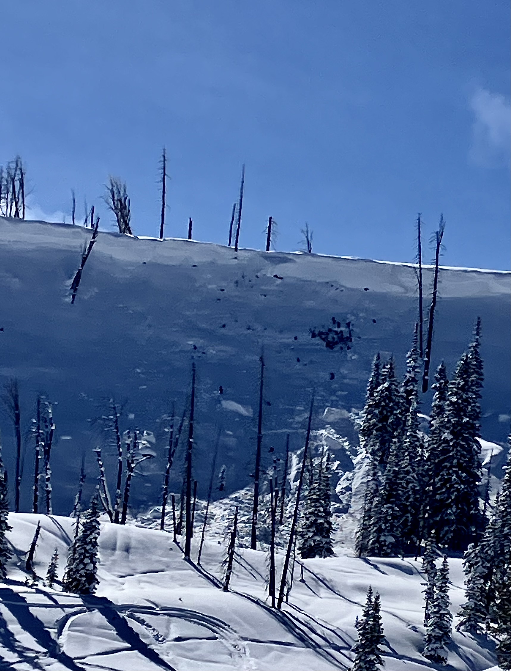
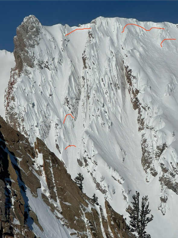
We came to the Taylor Fork searching for signs of instability from persistent weak layers and wind slabs, and we found both. We saw up to five recent avalanches from the last few days. 1-2 looked to have failed on PWLs, and the rest were wind slabs. Cornice collapses triggered at least two of these avalanches.
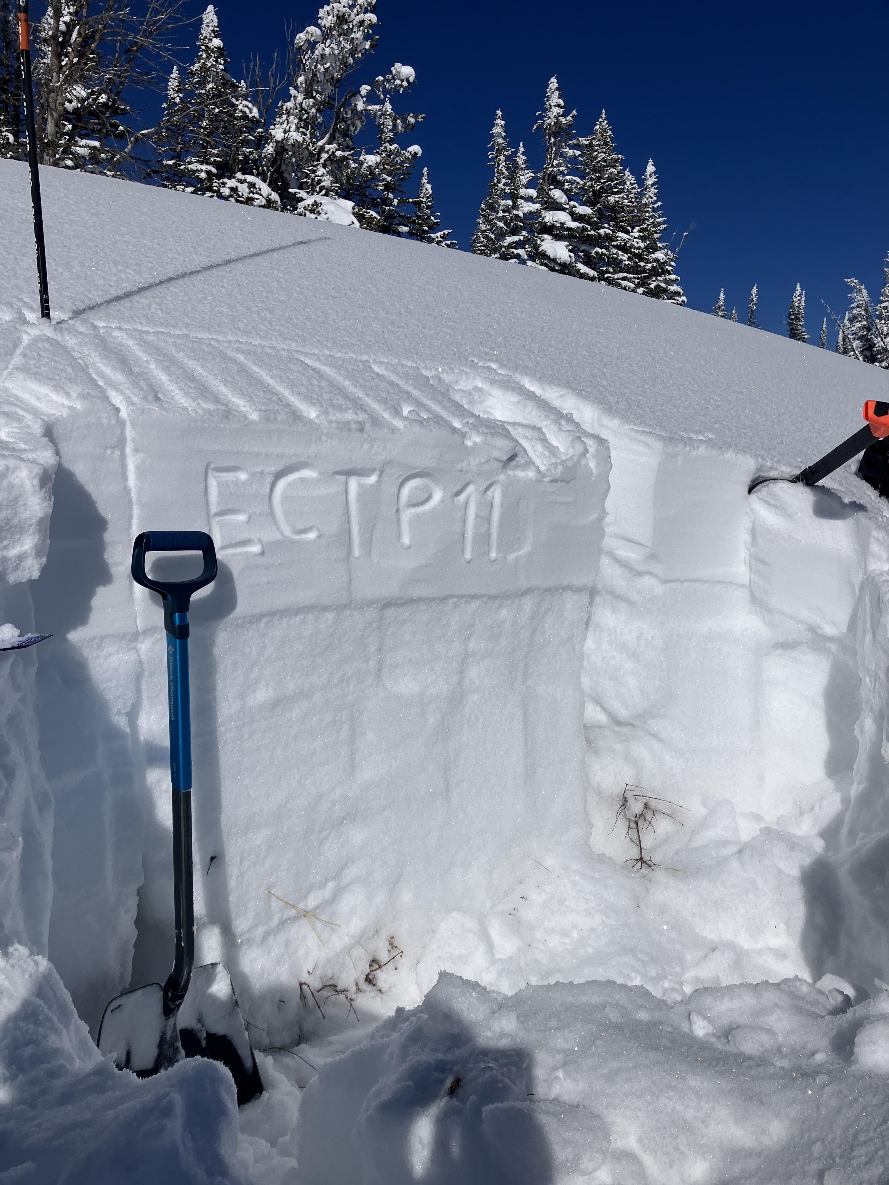
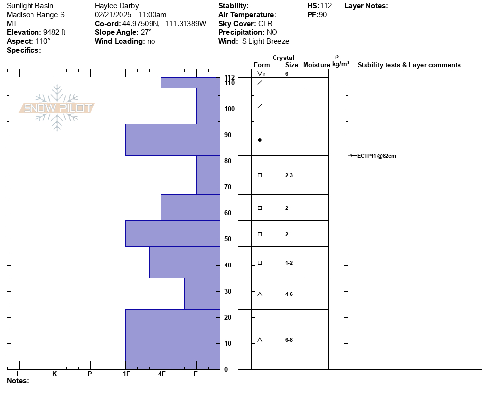
Outside of recent avalanches, a few other red flags jumped out at us. While traversing to our pit site in Sunlight Basin, we triggered a whumpfing collapse and a shooting crack up to 100' long across an adjacent slope. This snowpit on a SE aspect was made up of a dense slab of recent snow, sitting on top of many different layers of junky, faceted grains. Propagation was easy to find (ECTP 11, HS: 112). We also dug snowpits on N and SW facing slopes. While we found weak snow on these slopes, the N (ECTPX) and SW (ECTP25), the snowpack was deeper in both areas and the weak layers were less developed. When compared to what Alex and Mark found three weeks ago in this area, these instabilities are becoming less widespread and more stubborn to trigger, but an avalanche breaking on these weak layers is still possible.
Full Snow Observation Report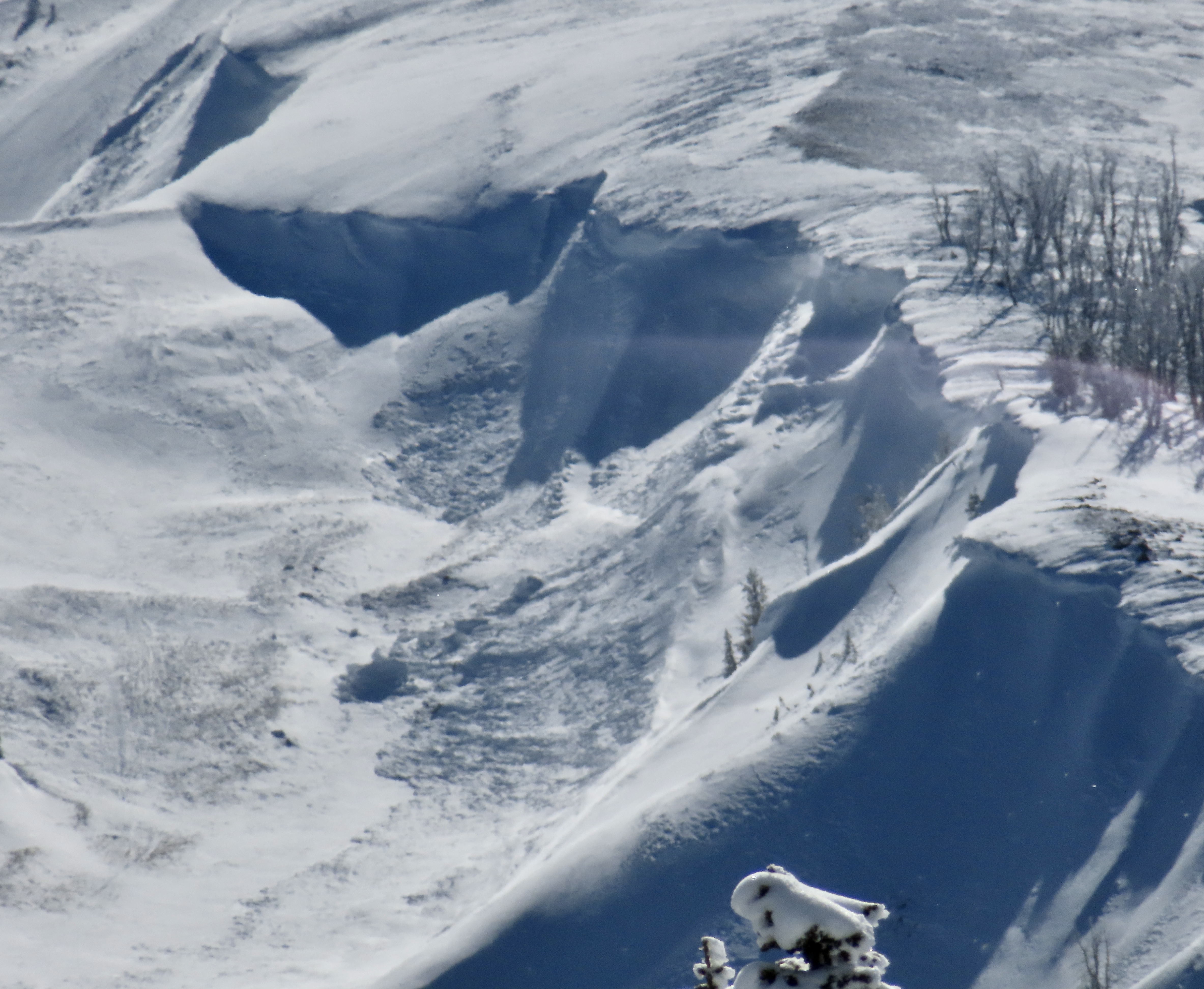

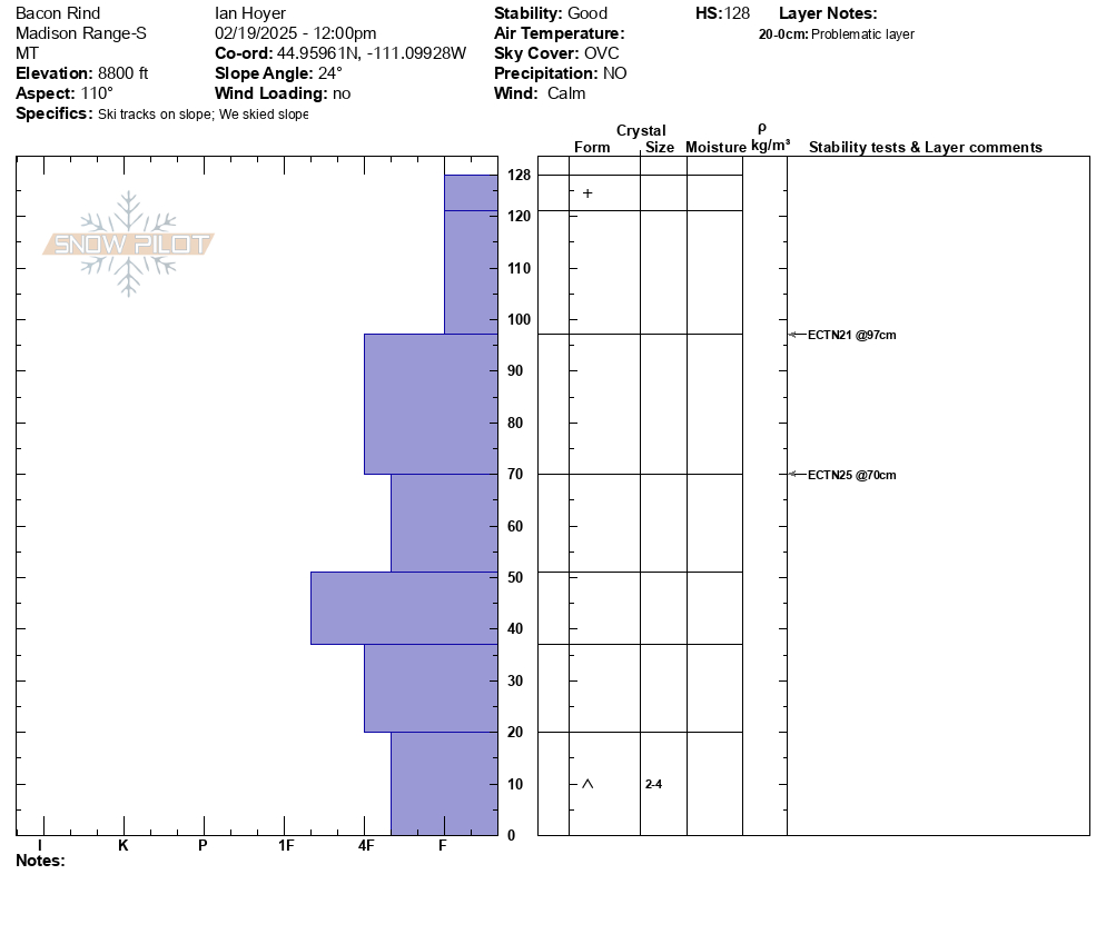
Skied the Bacon Rind Skillet on 2/21 based on the GNFAC's good report from their snow pit on 2/19 and had no signs of instability. Wind on 2/21 was from the SE and was moving some snow around down low (filled in the old skin track) but things were sheltered in the trees. Not much drifting in the meadows towards the top either. There was a thin melt/freeze crust formed on solar aspects lower down (up to ~500 feet above the parking). We were there from about 10:00 - 14:00 and it was cloudy all day, the snow never got very wet or heavy.
Full Snow Observation Report
Sooooo many pin wheels coming down in the Gallatin canyon today on my way home from work. I was driving and couldn't get a full look, but half way through the canyon, it looked like a whole, relatively small, slope slid, maybe propagated 50-75ft on the west facing side of the road.
Full Snow Observation ReportToday we observed a couple day old wind slabs in steep SW facing terrain on Mt Zimmer. Also, a wet loose occurred sometime today between 11-2 pm on S facing terrain nearby
Full Snow Observation Report
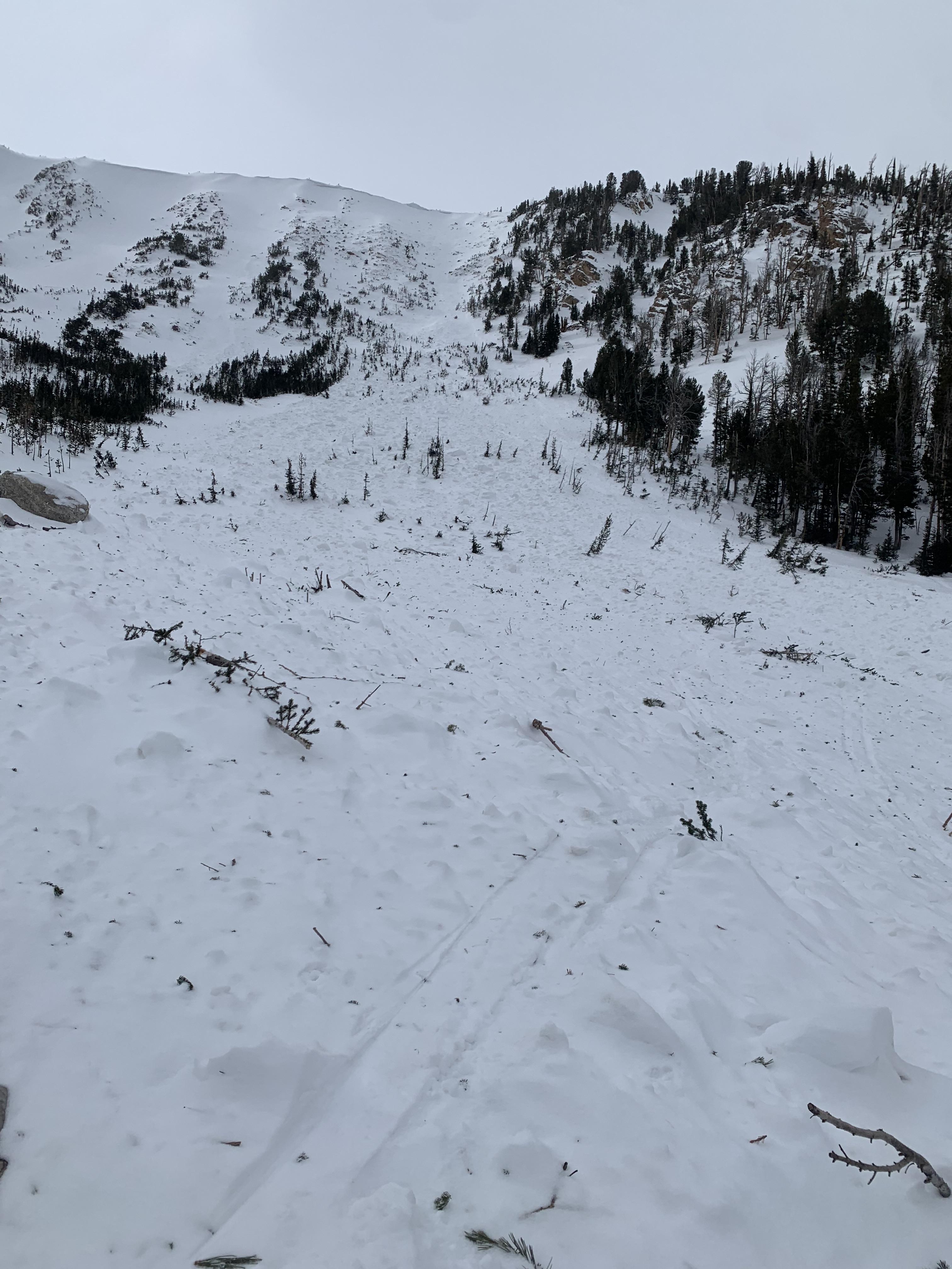
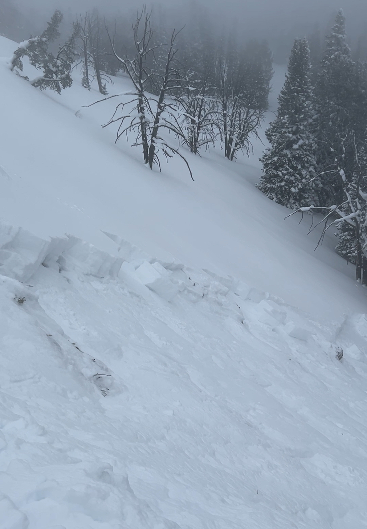
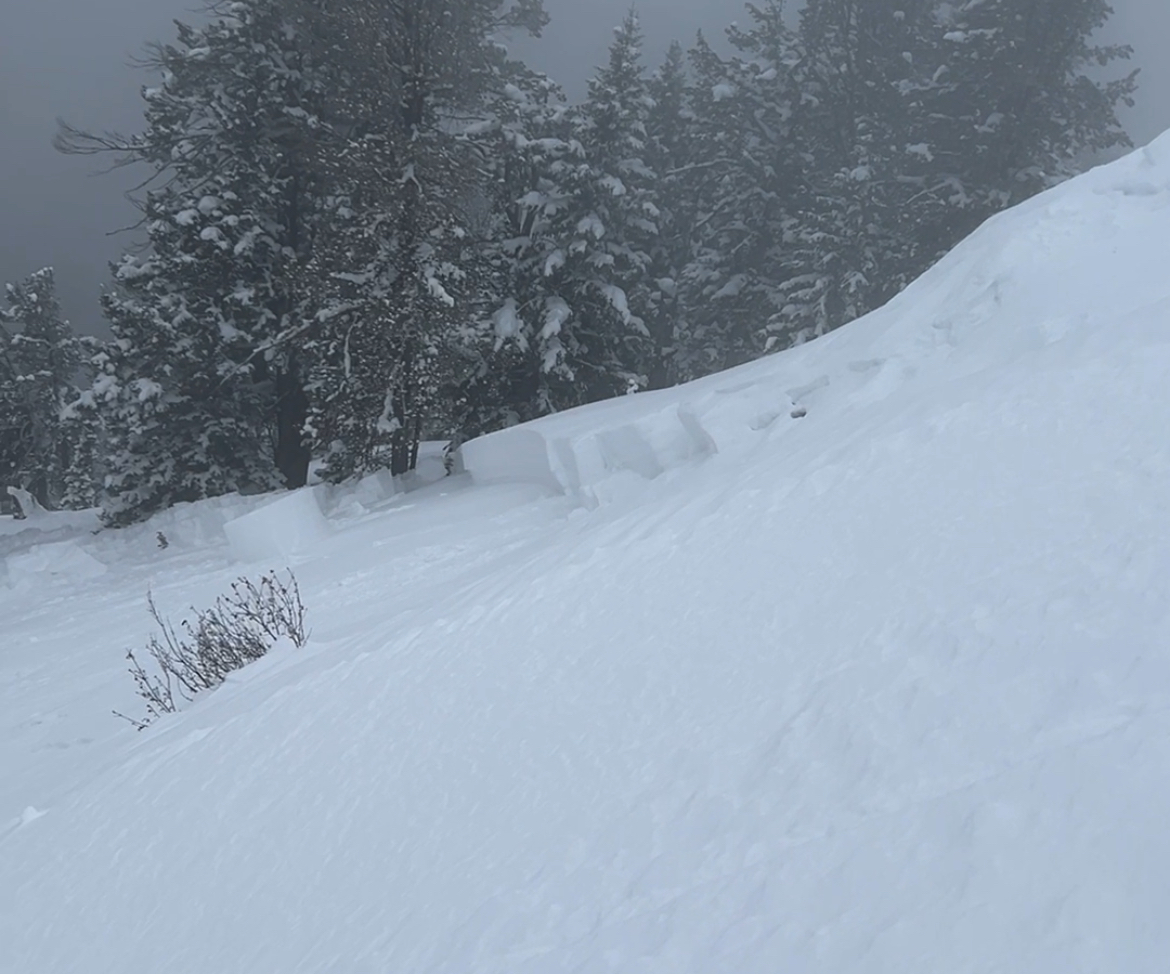
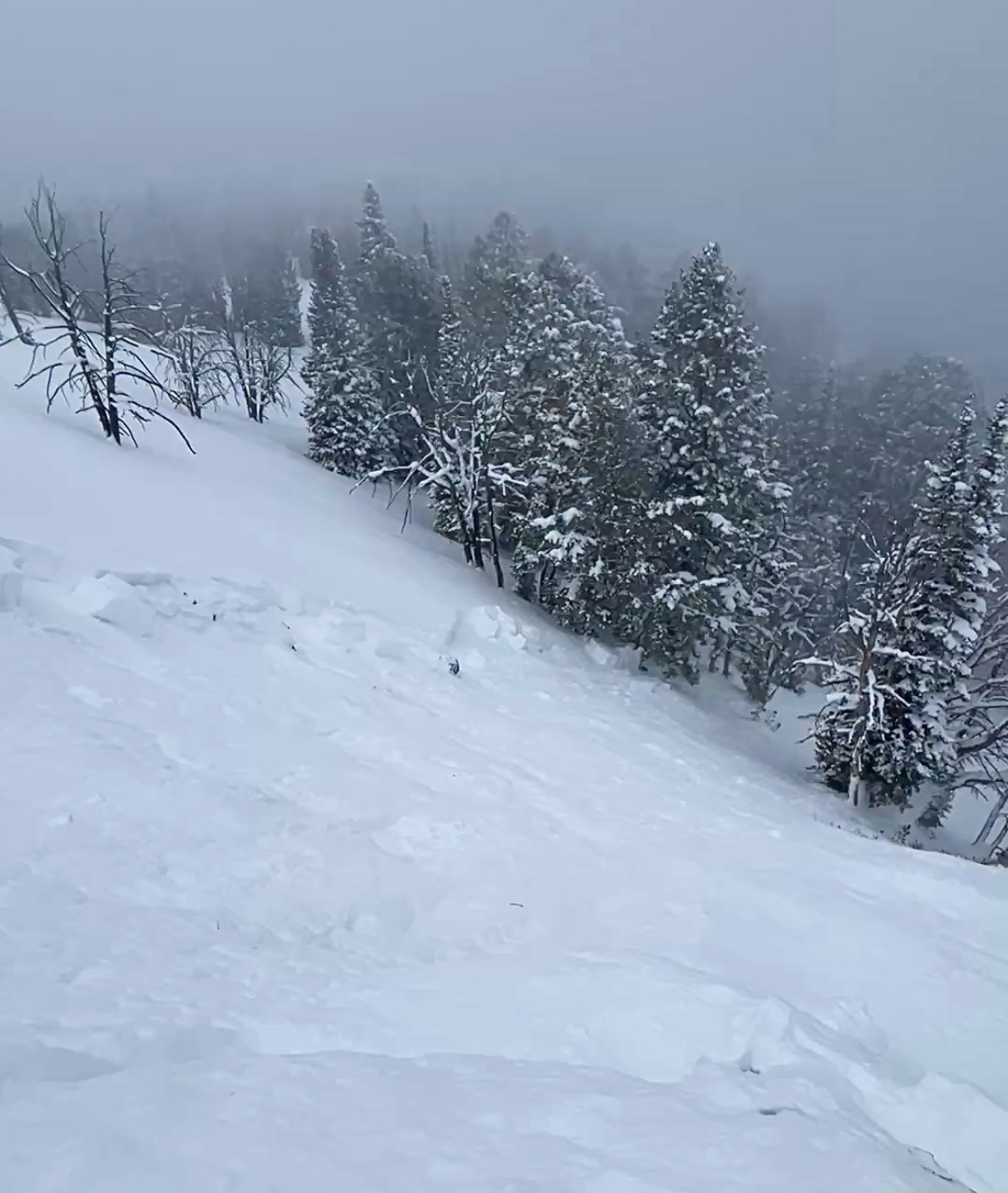
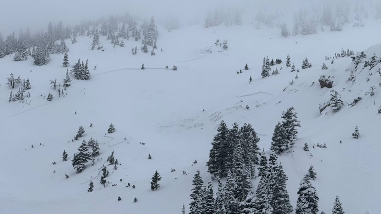
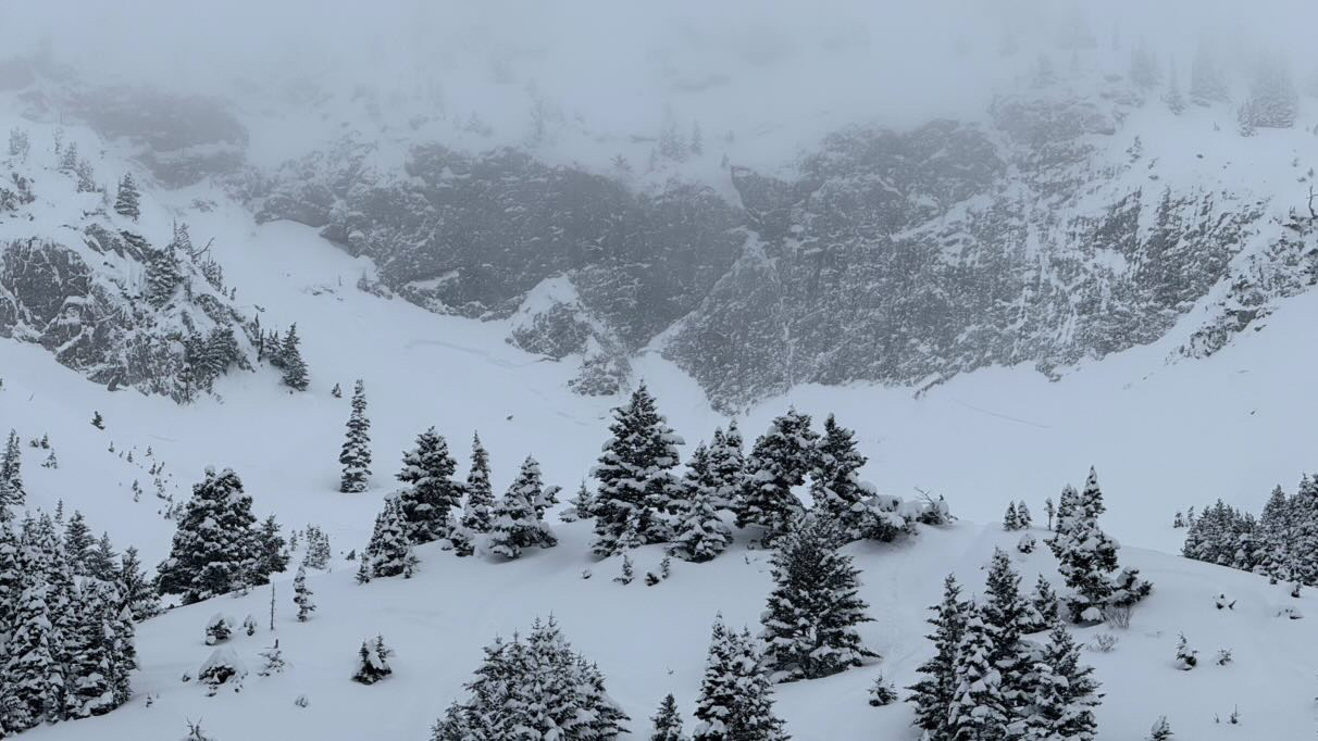
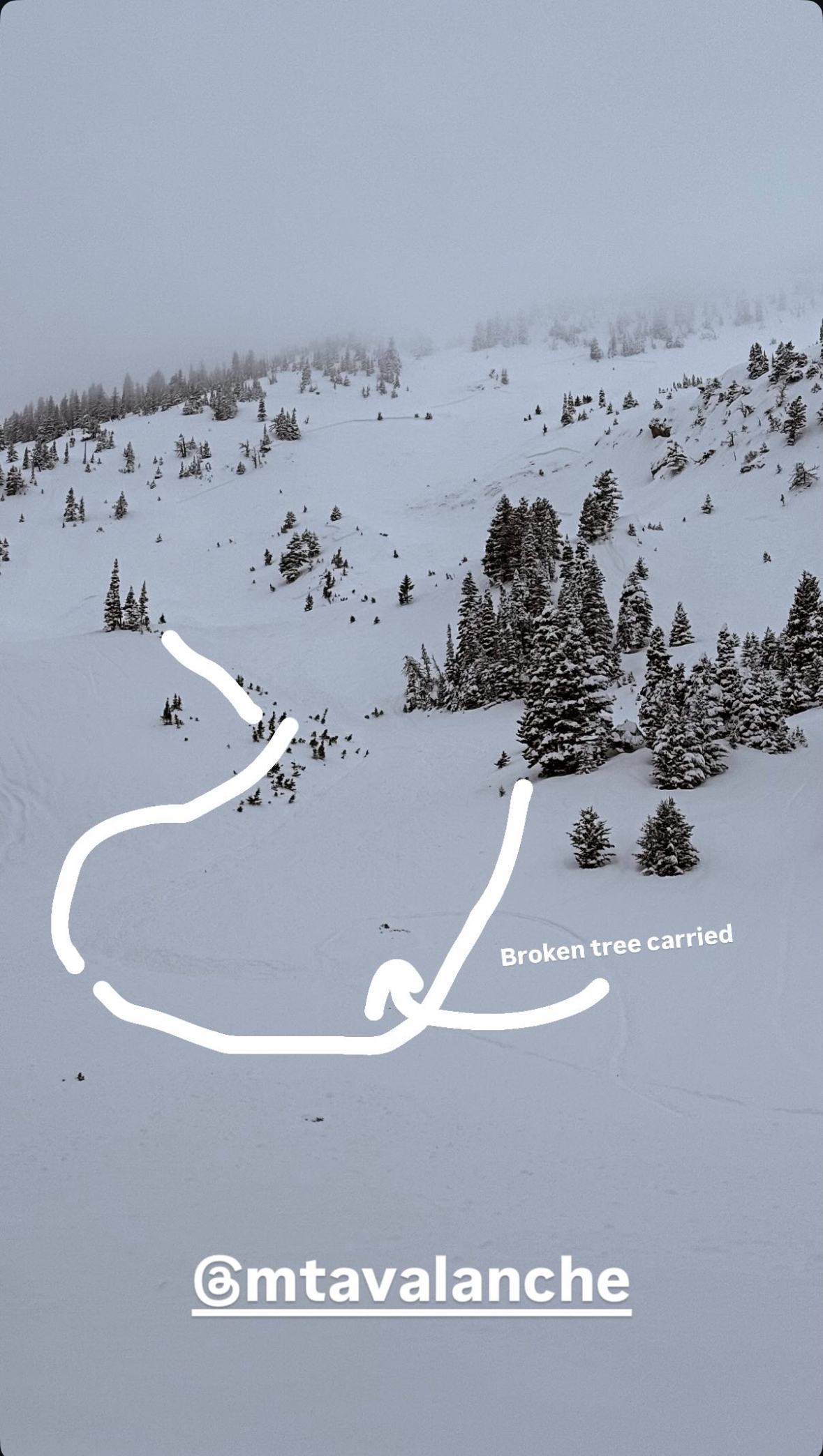
Mark, Dave and Brian DiLenge from IDPR rode up Denny Creek and out across below Lionhead Ride. Fog and low clouds made visibility tough but we bounced along the treelines and felt our way across to Moto Hill and back.
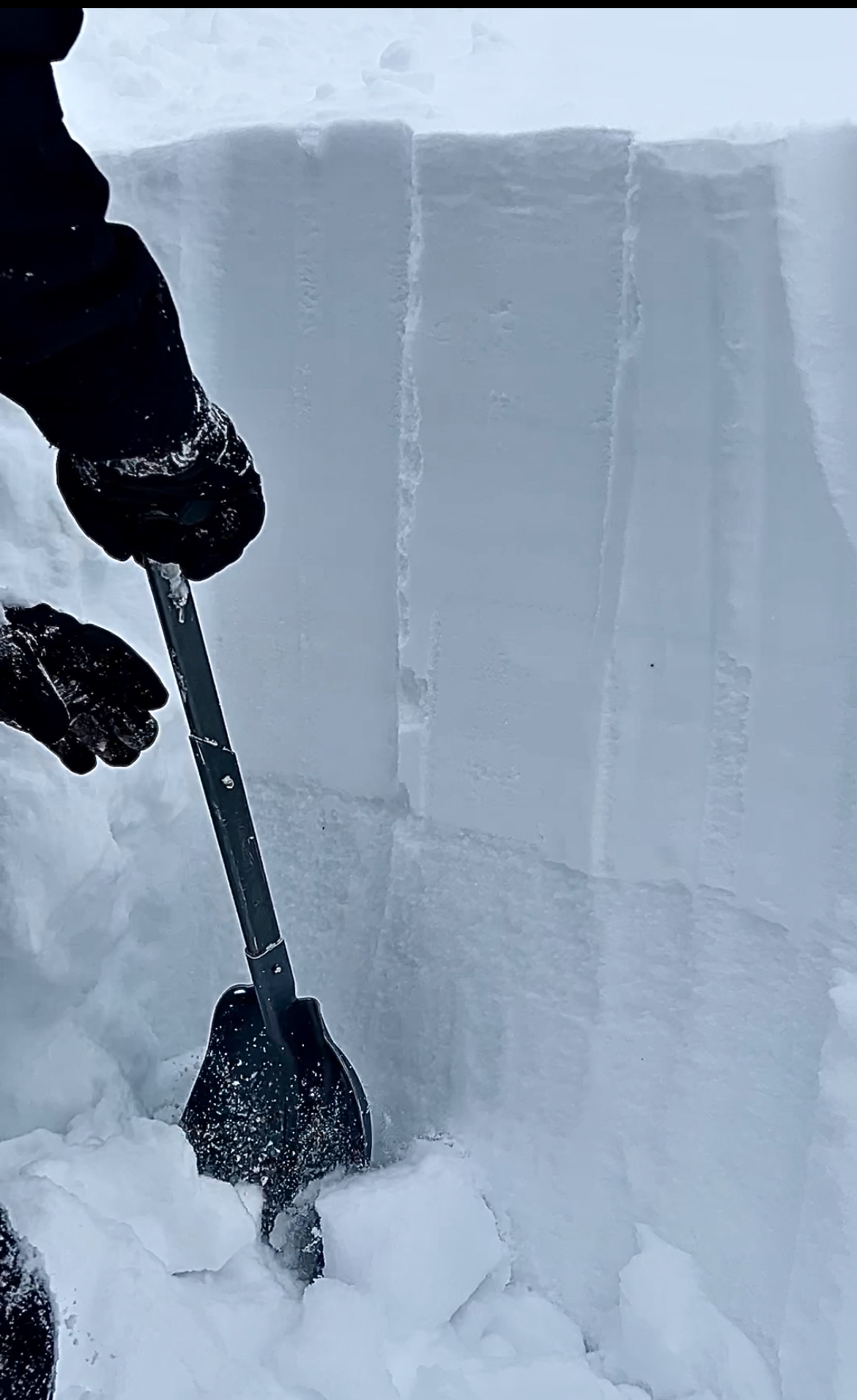
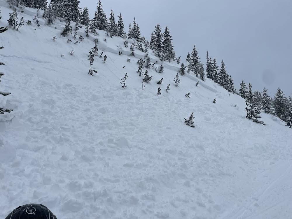
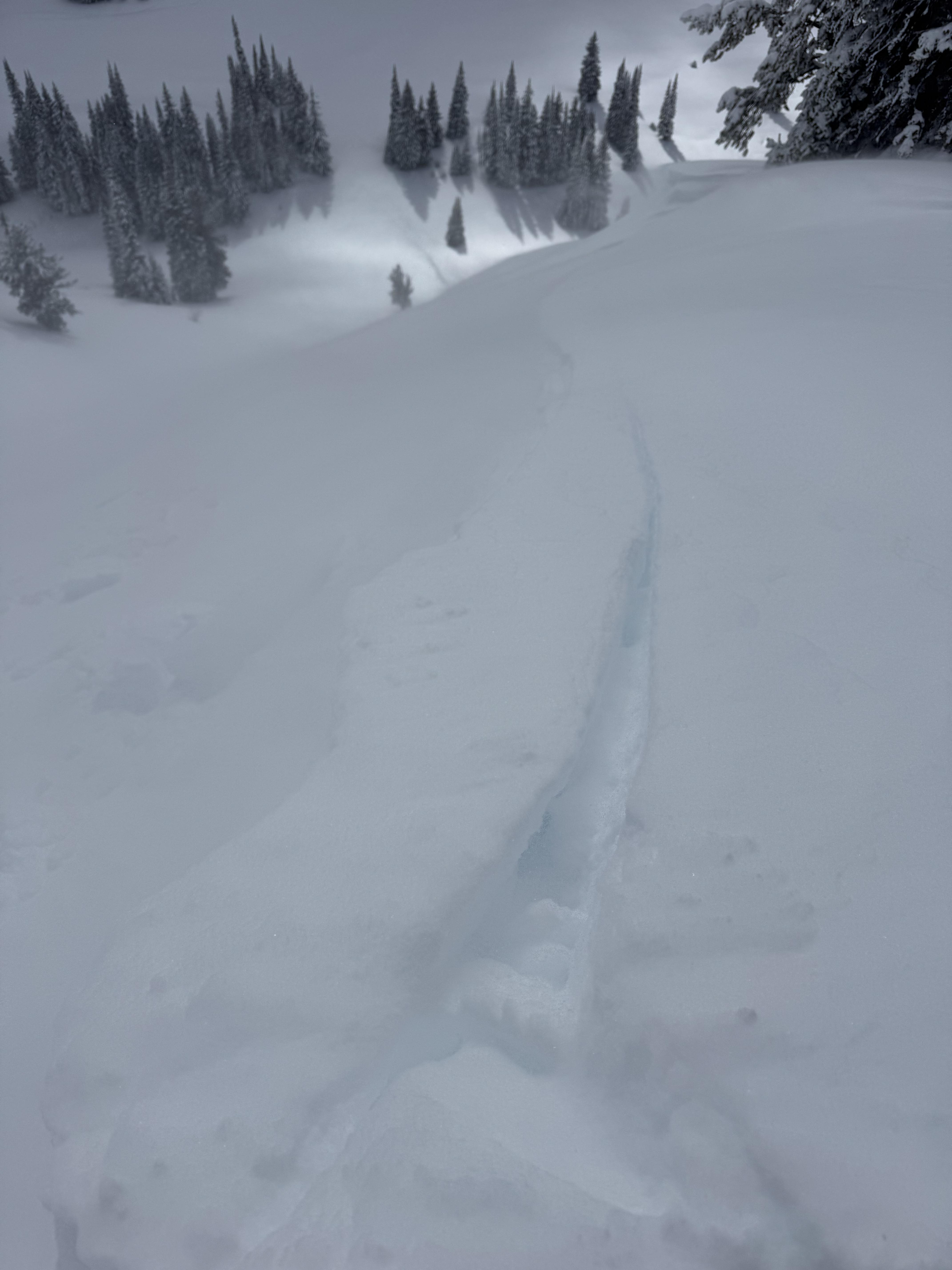
Important stuff first. As we approached our second pit site on the lip of Moto Hill (southeast aspect at 8600'), I stopped and looked back in time to see avalanche debris slamming into the trees on a connected slope below. We remotely triggered the avalanche from 150 feet away. It broke 200' wide and 1-3 feet deep. It ran an estimated 200' vertical feet (based on a slope map. We couldn't safely access the toe of the debris). The avalanche failed on a layer of Fist hard facets. This is interesting because it is these mid-elevation slopes in the LH area that seemed really weak on previous visits to the area. The slope may have some wind-loading, but it was minimal and not the cause of this avalanche.
We dug a pit on an east aspect around the corner and down from Airplane Bowl (before the avalanche) and found a similar snowpack setup. 150 cm of total snow and half was composed of weak facets. ECTP22 and P24 on the mid-pack January layer of Fist hard facets and surface hoar.
Take Homes:
- Lionhead seems to be the epicenter of persistent slab instability. It is the weakest I have seen. Southern Madison and Southern Gallatin seem to be similar and I would group them together when describing conditions.
- Mid-elevation slopes are thin and weak and can clearly avalanche. This is problematic because many folks play in lower elevation terrain when conditions are dangerous... While small compared to the upper bowl, the avalanche we triggered would have been deadly. It was deep and it would have strained its victim through trees.
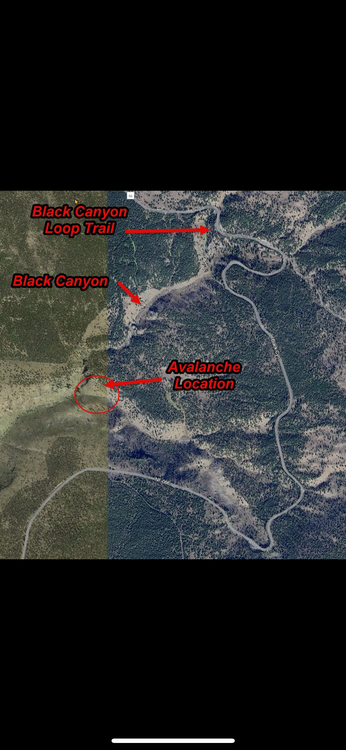
- We heard about a similar remote-triggered avalanche in Black Canyon today. This has me nervous that I missed something in the Centennials. While we didn't see anything too concerning there yesterday outside of wind-loaded slope, I am not happy about two remotely triggered slides less than 20 mile away.

From SnoWest Forums FB Page:
“Just getting word of a LARGE Remote Rider Triggered Slab Avalanche down inside of Black Canyon itself just off the Black Canyon Loop Trail in Island Park.
A 3-4ft thick slab broke loose and filled the bottom of the canyon with 12-15 FEET of debris, completely blocking off the canyon itself. Rider was NOT caught in it!! Had the rider been caught, there would have been ZERO chance of rescue under such a deep slide!”
No wind today, but recent loading
Note from BB ski patrol - skiers triggered a medium sized cornice fall that triggered a dry loose (sluff) avalanche that created large powder cloud.
Full Snow Observation Report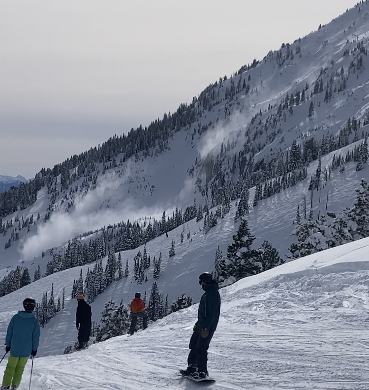
From IG - "Toured out to Frazier Basin and turned around seeing widespread avalanches and active wind loading. Despite our pits on the Throne the day before showing no weak layers, the amount of wind loading and potential for slabs over density changes gave us pause. Good skiing and sledding down low."
Full Snow Observation Report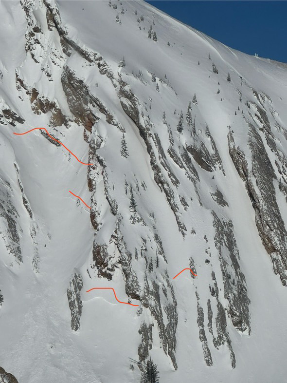
Skied up the southern of the two typical Bacon Rind skintracks (through the more heavily burned area to the upper meadows). Saw no signs of instability (no cracking, collapsing, or recent avalanches).
Dug a pit on an E aspect at 8800 ft in one of the upper meadows. 128 cm snow depth. No propagation in an Extended Column Test. There is weak snow at the ground, but it isn't super well developed or very weak (4 Finger minus hardness).
No wind affect where we traveled today.
Full Snow Observation ReportMODERATE on the non-windloaded slopes we saw today seemed right on.
We got lucky in the Centennials with great snow and good visibility. There was about 20" of new snow from this weekend's storm. We covered 35 miles of backcountry riding and got eyes on a lot of avalanche terrain from lower elevation slopes, to Jefferson Bowl, the terrain in and above Hellroaring Creek, and East Hotel Creek. We didn't see any avalanche activity. However, we observed shooting cracks in drifts and triggered small wind-loaded slopes and cornices. So, human-triggered avalanches on wind-loaded slopes are likely.
We dug three quick pits but prioritized getting eyes on terrain over in-depth snowpack analysis:
Low-elevation slope on Sawtelle - NE @ 7600' on a slope with no wind effect: ECTX in a 160 cm deep pit
Above Hellroaring - S @ 8400' on a wind loaded slope: ECTP1 6" deep (wind slab) and ECTP21 20" deep (wind slab)
Arange - SW @ 8700' non-wind-loaded slope: ECTP21 20" deep on facets below a melt-freeze crust
Travel Advice:
- Avoid wind-loaded slopes
- While stability on non-wind-loaded slopes seemed good, it snowed a lot. So, I would either carefully assess for instability in the upper 3 feet of the snowpack with an ECT , or I would give it a few days to settle out before getting on steeper, non-wind-loaded slopes.
The danger was CONSIDERABLE on wind-loaded slopes (human-triggered avalanches likely) and MODERATE in non-wind-loaded terrain (human-triggered avalanches possible).
Full Snow Observation Report

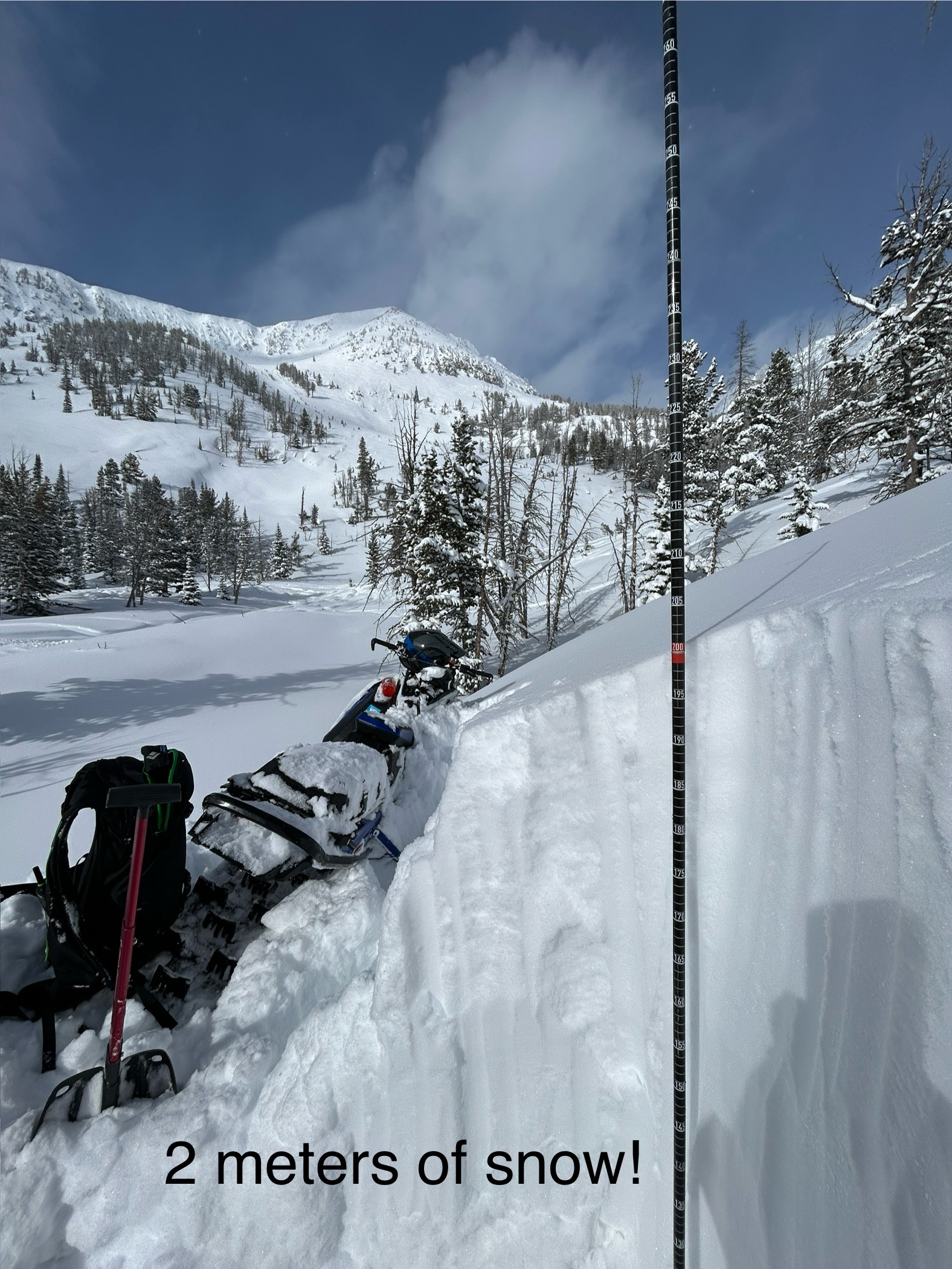
Deep snowpack in the Crazy Mountains and seemingly strong. It seems that the snowpack in the Crazies is typically weak, shallow, and sketchy. This year the snowpack is quite deep - crazy!
We saw one soft, storm slab and a few sluffs. We didn't get onto slopes steeper than 30 degrees, but we felt ok traveling in runout zones which says a lot.
Winds were drifting some snow in the alpine but otherwise mostly calm. Tons of snow available for the wind when it finally picks up
Full Snow Observation Report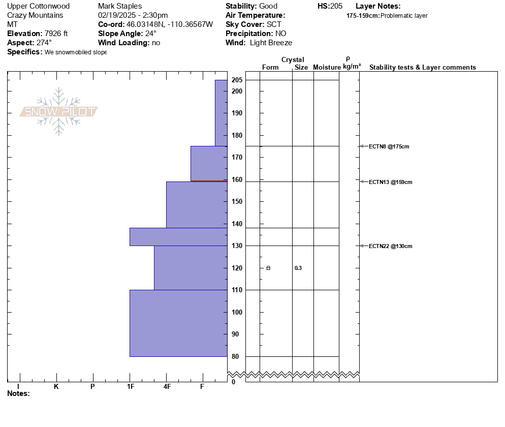
Cornice broke in between north and south saddle peaks. The initial propagation width was hard to distinguish. Maybe 50 feet. About 18 inches deep at height of crown.
Skied down Rocky Rib and then into south east facing trees that follow the path. At the Argentina/ Shushmans traverse elevation there was a visible 2 foot wall and the slide had continued over the roll below.
Full Snow Observation Report
Cohesive wind slabs roughly 1 foot deep were triggered between middle peak and the going home chute on the northeast aspect. Upon skiers weight shooting cracks traveled roughly 100 feet to trigger a small avalanche. The size was small as only the top 50 feet of the slope slid but the snow from the avalanche carried down the entire face.
Full Snow Observation Report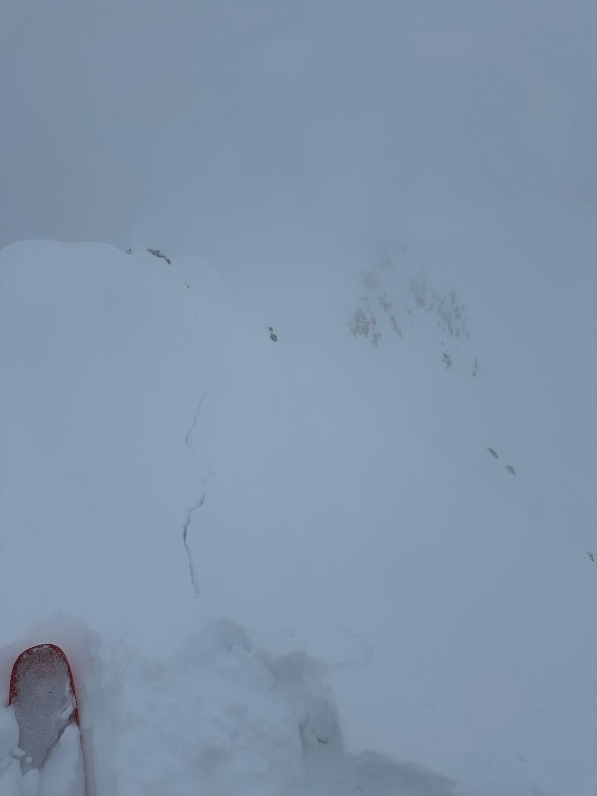
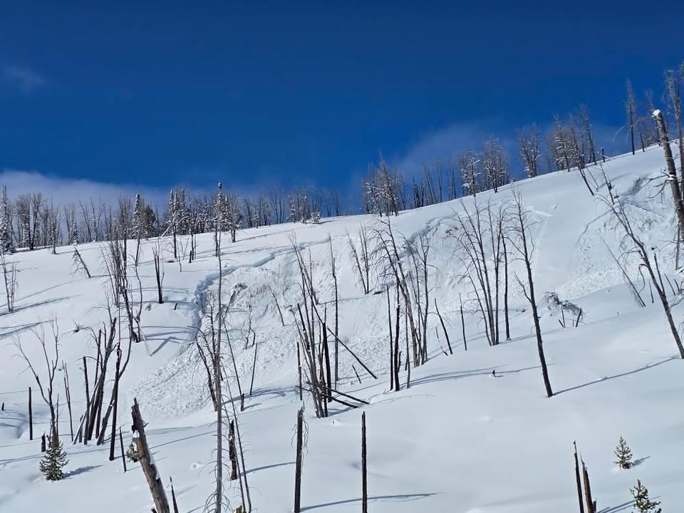
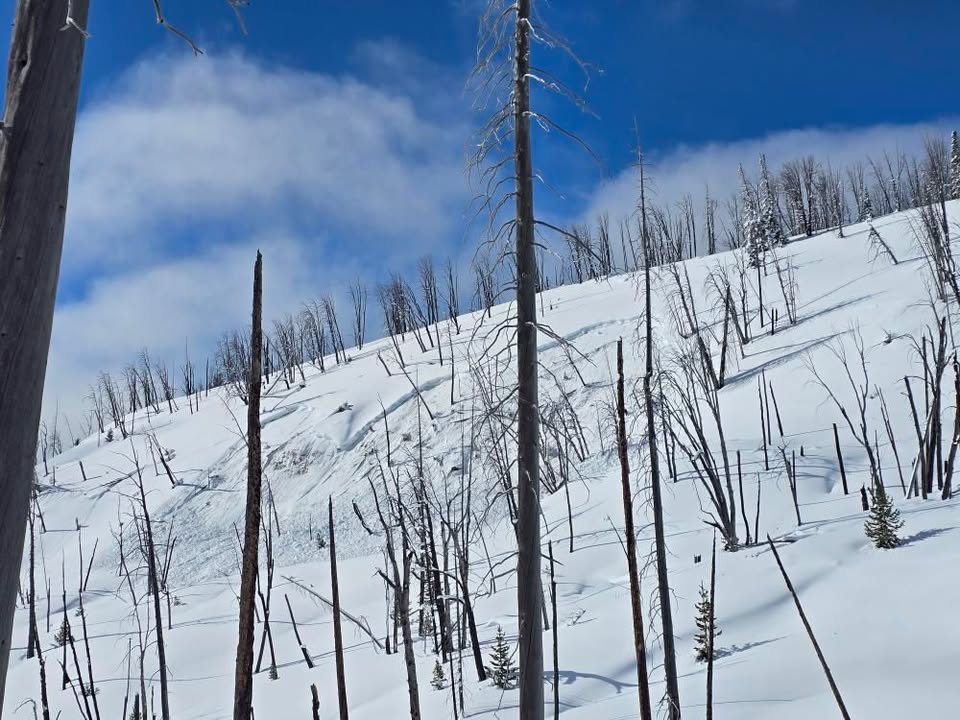
From IG: 3 separate natural slides viewed south of the throne today. All east facing. This was the biggest.
If this is R3 others were more R2
At 16:10 I arrive at the sumit of Ellis. The wind was Westerly 0-5mph. I planned to ski the South Face of Ellis and then come up and ski the typical East face slides back to the car. The south face was skied on Saturday and I was told there was a stout melt freeze crust with roughly 6 inches of new snow. I was also told it was skied out after 4 skier had skied the face.
From the summit I make 2 ski cuts to safe spots. The snow was unreactive, but it was wetter/ denser than expected. There was 6-8 inches of new snow. Roughly 150-200 vertical feet down the face I bailed. Wind affected snow was becoming widespread and I noticed the new snow falling at the apex of my turns (storm slabs). The new snow was thinner, 4-6 inches and the crust was very noticeable. In tight trees I transitioned and skinned over to east face. Skiing through newly formed wind slabs there were small shooting cracks (not particularly energetic) that extended roughly 10 feet. Wind slabs were up to 2 feet deep. The melt freeze crust was easily breakable in some places and unbreakable in others.
Long winded, but the new snow and wind loading lined up exactly with the forecast.
Full Snow Observation ReportVery deep snow past Round Lake today. New snow ranged from 2-4’ deep. My elbows and shouldered were touching the trenches of my sled track as I rode through Star Lake toward the wilderness boundary. New snow was very low density. No natural avalanches observed and ski cuts were non reactive on test slopes.
Full Snow Observation ReportTraveled up Republic Creek, ascending to ridge separating Wyoming and Republic Creeks. Trailbreaking was arduous, ski pen ~ 60-80cm depending on travel under canopy or in more open terrain. Did not formally evaluate HST, suffice to say it was significant. HS 260cm at 9600ft. Skies obscured all day with varying snowfall rates, S1-3. Moderate W/SW winds and PLENTY of transport. Observed a D2 natural (wind/storm slab? Hard to say from my vantage) on E aspect at ~9200ft. A member of our party intentionally triggered a 30-40cm storm slab on a small convexity in treed terrain in Wyoming Creek. No other natural or skier triggered activity observed, though visibility limited our view to the more complex terrain further up Republic. Ended the day with a Woody Ridge lap and encountered no cracking/slabbing of new snow in this zone. Snowfall was intensifying as we left the drainage around 1700.
Full Snow Observation Report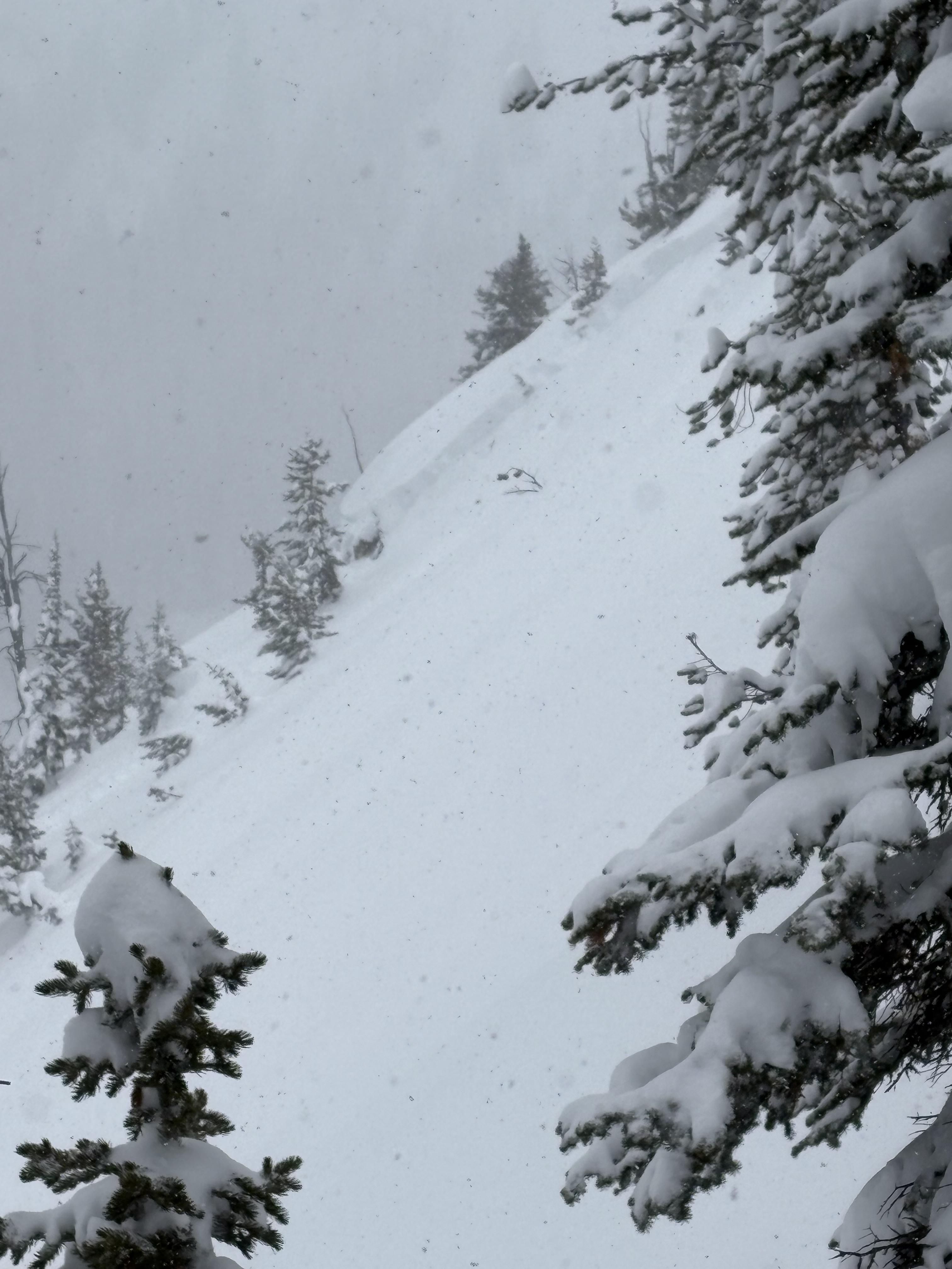
Observed a few old avalanches today, maybe from the 2/8 storm. Although well out of the advisory area, helpful for skiers in the Red Lodge Area.
1) Silver Falls Cr (Lake Fork), 9200', E, HS-N-R4-D1.5-O 45cm thick pencil hardness slab, HS 135. Pulled out into upper 20 degree terrain. 2-3 avalanches here, with one crown ~600' long.
2) Misery Bowl (Main Fork), 9400', ESE, HS-N-R2-D2.5-O A few avalanches here similar to above, with one significantly larger avalanche appearing to have failed on depth hoar where the bowl tips South. 2-4' crown, ran about 600' vertical.
Full Snow Observation Report