Snow Observations List
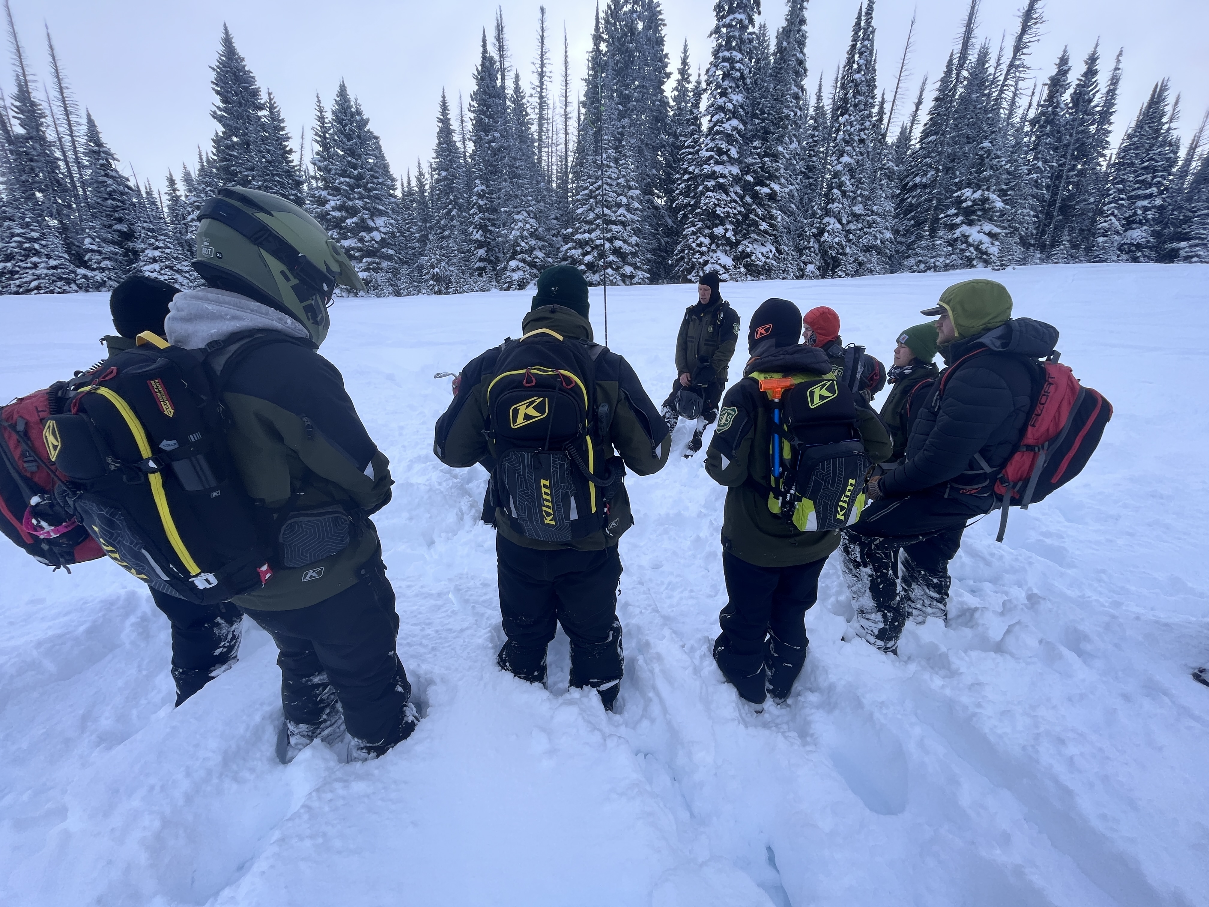
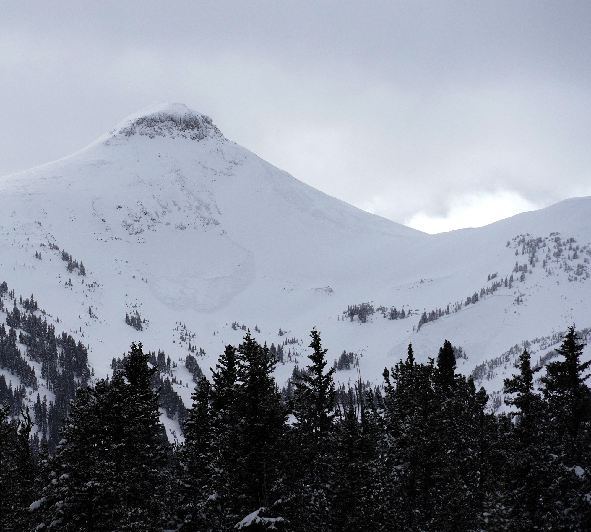
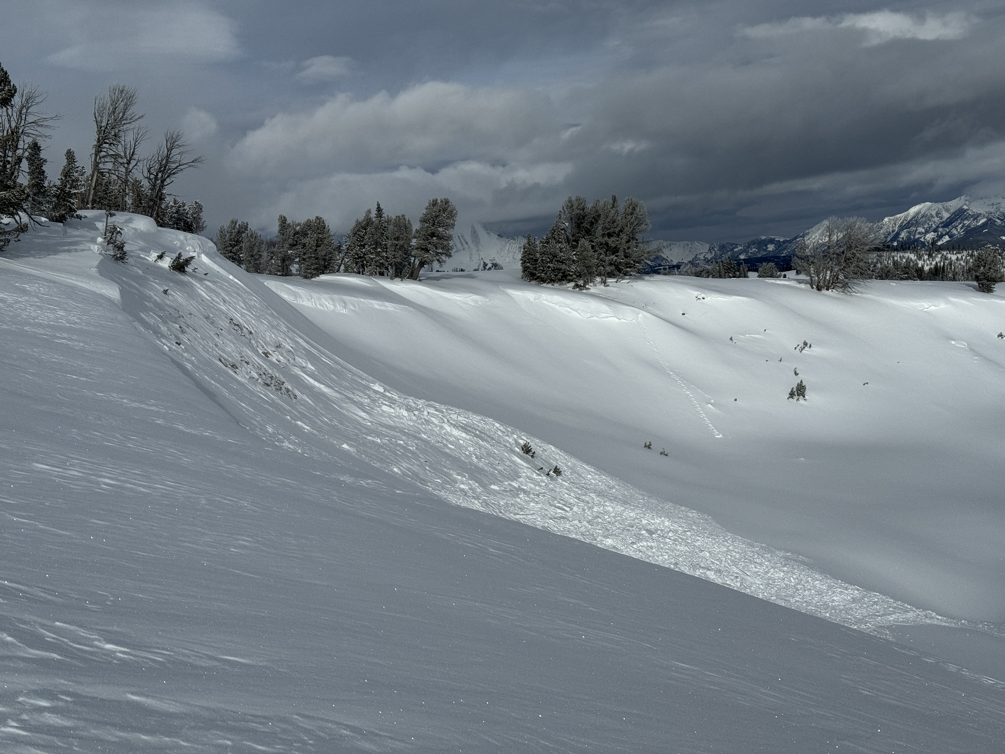
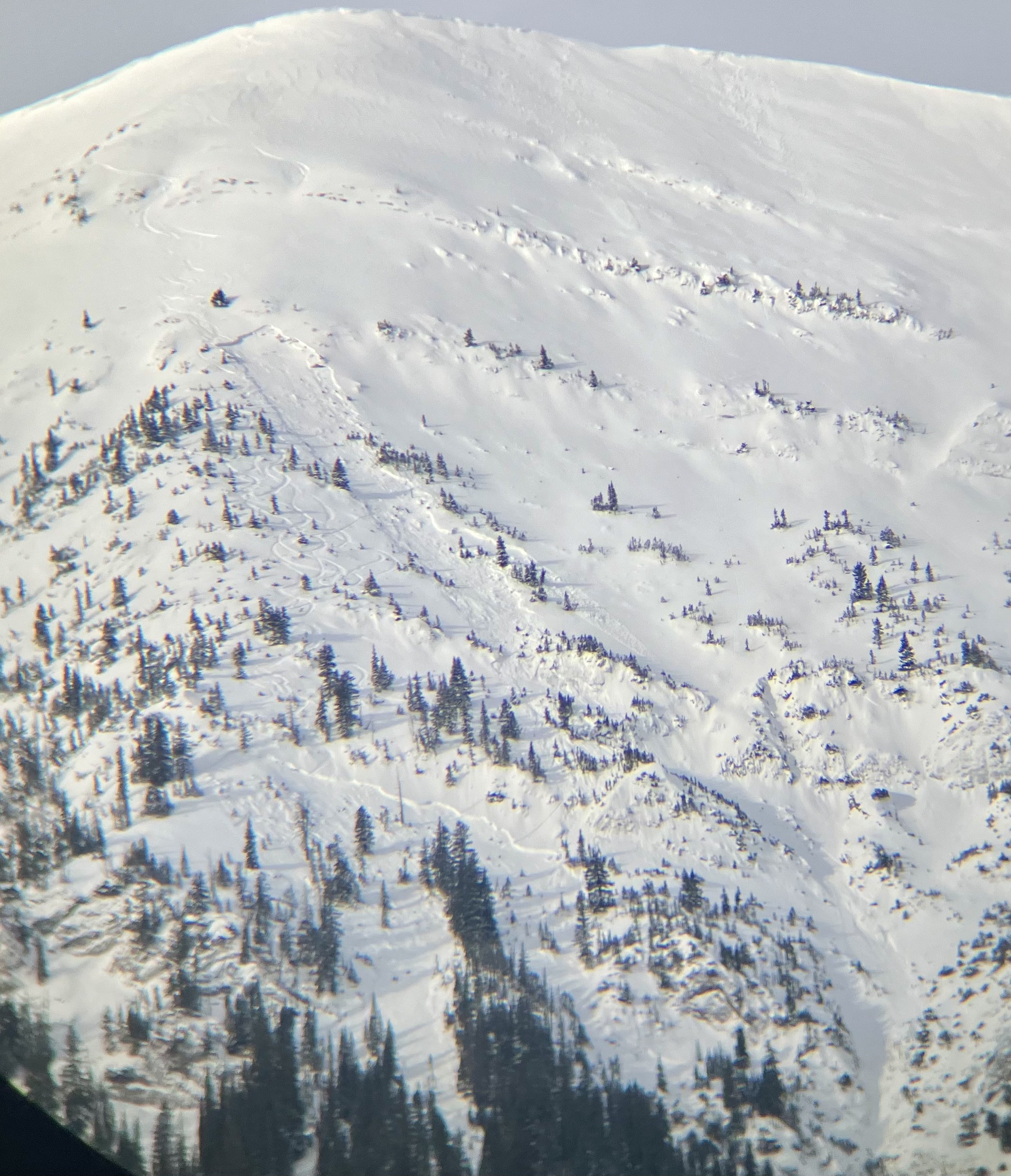
We rode into Tepee Basin today to practice rescue skills with snow rangers from different districts across the Custer-Gallatin Forest. On top of a great day riding and practicing rescue skills we saw a natural avalanche above the first meadow of Tepee. This avalanche is old and likely happened a few days ago near the end of the last storm on 01/20. NE facing slope at ~8500 feet.
There is plenty of snow on the ground to practice rescue. Now is as good of a time as any to get out and practice your skills!
Full Snow Observation Report
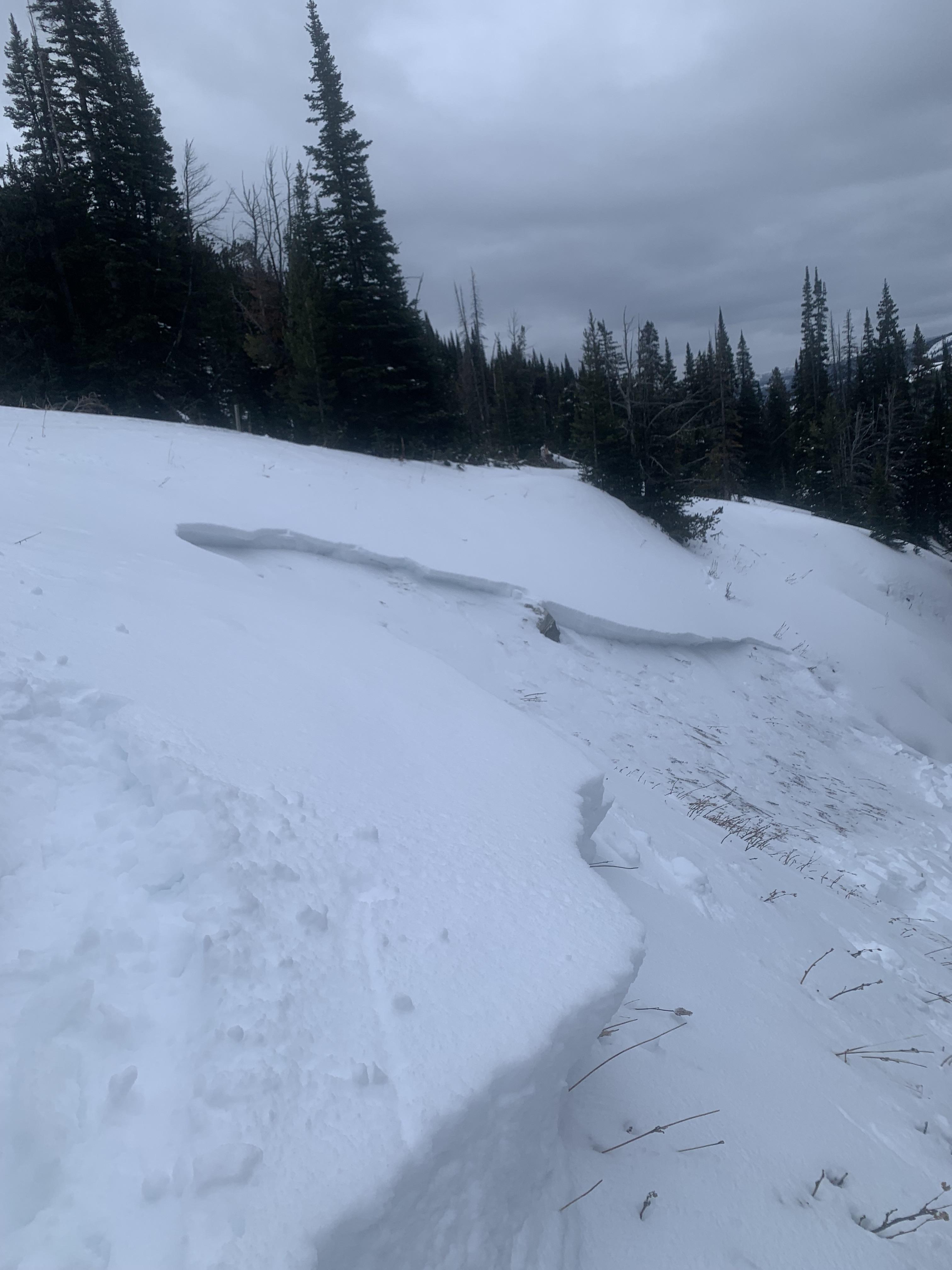
20ft diameter collapse on shallow slope, 25-30 inch snowpack, bottom 10inches to ground rotten and ball bearing like.
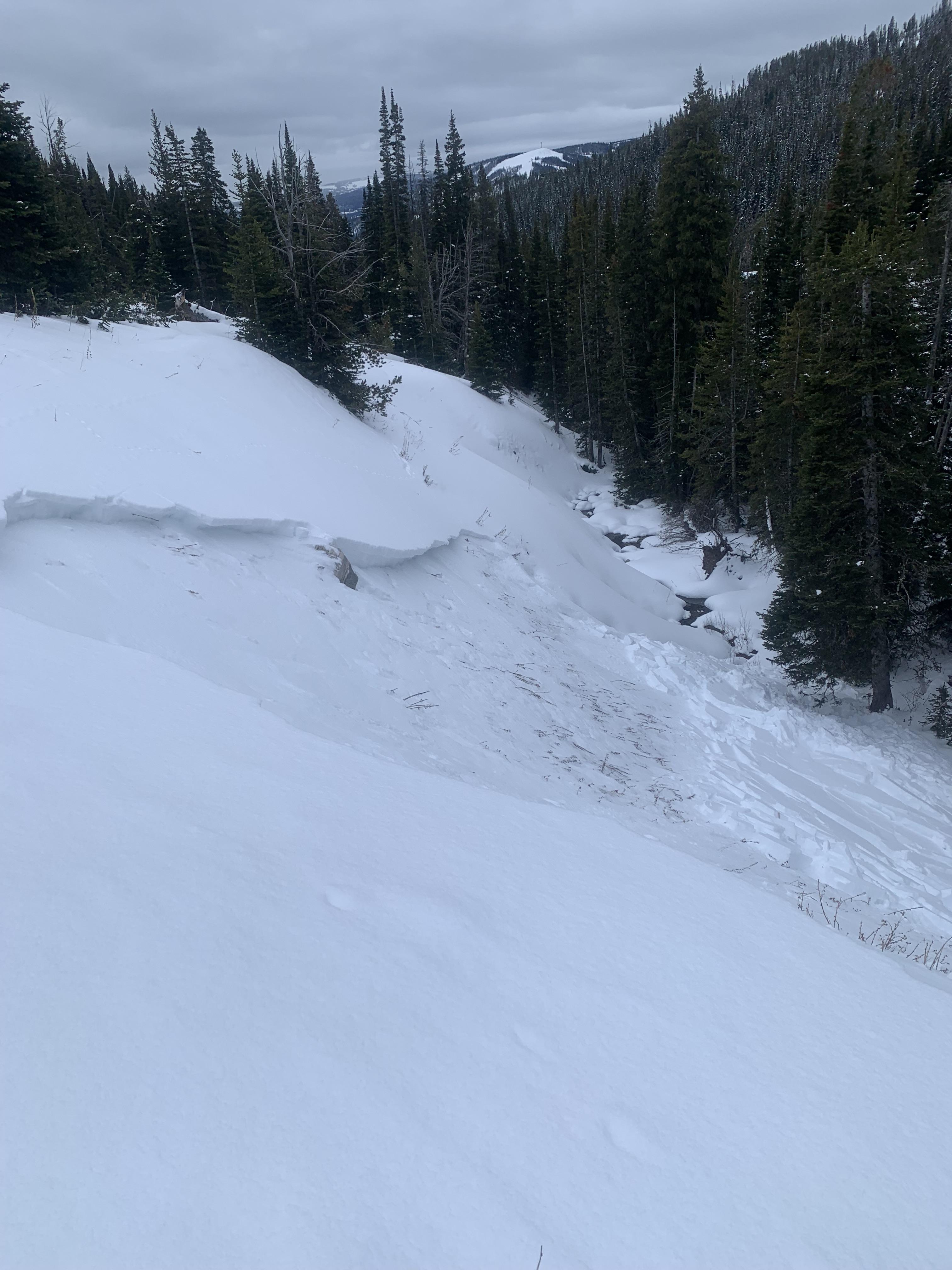
Shooting crack in a gulley, evidence of previous avalanche present in same gulley
Full Snow Observation Report20ft diameter collapse on shallow slope, 25-30 inch snowpack, bottom 10inches to ground rotten and ball bearing like.
Shooting crack in a gulley, evidence of previous avalanche present in same gulley
Full Snow Observation ReportI believe this occurred either Wednesday Jan 24th or Tuesday Jan 23rd
Full Snow Observation Report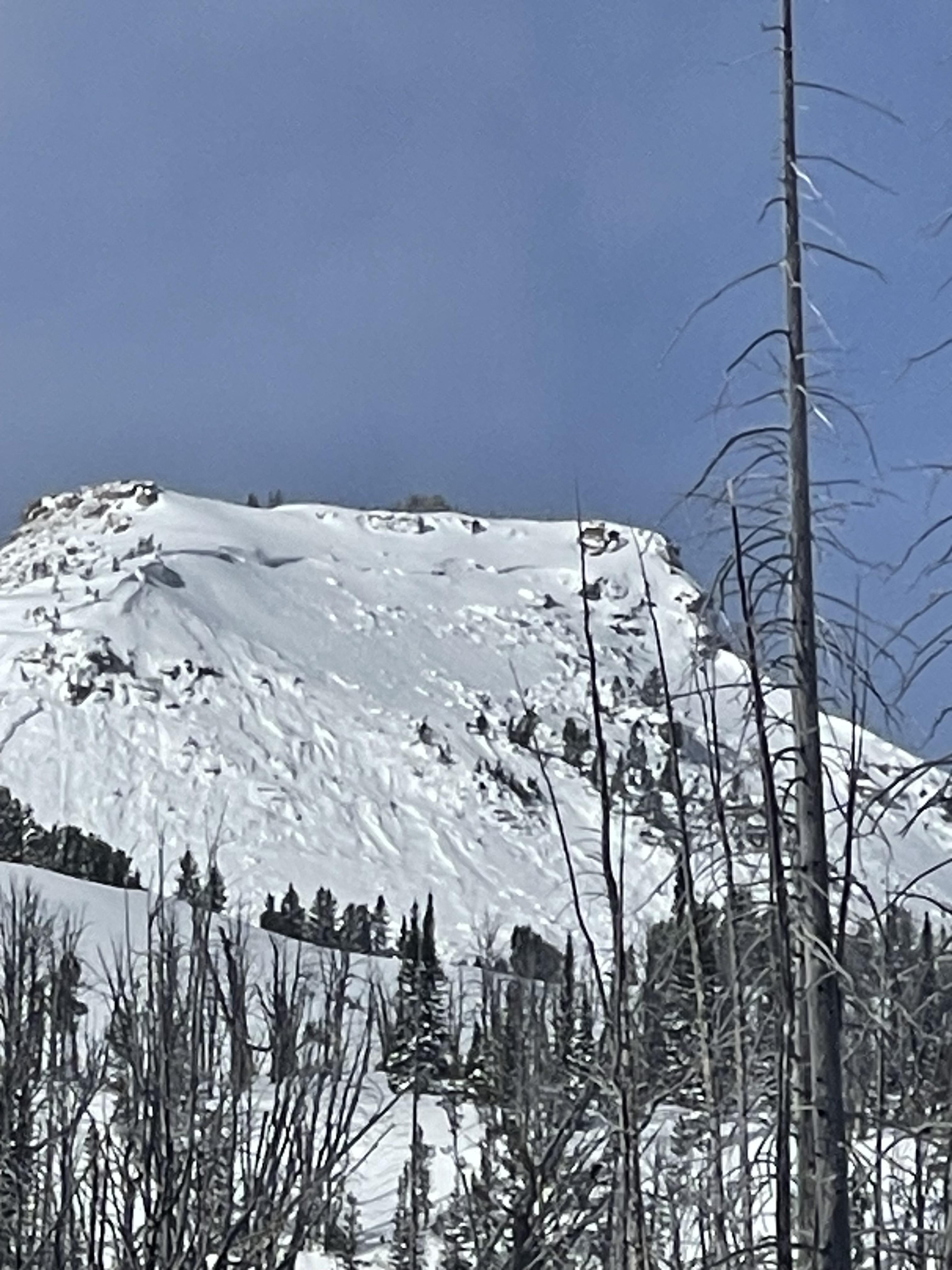
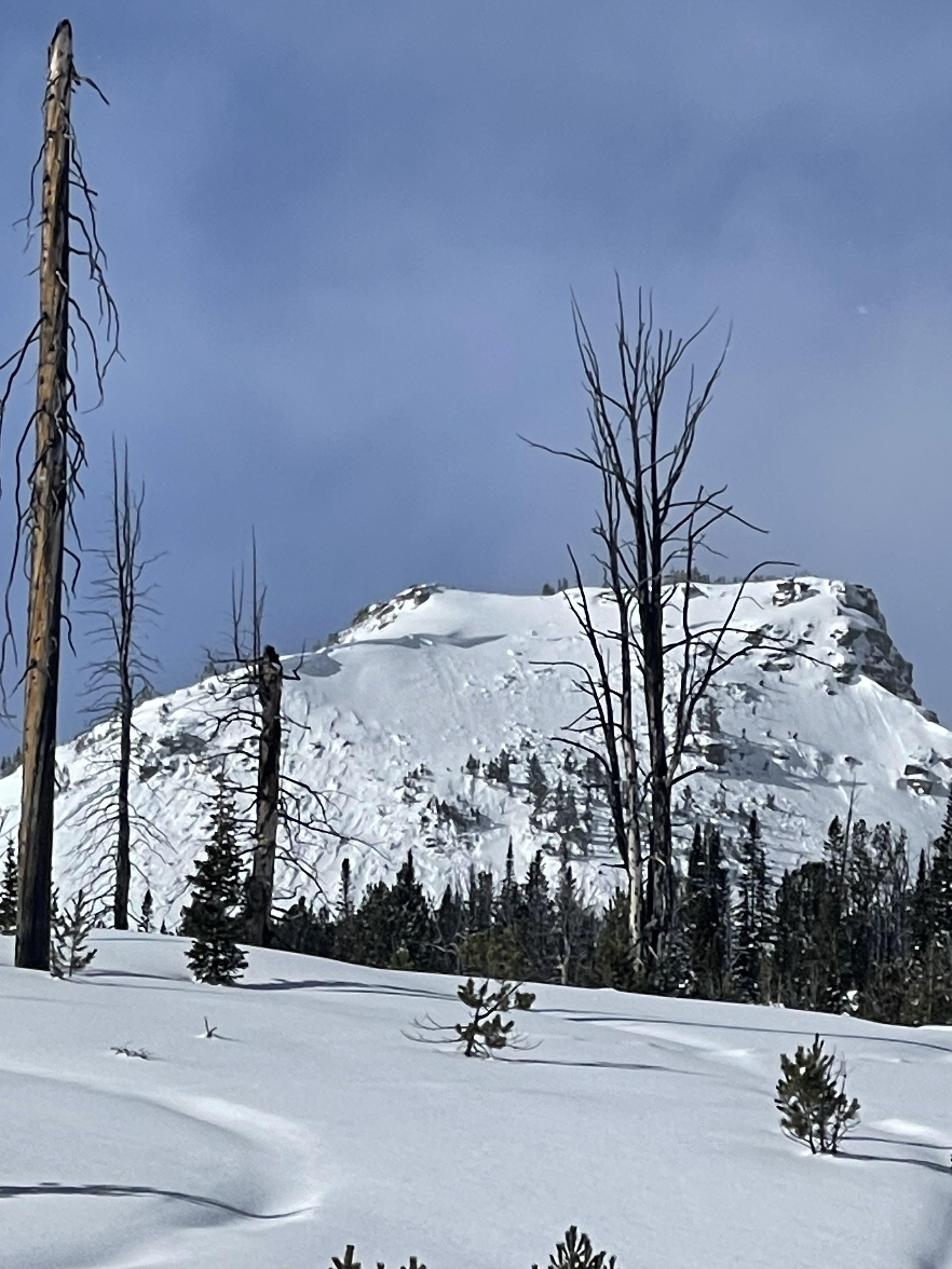
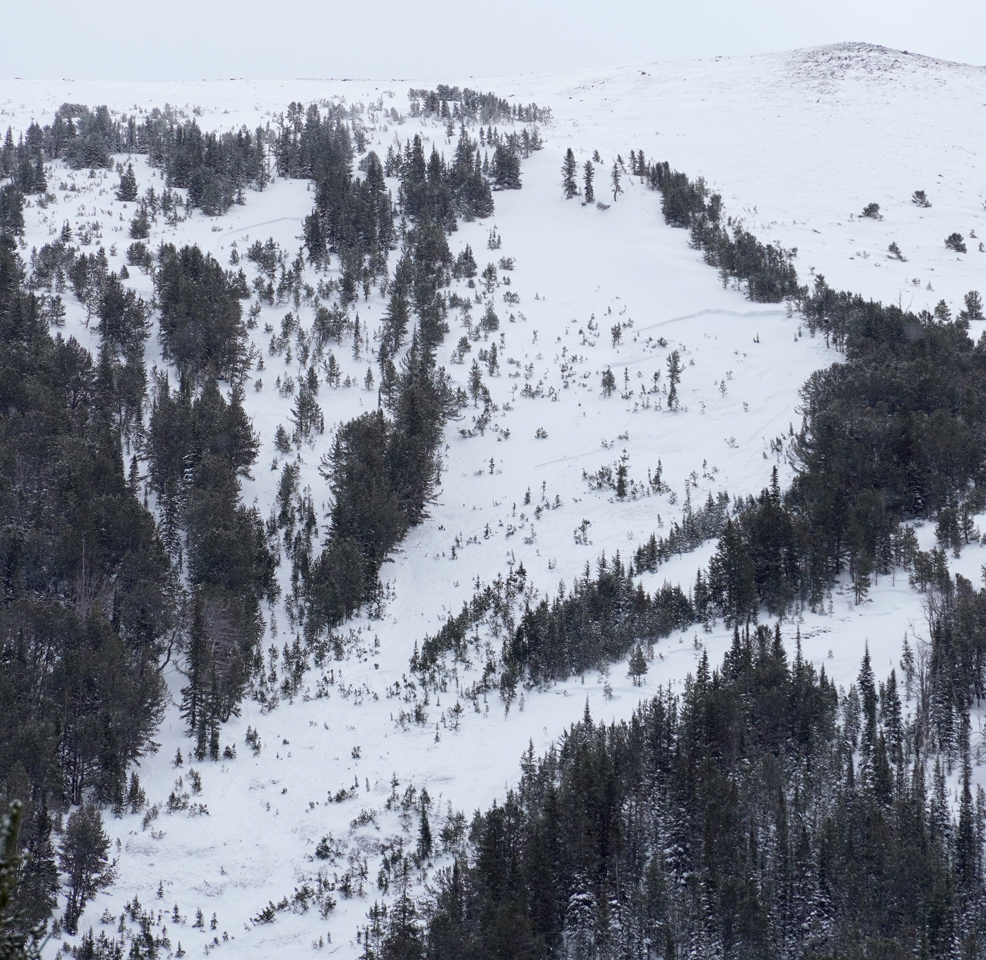
Was out today and noticed this large avalanche on the south side of Henderson. Looks like it happened today (1/24) or yesterday (1/23). Possible remote trigger, there were snowmobilers riding underneath that zone. The slide looks about 200 feet across and 4 feet deep in the thickest spot. D2.
Dug a pit over there. HS 145. ECTP19 50 cm down on surface hoar.
From B. Fredlund: "...large avalanche observed today on the SE aspect Mt. Henderson was not visable there at 4pm yesterday." (1/23).
Full Snow Observation Report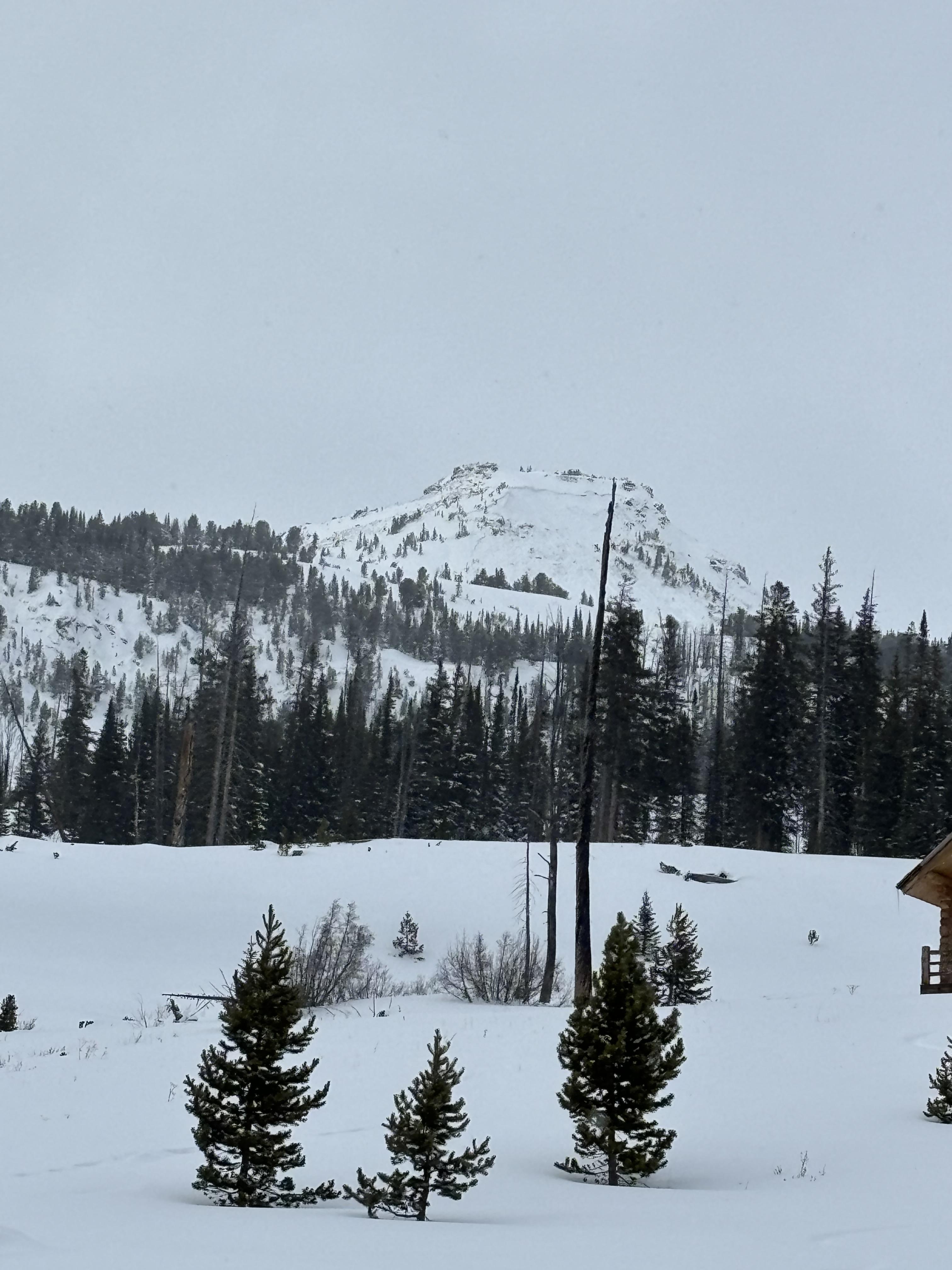
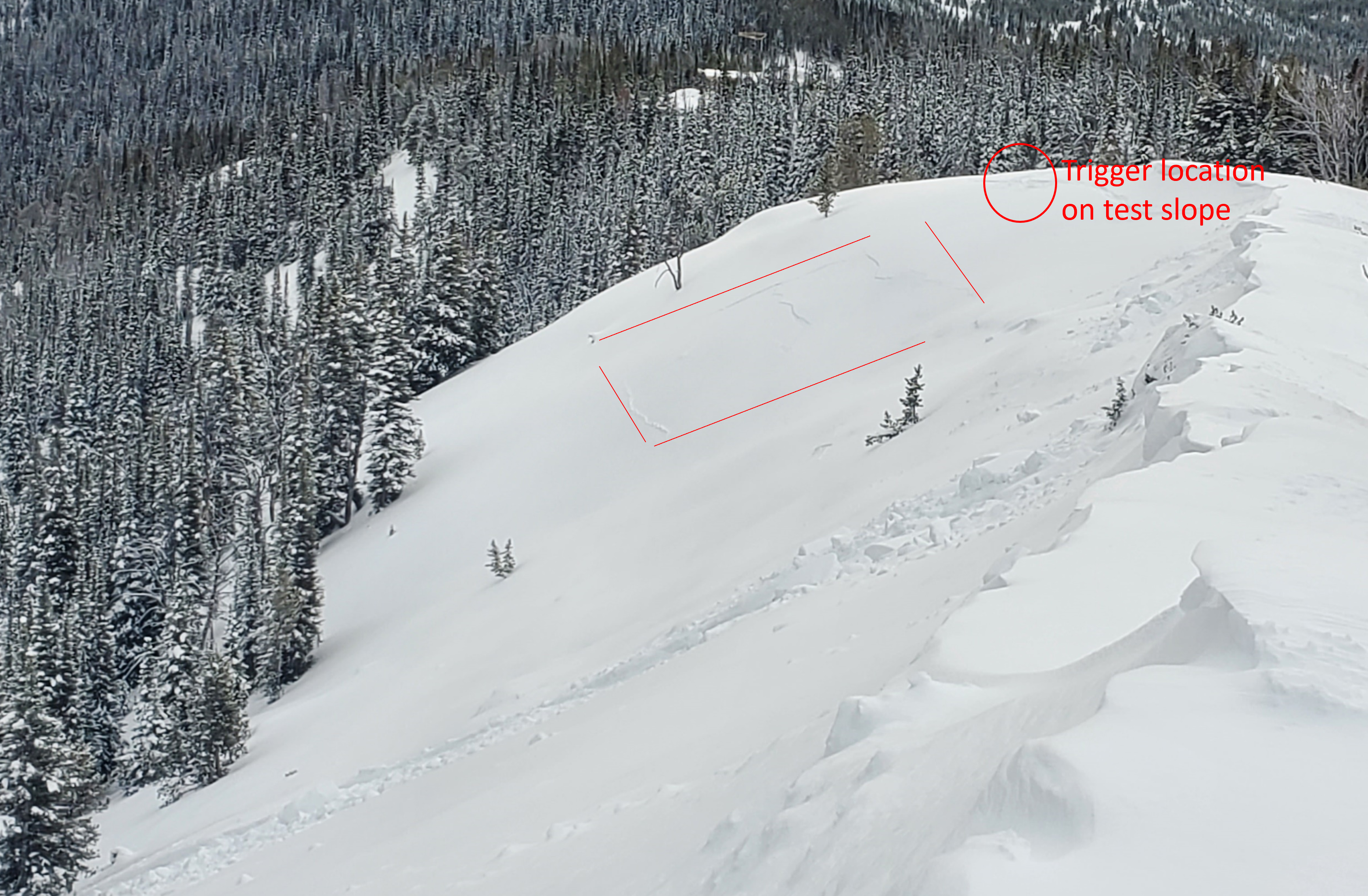
Triggered a good size slide intentionally on a test slope in bhive, about 5 ft below the summer trail. I’m currently doing a pro level 1 course with AAI, my instructor told me to go jump around above the rollover. The slab initiated almost with a slight delay after my 3rd and closest jump toward the rollover, I started to mumble “well not today” and boom it went.
total snow depth:69cm
SS-AR-D1.5-R3 intentionally triggered
aspect:sw
elevation:8250
I went back after class and did an ect and ct test directly above the crown, where the top of the crown was 24 degrees :
Ectp20 @44cm down
ectp11@44cm down
ct21 @60cm down
Full Snow Observation Report
From email: "AAI Pro 1 course to Beehive Basin. One of the students stomped on a lower angle slope directly above a large test slope. On the second stomp the slope released. West aspect at about 8000'. SS-ASc-R3-D1.5-O
18 pits were dug by students and all had ECTP results scoring 15 or lower, and most scoring less than 10, failing on small facets down 20-40cm. PST 22/100 end and 40/100 end. Rutschblock RB3. HS 60-80cm, E and W aspects at about 8500'. Surprisingly, we didn't find SH in any of our pits. Some localized cr, co while breaking trail."
Full Snow Observation Report
Collapsing snow could be felt underneath my sled all day up Black Canyon Loop trail, east of Island Park. There was a moment where shooting cracks spread from my ski tips to about 10 yards away on flat ground. The canyon just north my location was probably steep enough to slide.
Full Snow Observation ReportN45.923090° W110.958035°
8150ft NE aspect 20 degree slope
ECT18 at 20cm boundary between soft slab and depth hoar. All "sugar" below the boundary extending to the ground. No releases were observed. In the distance at far northern peaks there were cornices that had released naturally.
Full Snow Observation Report
We rode into the Throne in the northern Bridgers. On the east facing hill visible from the sleds, a slab avalanche about 1 foot deep and 100 feet wide was seen. The debris fanned out and did not seem deep enough to bury a person. A roller ball likely triggered it on Sunday (01/21/24) as there were no roller ball tracks on the bed surface, only leading to the crown. It was a bit disheartening to think that a roller ball was enough to trigger a slide.
We skinned to the runout zone of the Throne letting our runout angle approach 23 degrees. We has numerous collapses and we decided to not ascent because there is not a way to stay out of avalanche terrain, plus we were concerned about having a collapse propagate up the hill and avalanche on us.
Full Snow Observation Report
The sleds did not overheat on the way in. There were no tracks on the Throne.

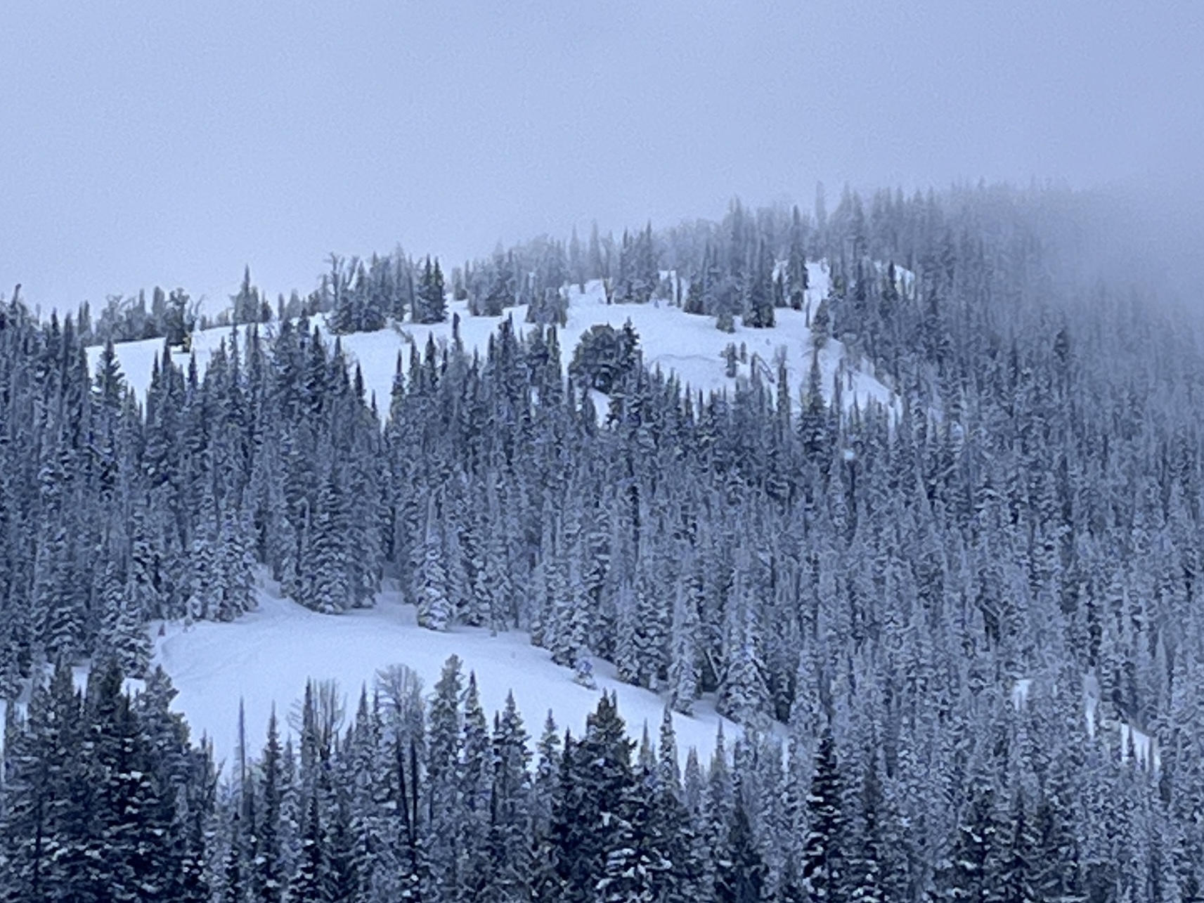
Large natural avalanches and significant cornice formation were visible in October Bowl. We noted frequent collapsing and shooting cracks (5-100ft+) on E facing slopes at ~8000ft.
Full Snow Observation Report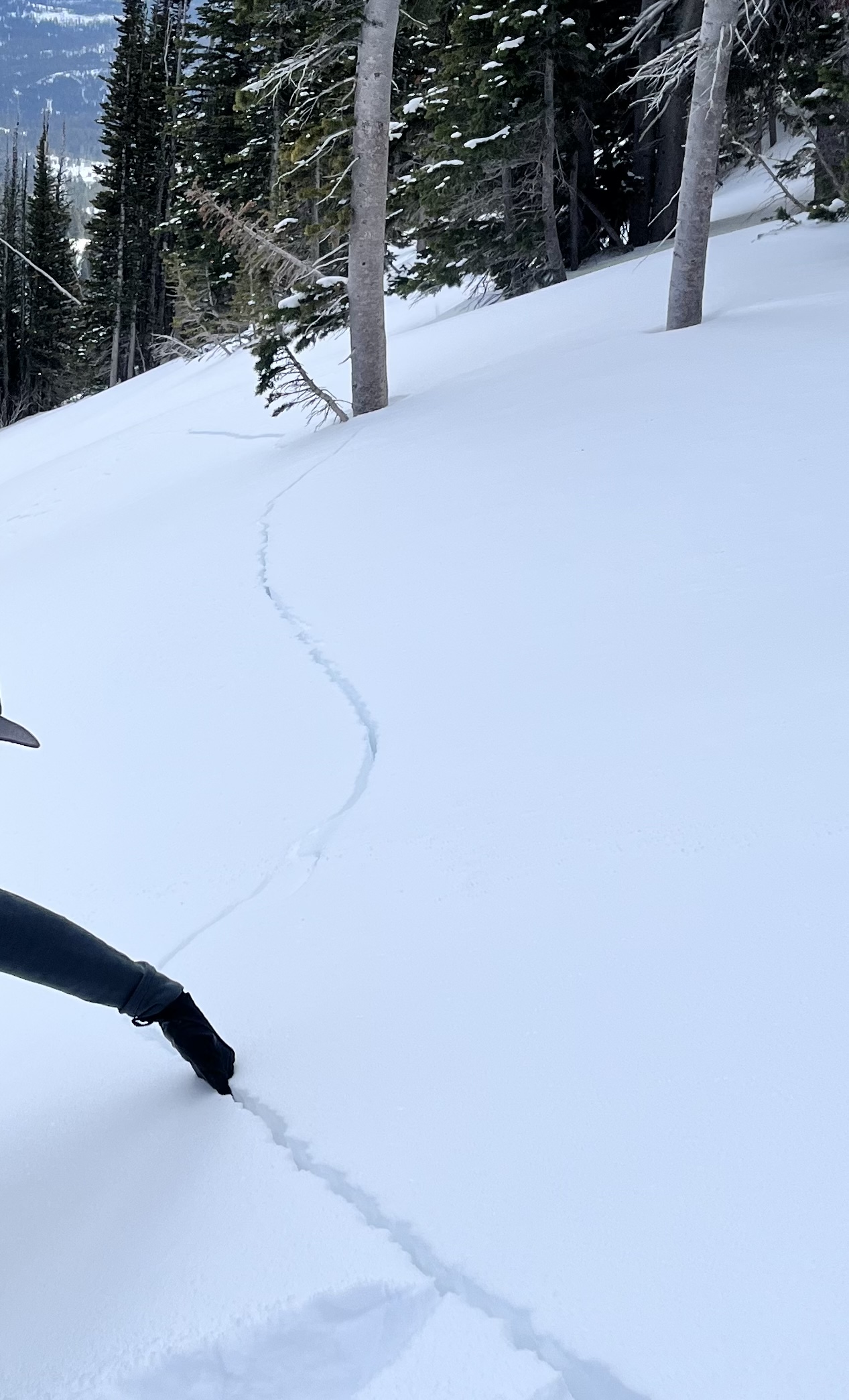
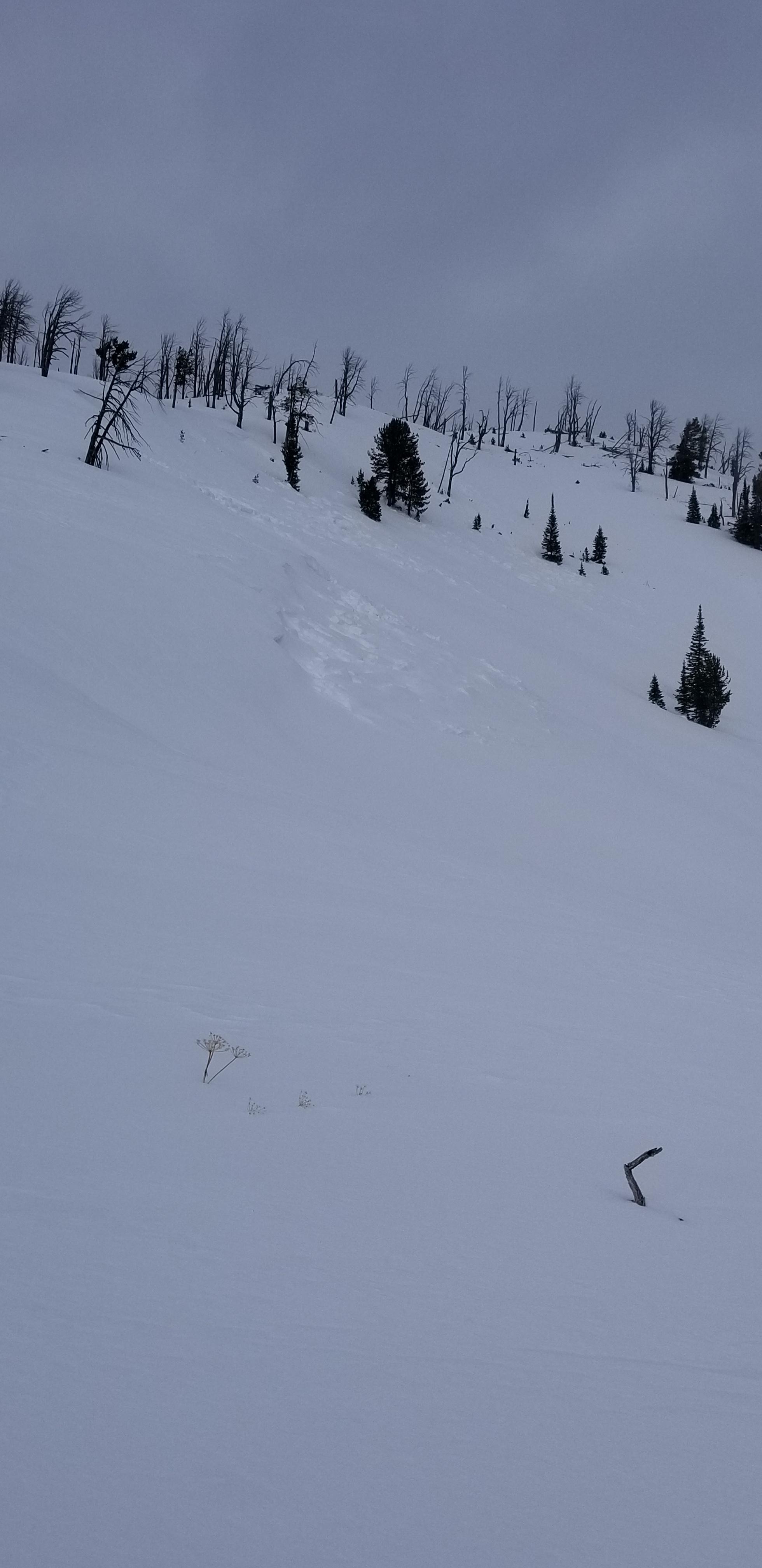
Observed extremely unstable avalanche conditions while ski touring in the Woody Creek Drainage south of Cooke City for the past 4 days. While traveling through the valley floor, I noted whumphing, collapsing, and cracking in the snowpack. I was able to trigger small slides on steeper test slopes just above creek beds from 50-60 feet away. I noted several larger avalanches up high, on all aspects. We played it safe and stuck to skiing and traveling through slopes under 25 degrees and limited our exposure time under large avalanche paths.
While skiing a zone called "ollies woods", a southern aspect that's relatively low angle, we noted widespread loud whumphing of the snowpack in the trees. I Spent some time traversing around the tree'd face on the way down to my group, traveling far right to a sub-ridge where the aspect changed to east, the terrain became more open, and slope angle became steeper. I felt a large whumph, paused, and turned around descending the rest of the southern aspect to the valley bottom.
Once back to the valley bottom, I saw a recent avalanche had slid just below where I was standing earlier on the sub-ridge. Looking from a far, the crown looked about 10" - 15" deep, 60'-100' wide, and fractured on a layer of facets. The slope angle was 31 degrees and at 9100ft elevation. See photo, x marks my relative location when I heard the "whumph"
SS-ASr-R1D2-O
Full Snow Observation Report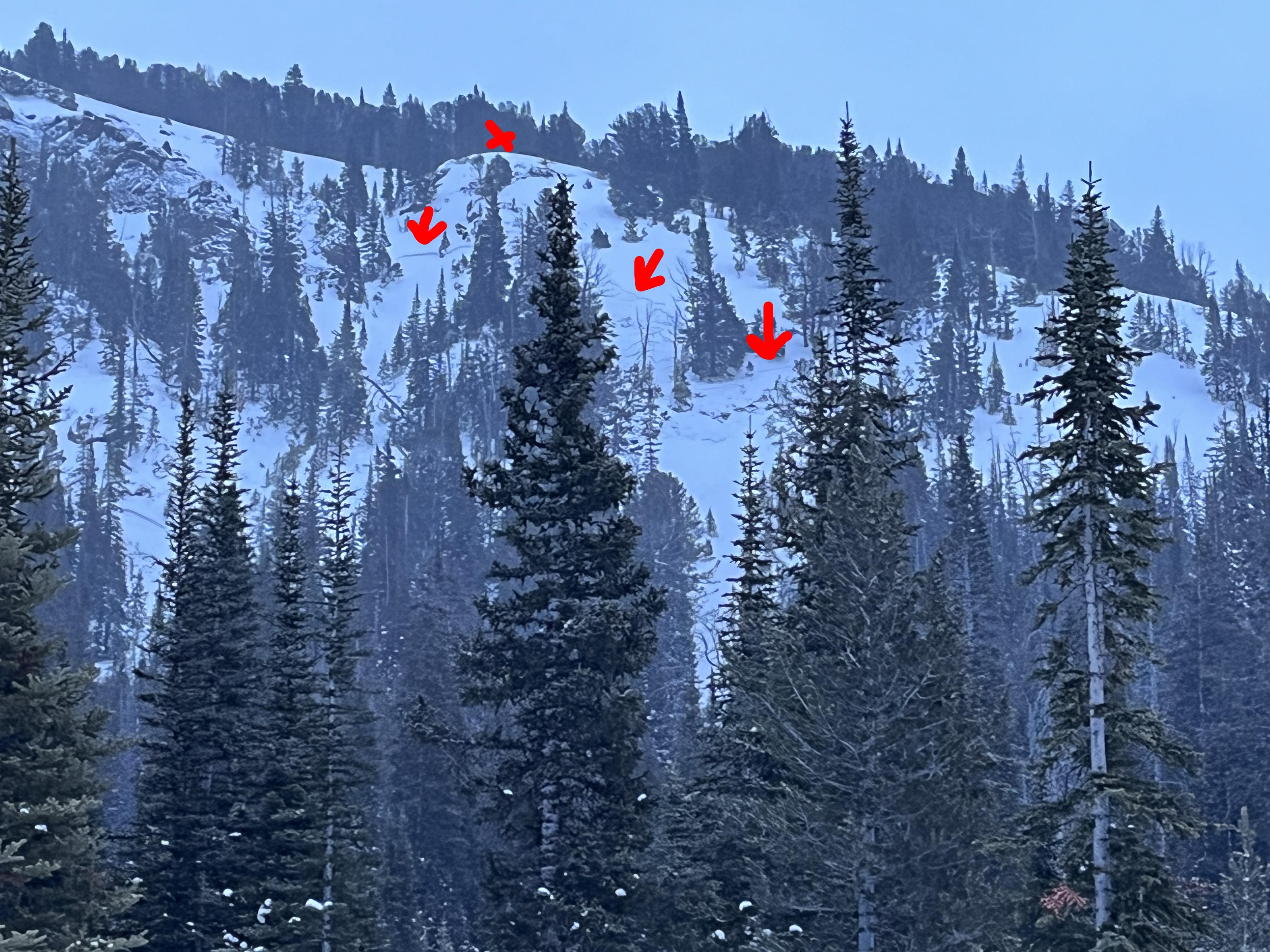
Also that large avalanche observed today on the SE aspect Mt. Henderson was not visible there at 4pm yesterday (1/23)
Full Snow Observation Report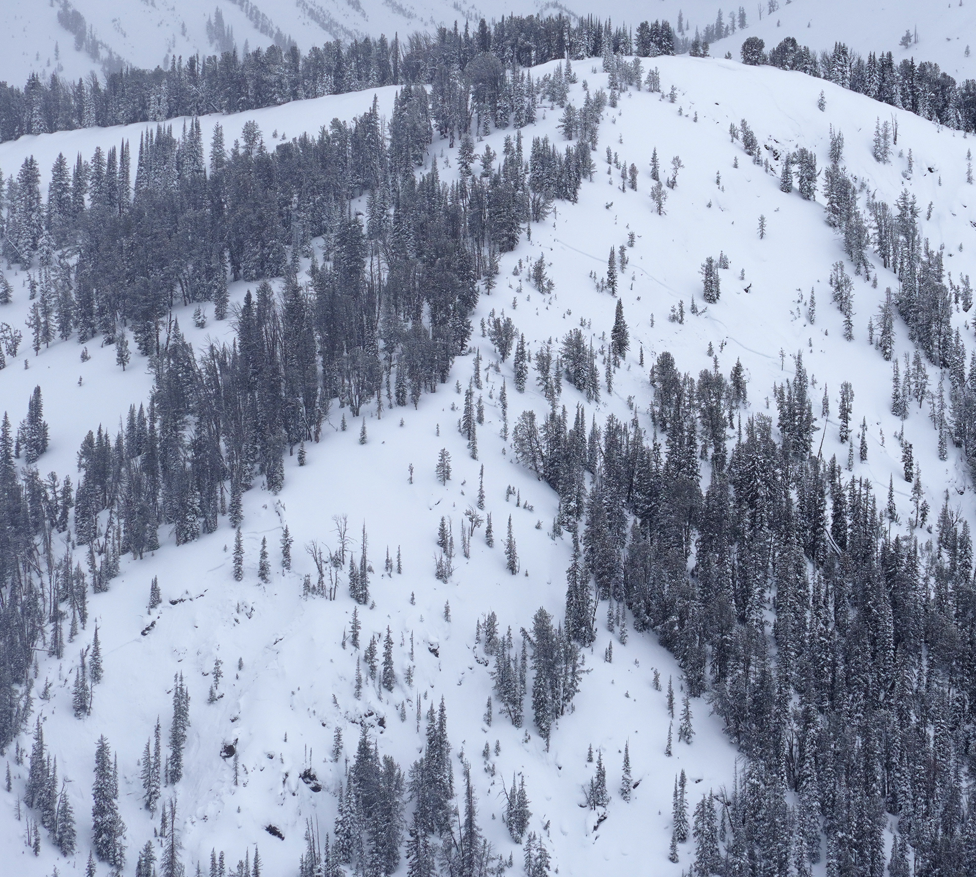
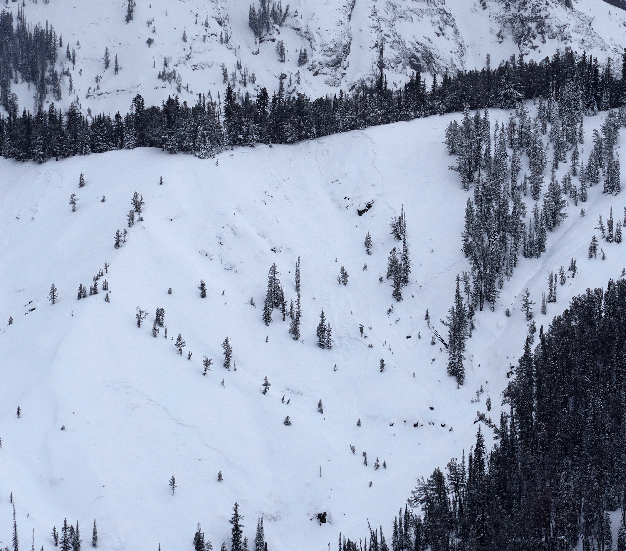
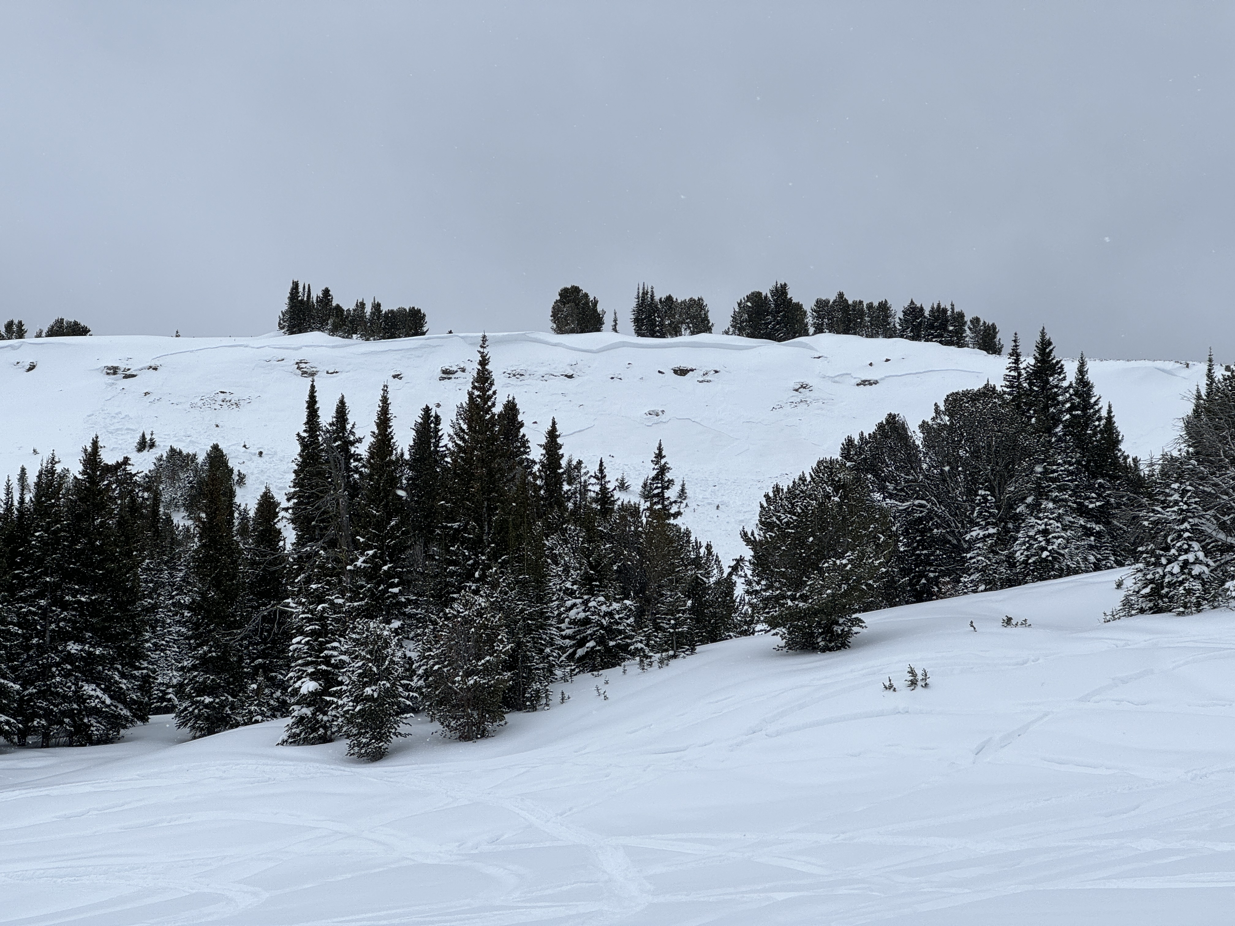
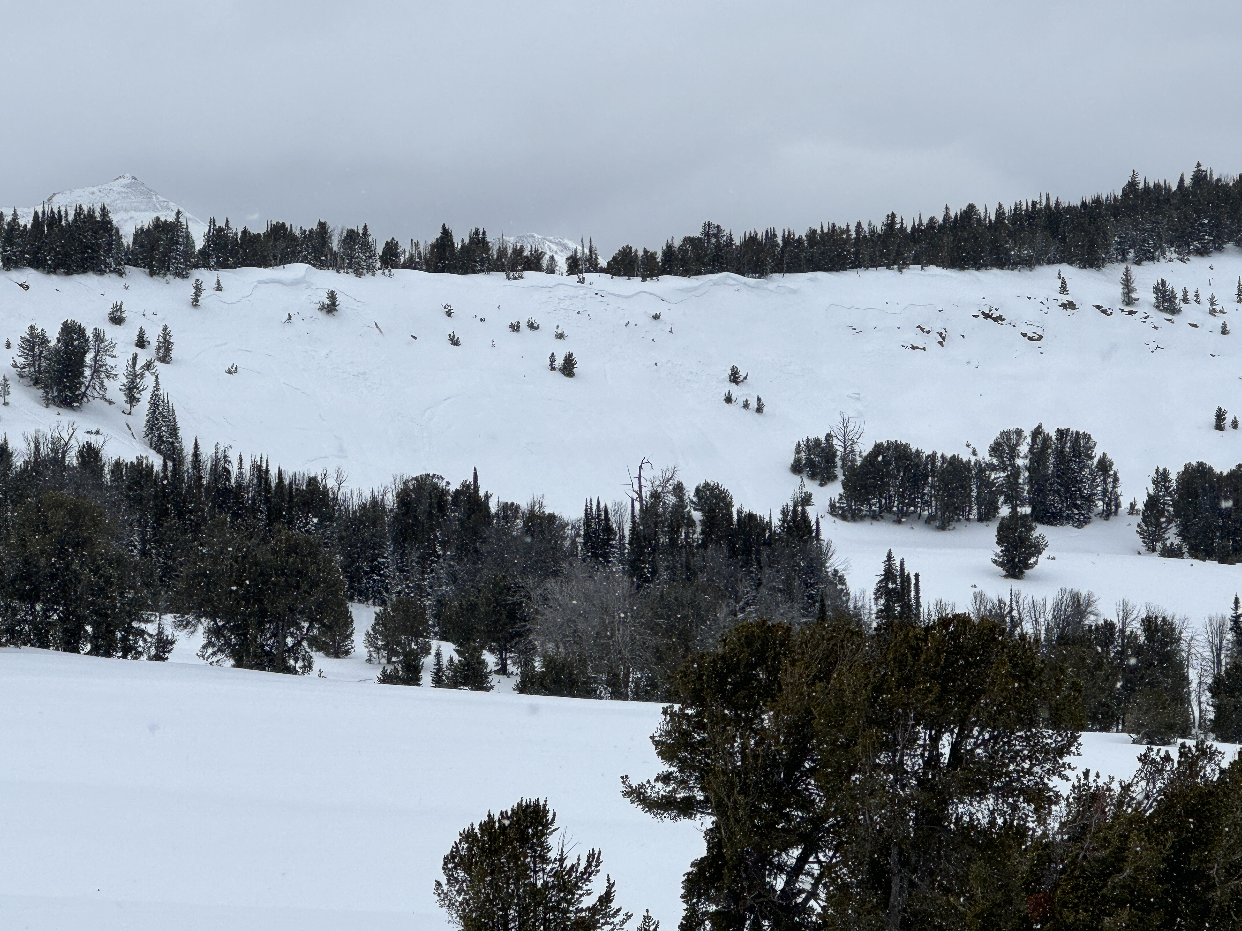
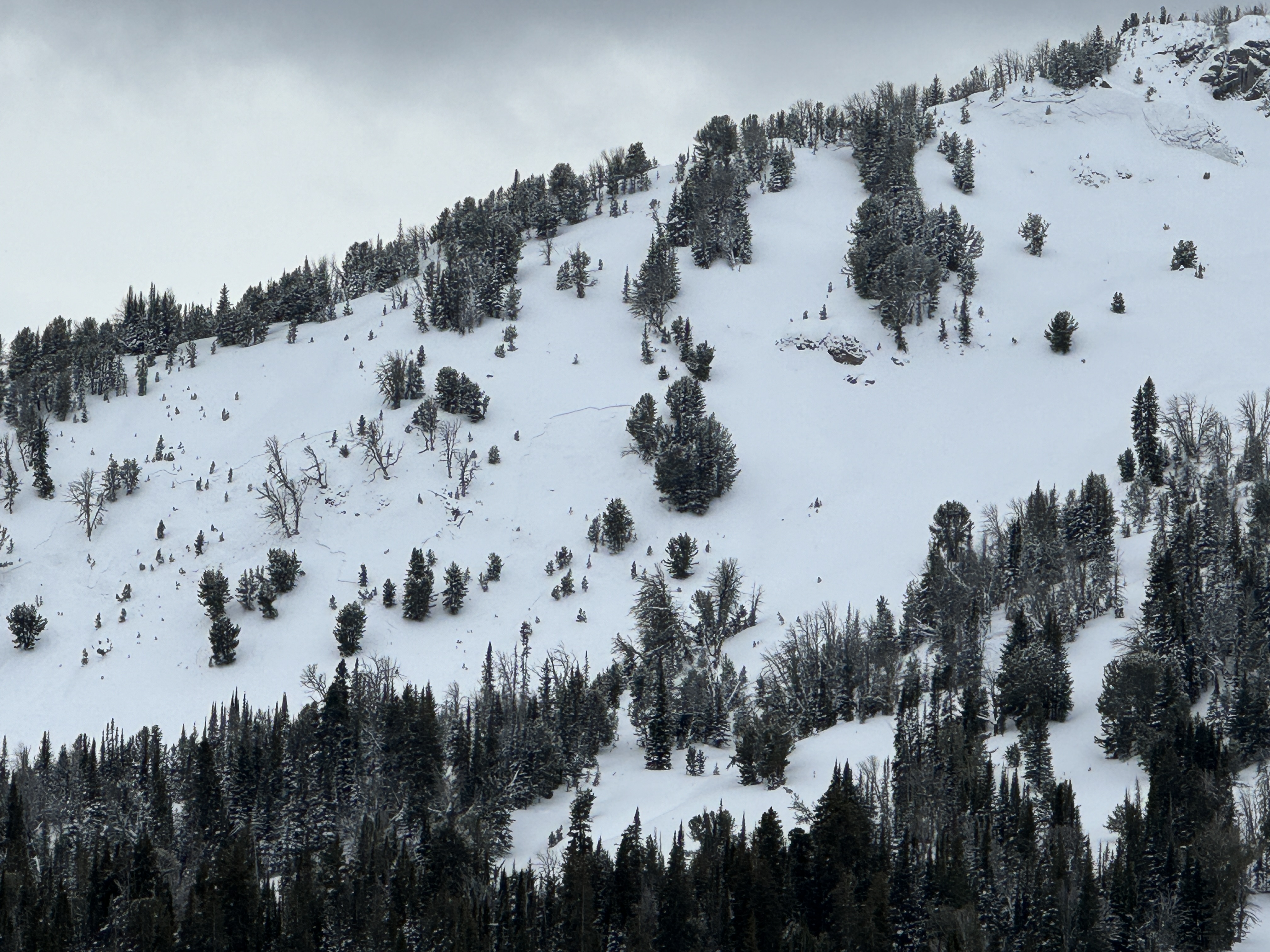
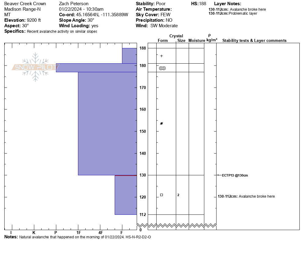
We rode into Buck Ridge today, 01/22, towards the Bear Creek wilderness boundary. Dangerous avalanche conditions exist. Skiers and riders should give themselves wide safety margins when traveling around avalanche terrain. Cautious route-finding and conservative decision-making are essential.
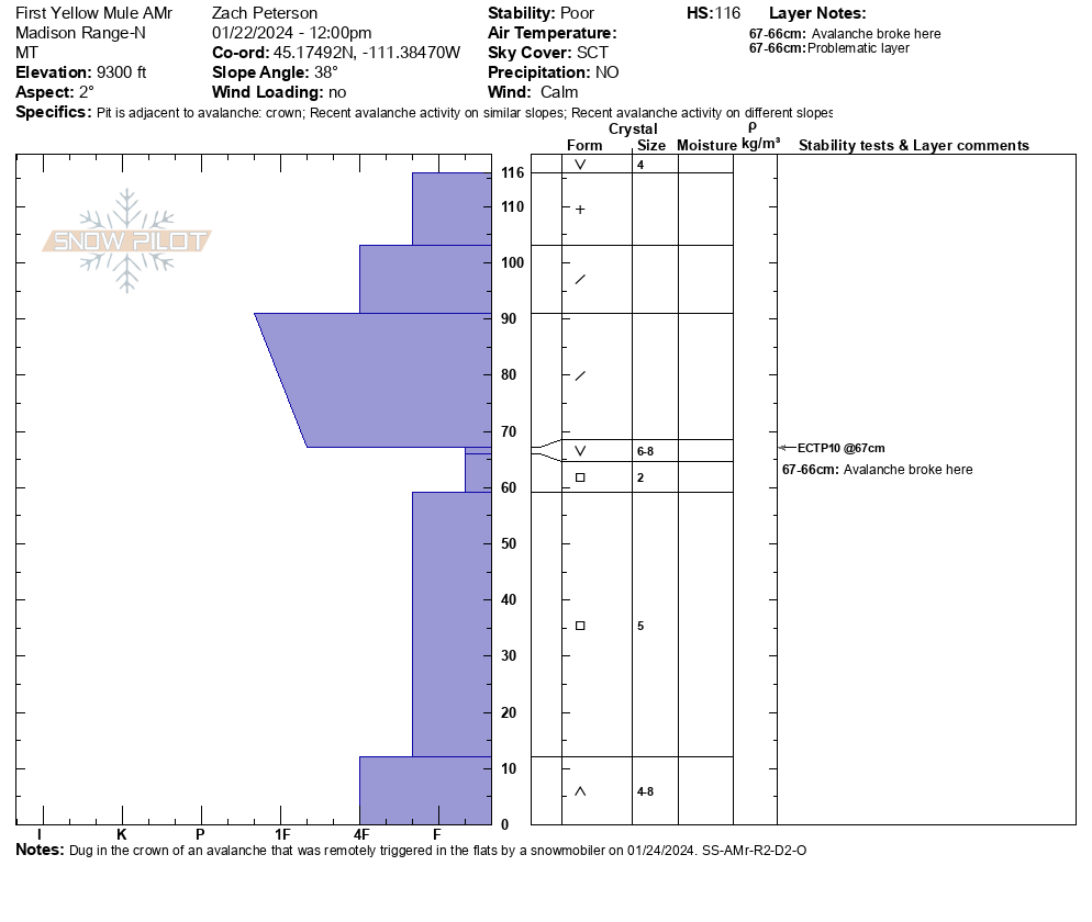
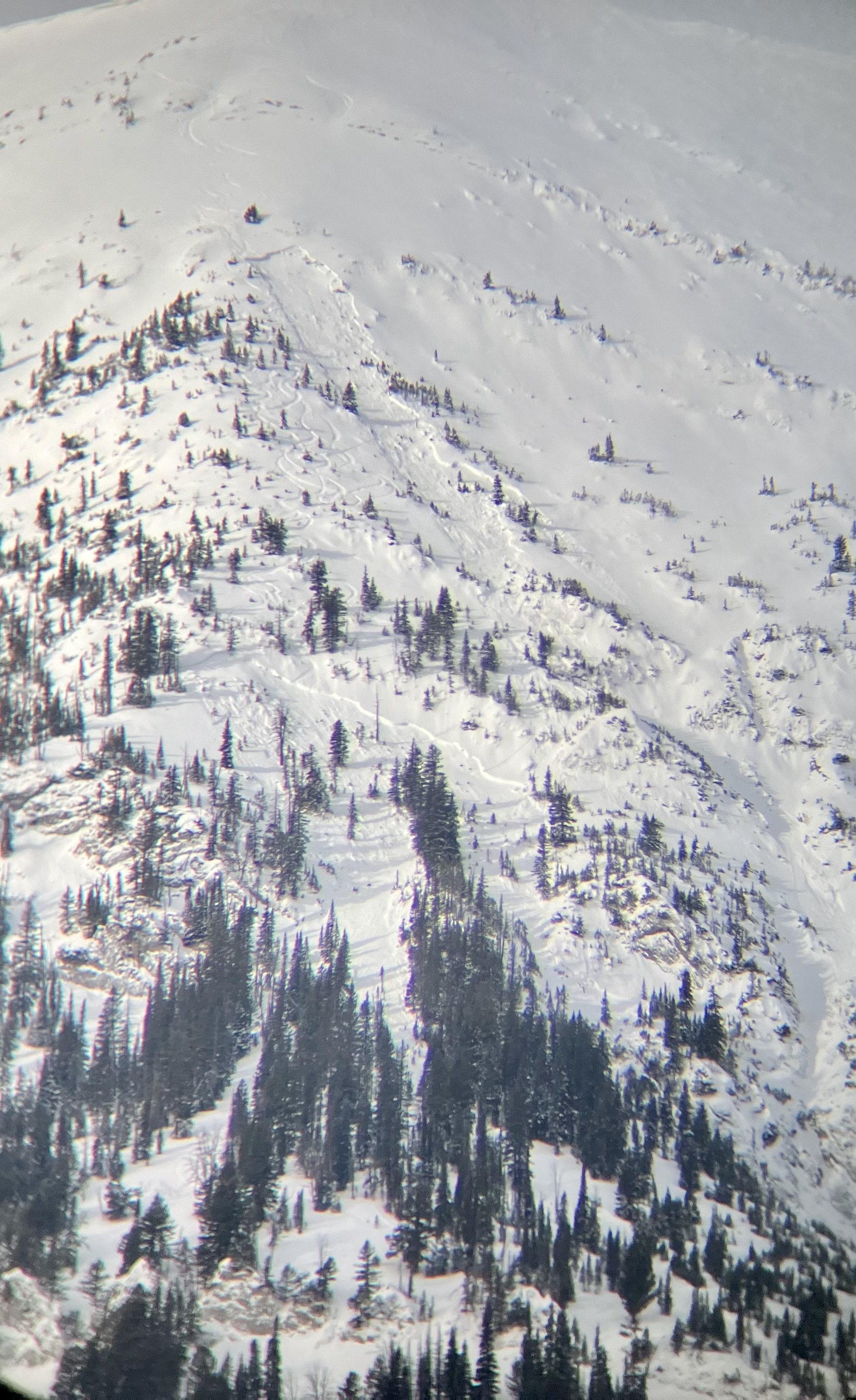
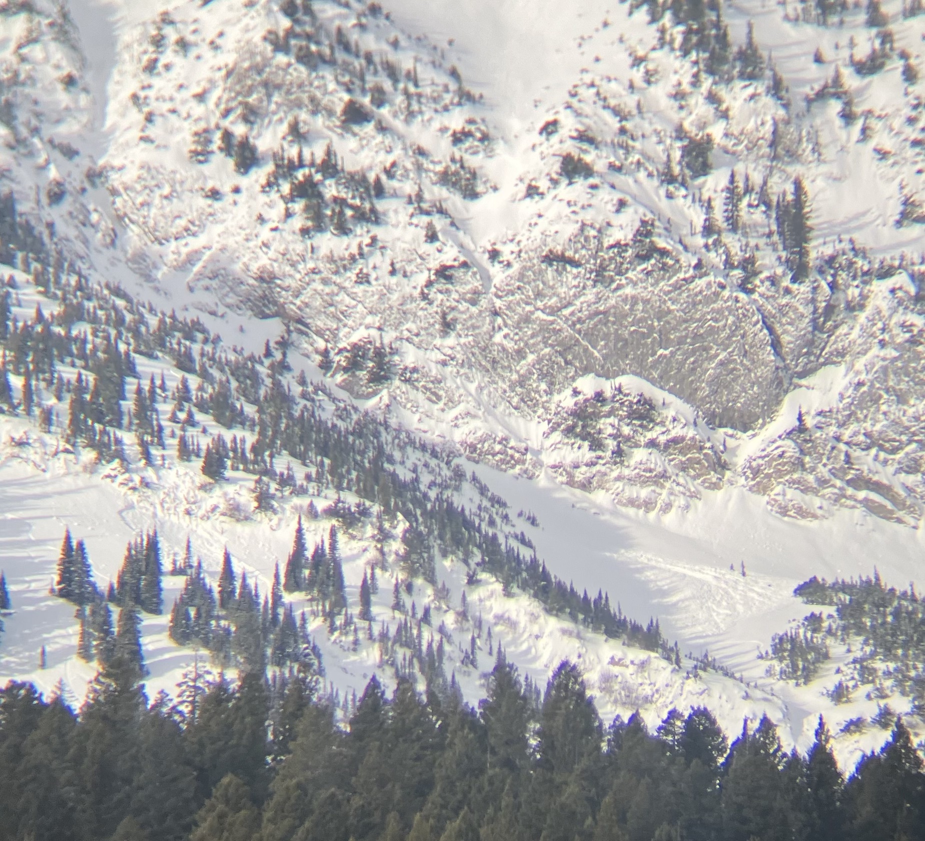
We saw multiple natural avalanches in Beaver Creek, First Yellowmule, Second Yellowmule, Third Yellowmule, and McAtee Basin. The recent avalanches were large enough to bury or injure backcountry travelers (D2) and likely happened within the last 24-48 hours.
We stopped at the crown of an avalanche in Beaver Creek and found a stiff, cohesive slab of wind-drifted snow on top of faceted snow below (ECTP 13, HS=188). The avalanche failed on the interface between the wind-loaded snow and fist hard facets below. The avalanche broke 2-3 feet deep, 100 feet wide, and ran 100 vertical feet.
In First Yellowmule, Dave was crossing a low-angle slope and remotely triggered an avalanche in steep terrain from 750' away. This avalanche was 1-2' deep, 250' wide, and ran 200' to the meadow below. The avalanche failed on a layer of buried surface hoar. At the crown, we dug a snowpit and had ECTP10 results on this layer.
SW wind blew throughout the day. Small wind drifts had begun to form on the road while riding out.
Some avalanches we saw/ triggered were on wind-loaded slopes, and others were not. All steep slopes are suspect.
Full Snow Observation ReportThe danger was CONSIDERABLE across all slopes. Wind-loading is not relevant to the current story.

Avalanche triggered by a skier on Saddle Peak on 1/21. No one caught. Appeared 2 feet deep, measured 75-250' wide and 1300' vertical on OnX. Photo: GNFAC
Full Snow Observation Report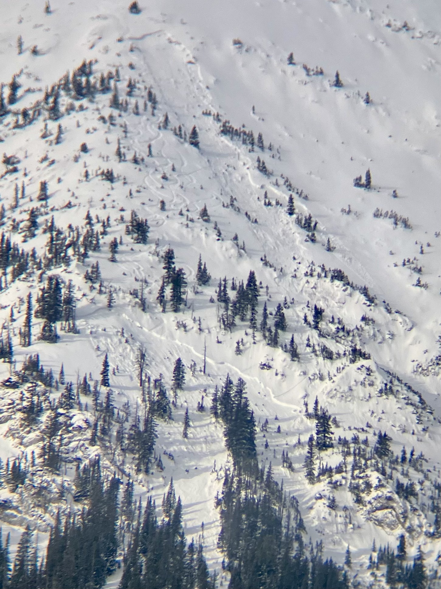
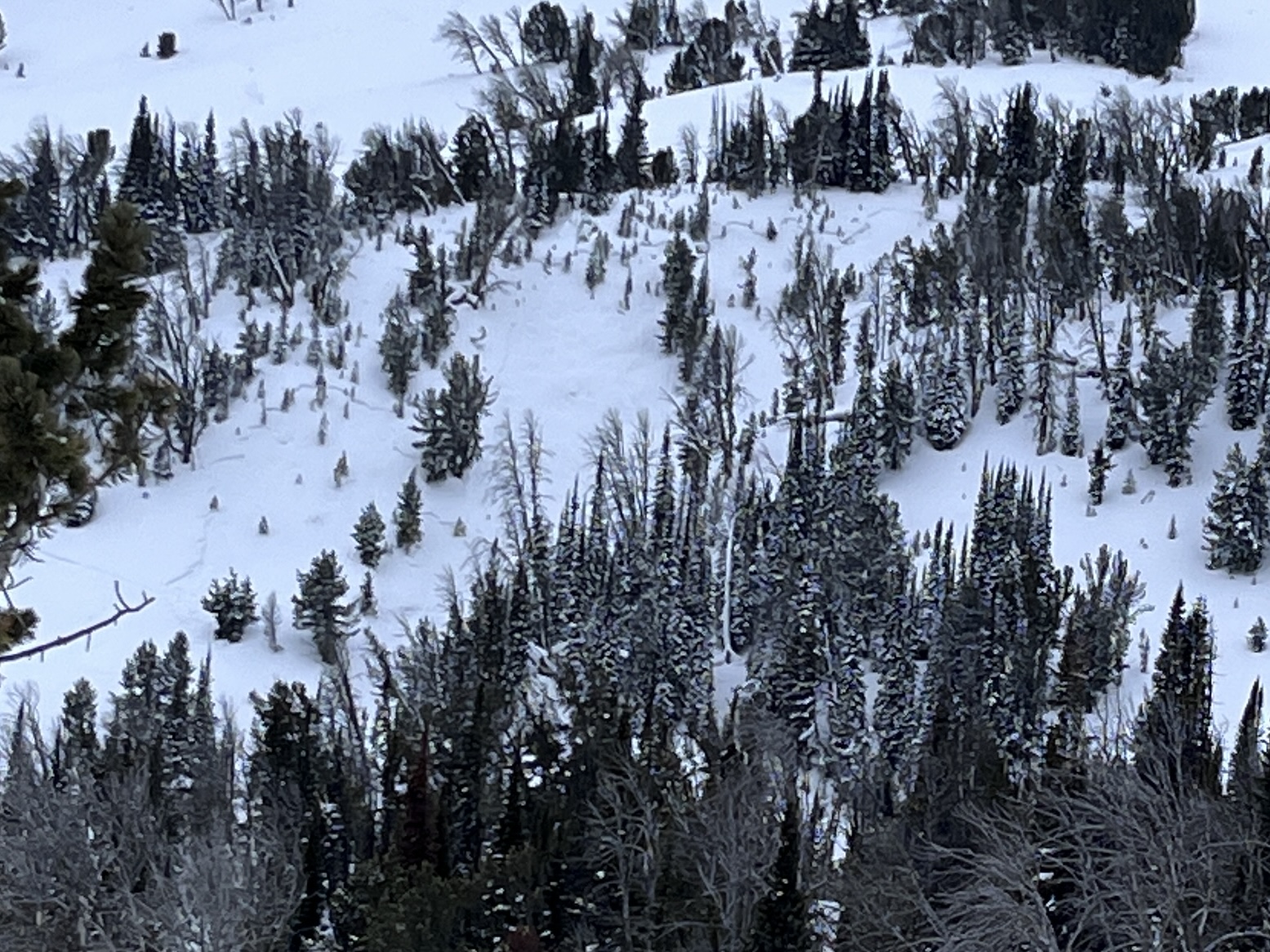
Still experiencing whumphing, and cracking along the skin track. Tracks from 24 hrs ago had filled in from wind. Wind today was 3-6 mph at 8900'. HS at 8900', exposed ridge = 30" deep. We saw 2 slides a couple days old? One was either natural or possibly remotely triggered by skiers this weekend (photo attached). SE aspect, about 9000' elev.
Temp was 28° up high, 38° at highway. Ski out from switchbacks down was sticky.
Full Snow Observation Report
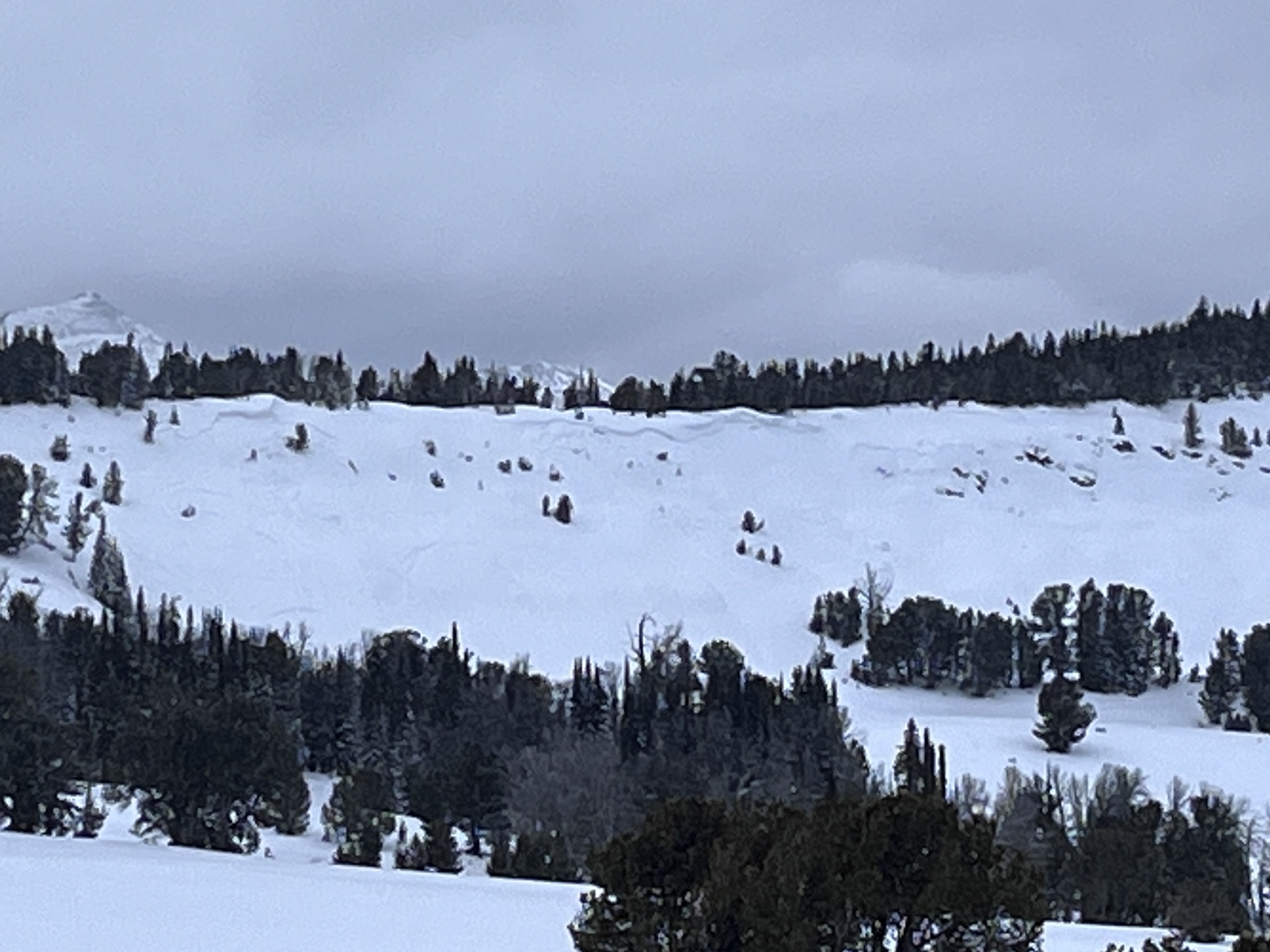
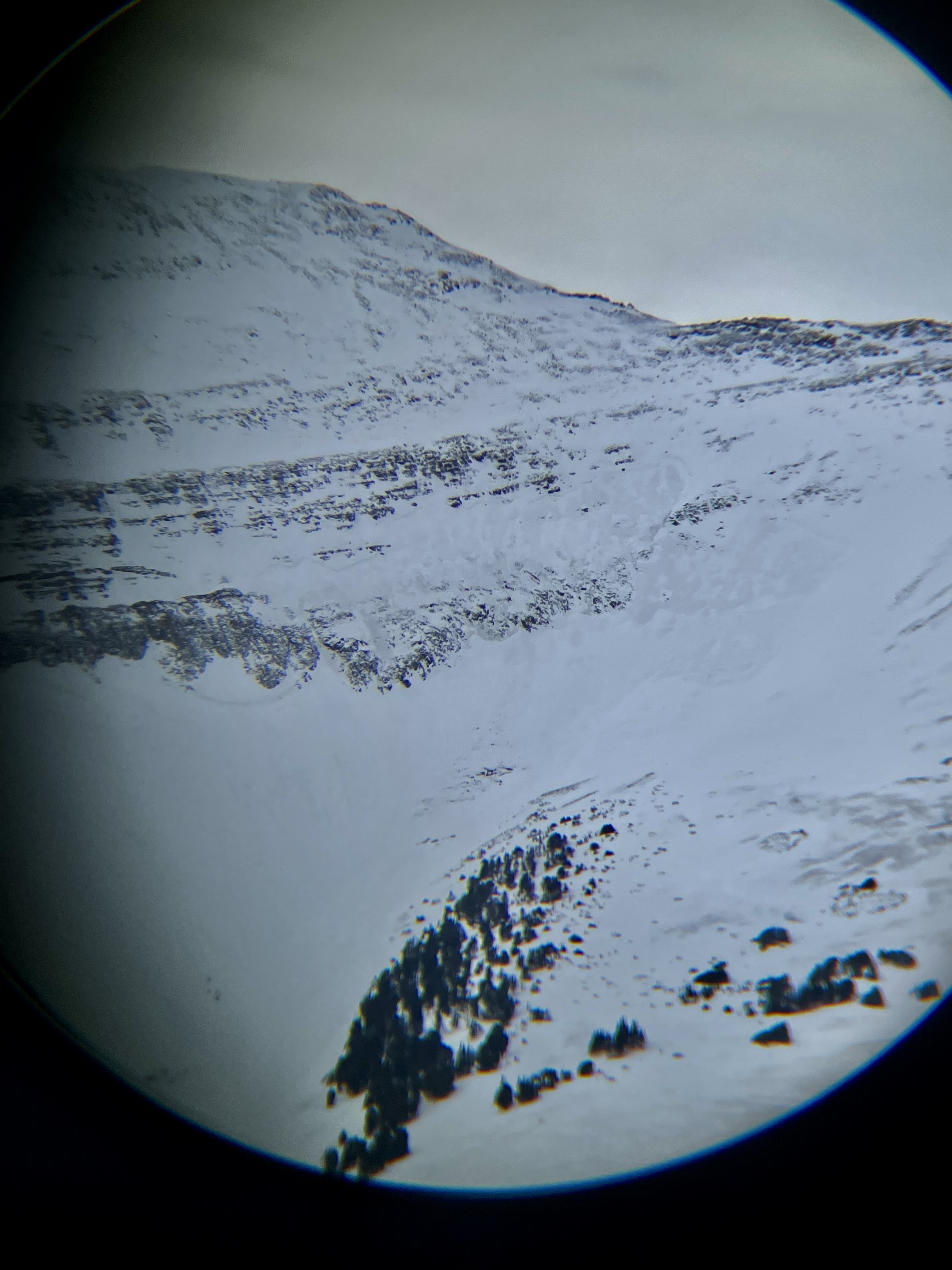
Noted over a dozen avalanches in the last several days around Buck Ridge, the Sphinx and Cedar mtn. Primarily near ridge lines, but also at lower and mid elevations. The most notable slides being the East face of the Sphinx (1/21)and NE basin off of Cedar. Photo of cedar crown.
Full Snow Observation Report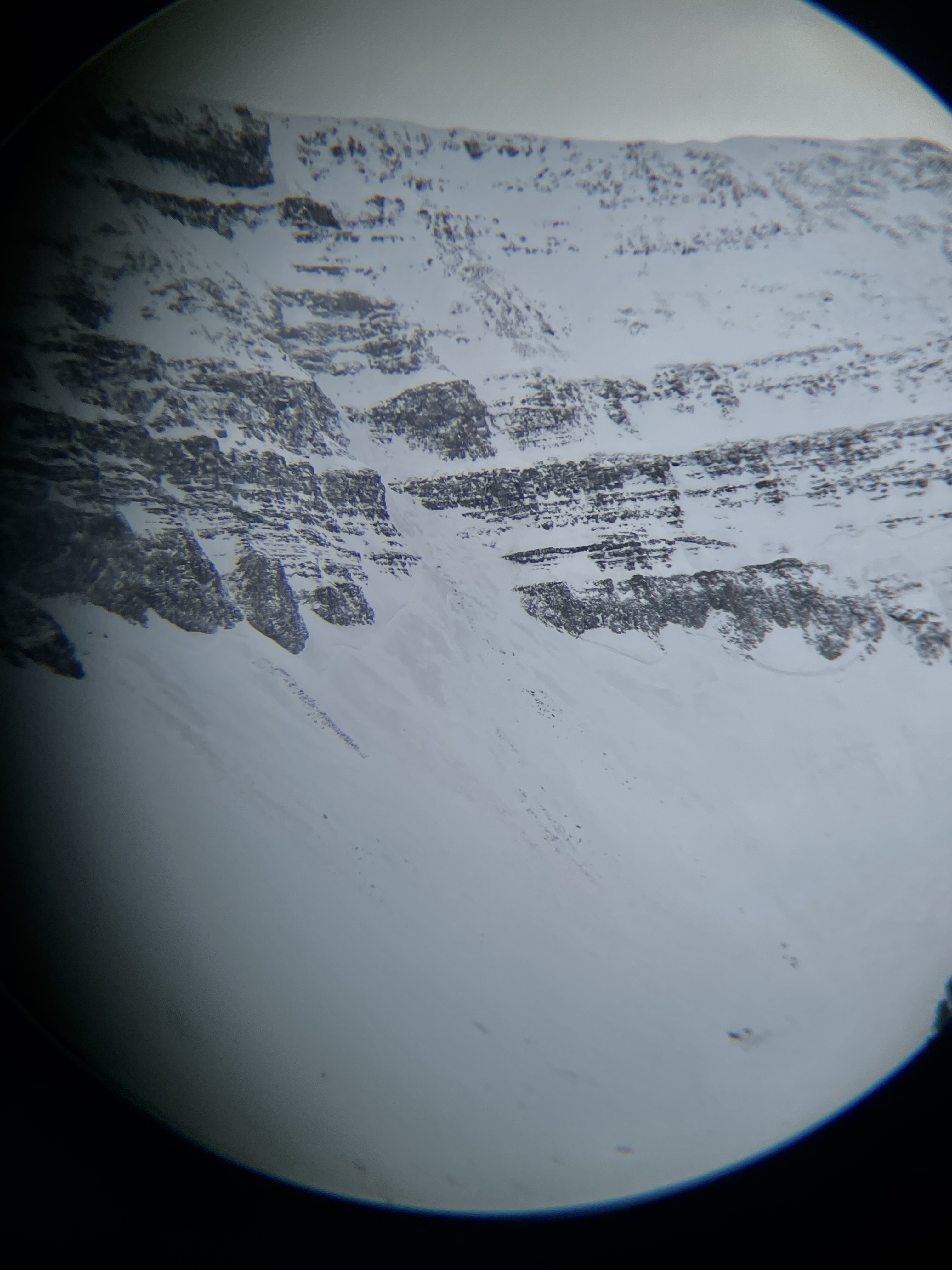
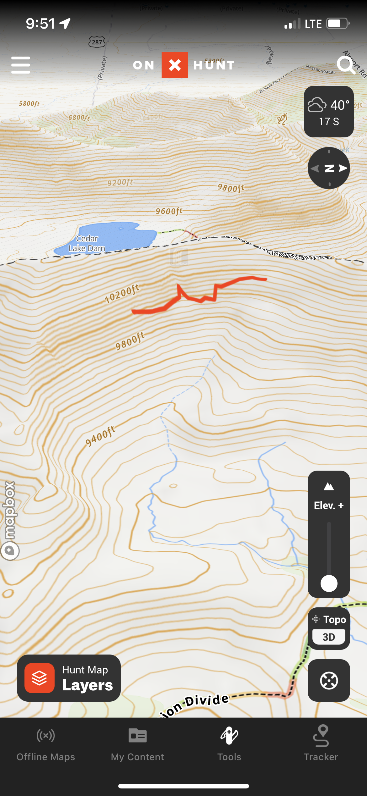
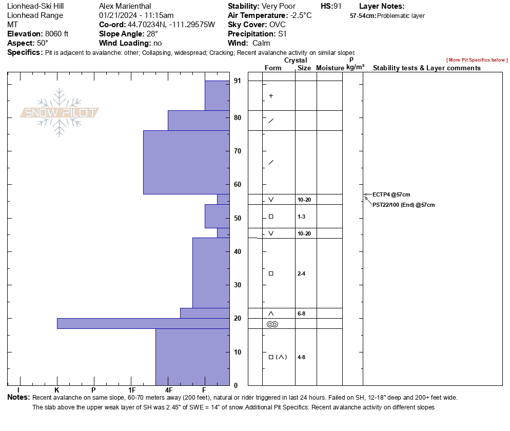
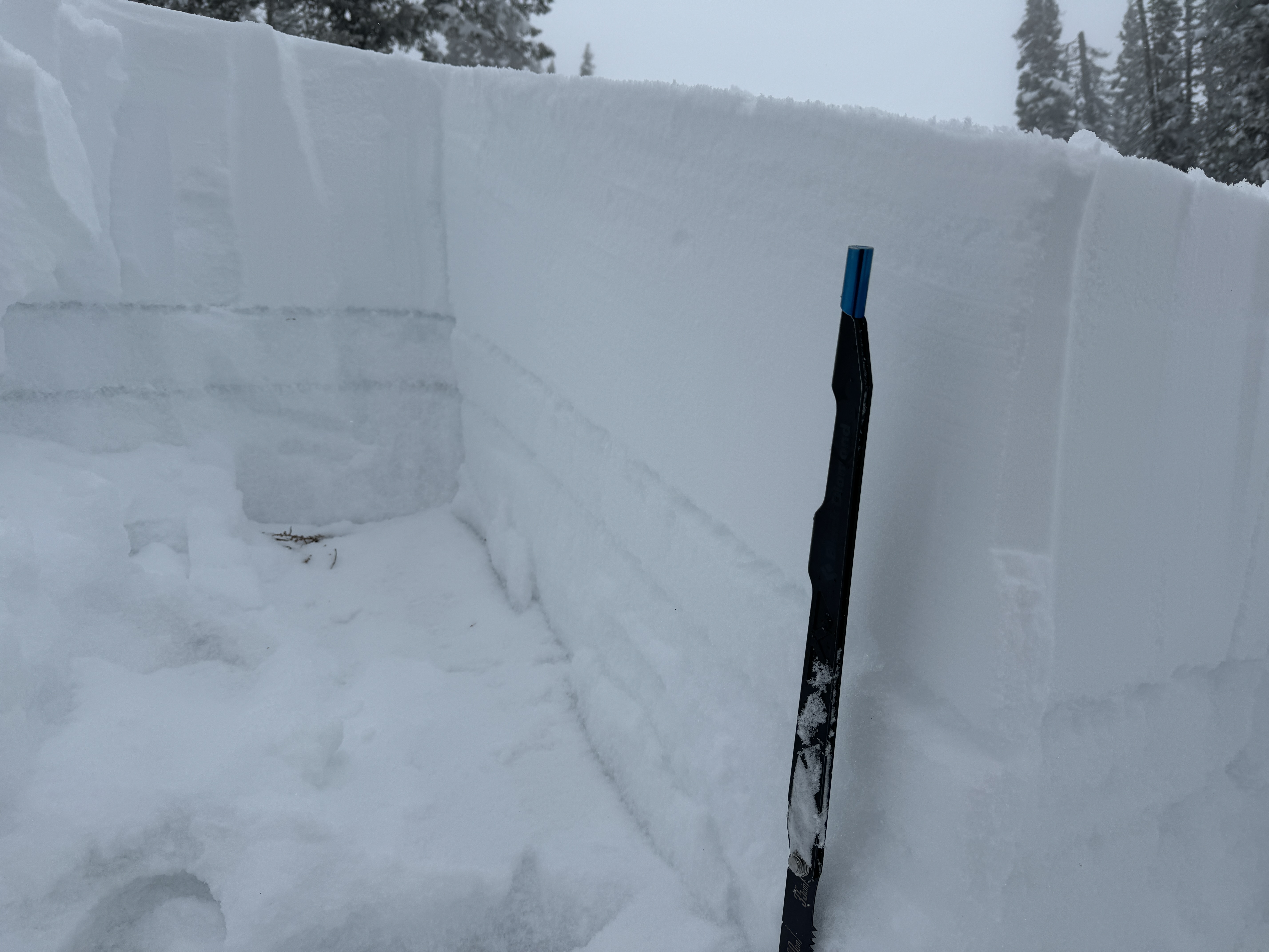
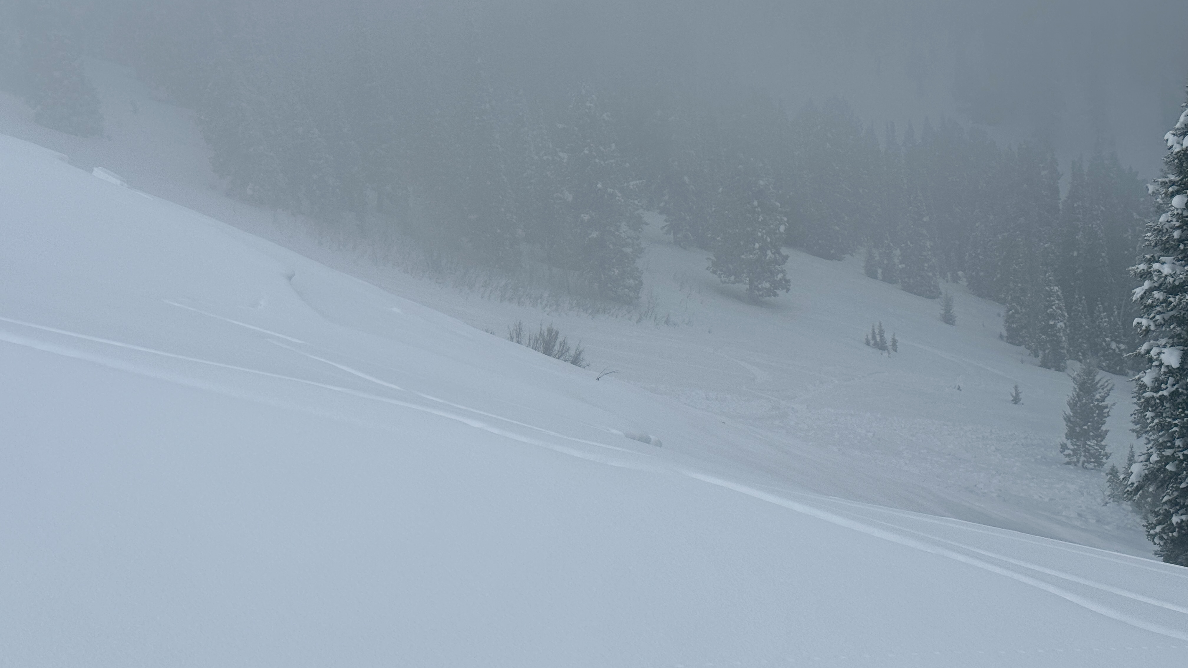
There was low visibility at Lionhead with a thick fog engulfing the ridge. We rode to Ski Hill and dug a pit on the south end. As we approached our pit site we noticed a recent avalanche on the steep center section of ski hill. It looked natural, possibly rider triggered in the last 24 hours, 14-18" deep, 225' wide, 200' vertical. SS-R2-D2-O.
Our snowpit had a layer of well-preserved 10-20mm surface hoar below 14" of snow (measured 2.45" SWE in 14" slab). Below that was soft facets, another layer of surface hoar, and more soft facets. We got ECTP4, and PST22/100end on the upper layer of surface hoar. The nearby avalanche probably failed on that surface hoar layer.
We went to look a little closer at the avalanche from a low angle (25 degree) slope above. While approaching we had a large collapse and shooting crack.
A group of riders in the parking lot saw a similar depth recent avalanche a little further up the ridge.
The snowpack is very unstable and avalanches large enough to bury or injure a person are likely to be triggered on any steep slope.
It was snowing lightly all day with calm wind and overcast to foggy skies.
Full Snow Observation ReportButtermilk was doable, but we got a little stuck trying to squeeze in...

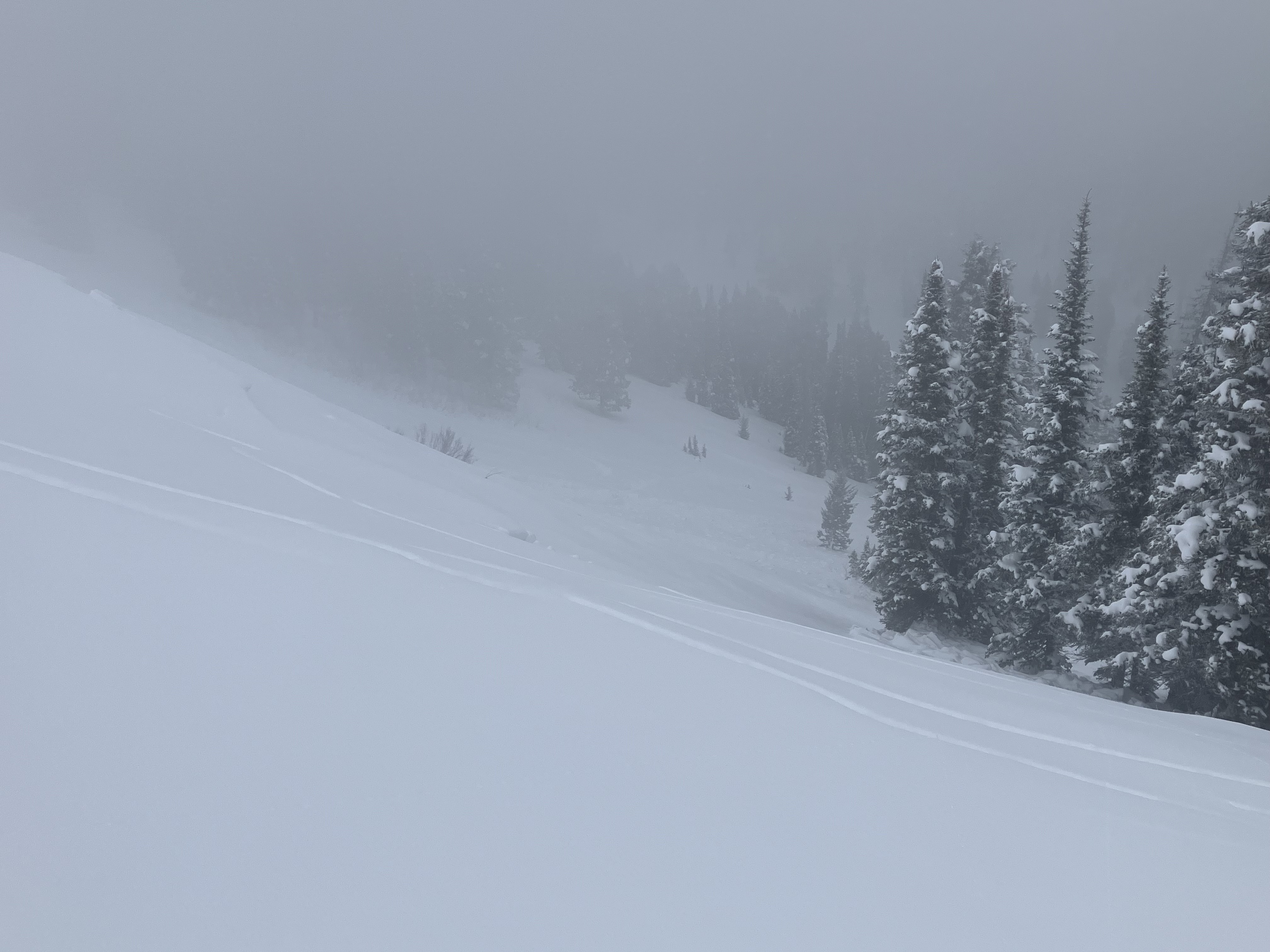
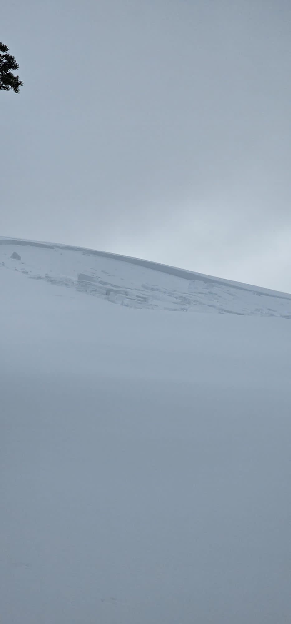
Toured out the gate of Bridger Bowl north of Texas meadows. Walking up through the flat meadow we got 10 or so small whumphs and 3 large booming collapses. No remote triggers on the steep terrain above were observed. Snowpit from where the large collapses were triggered is attached.
Full Snow Observation Report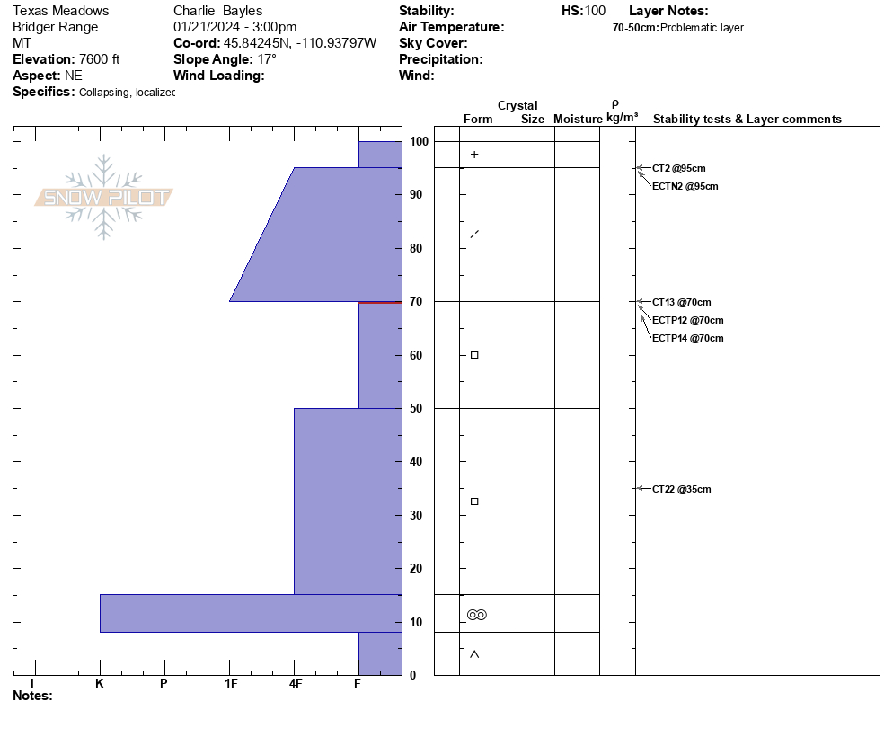
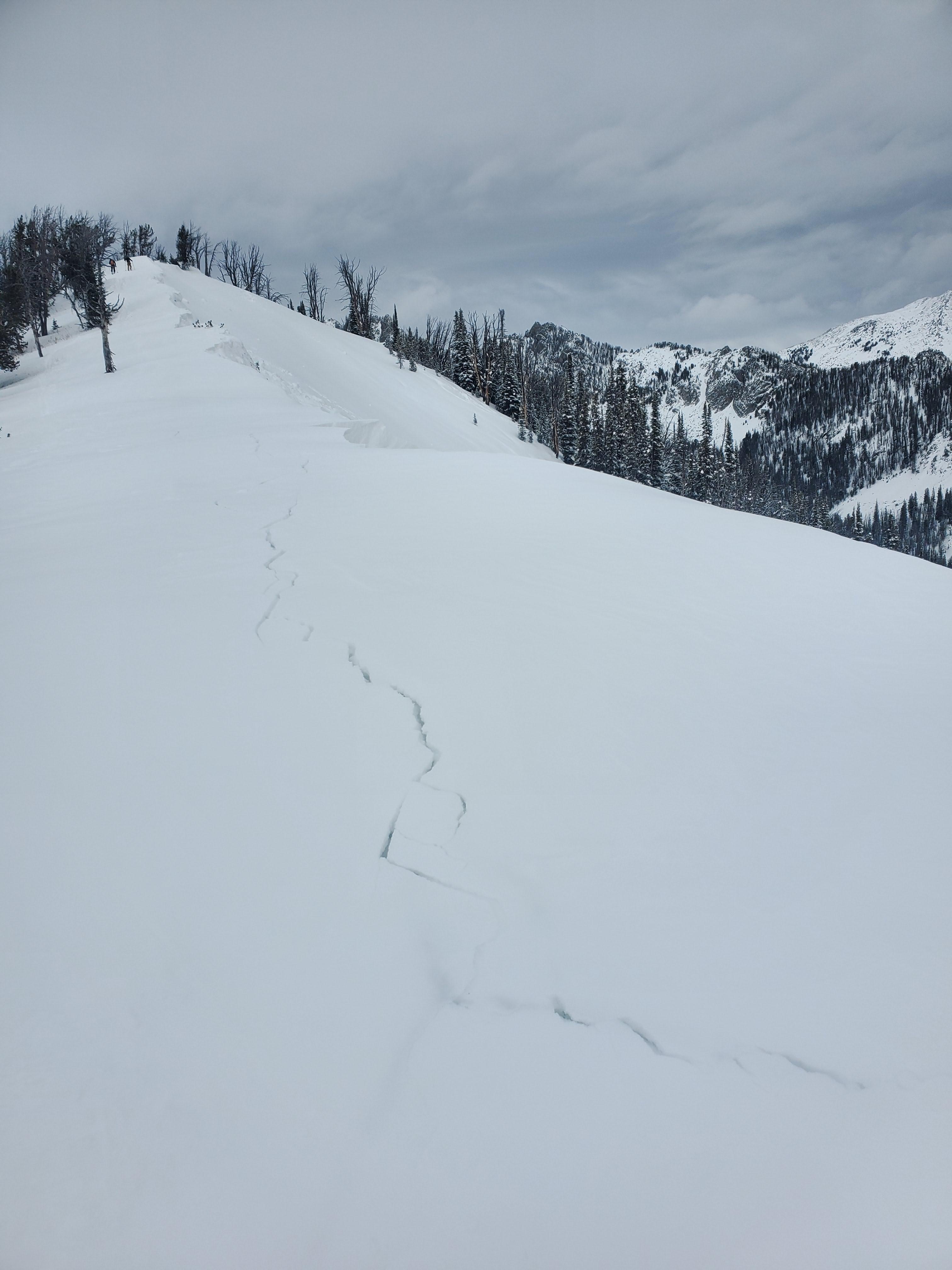
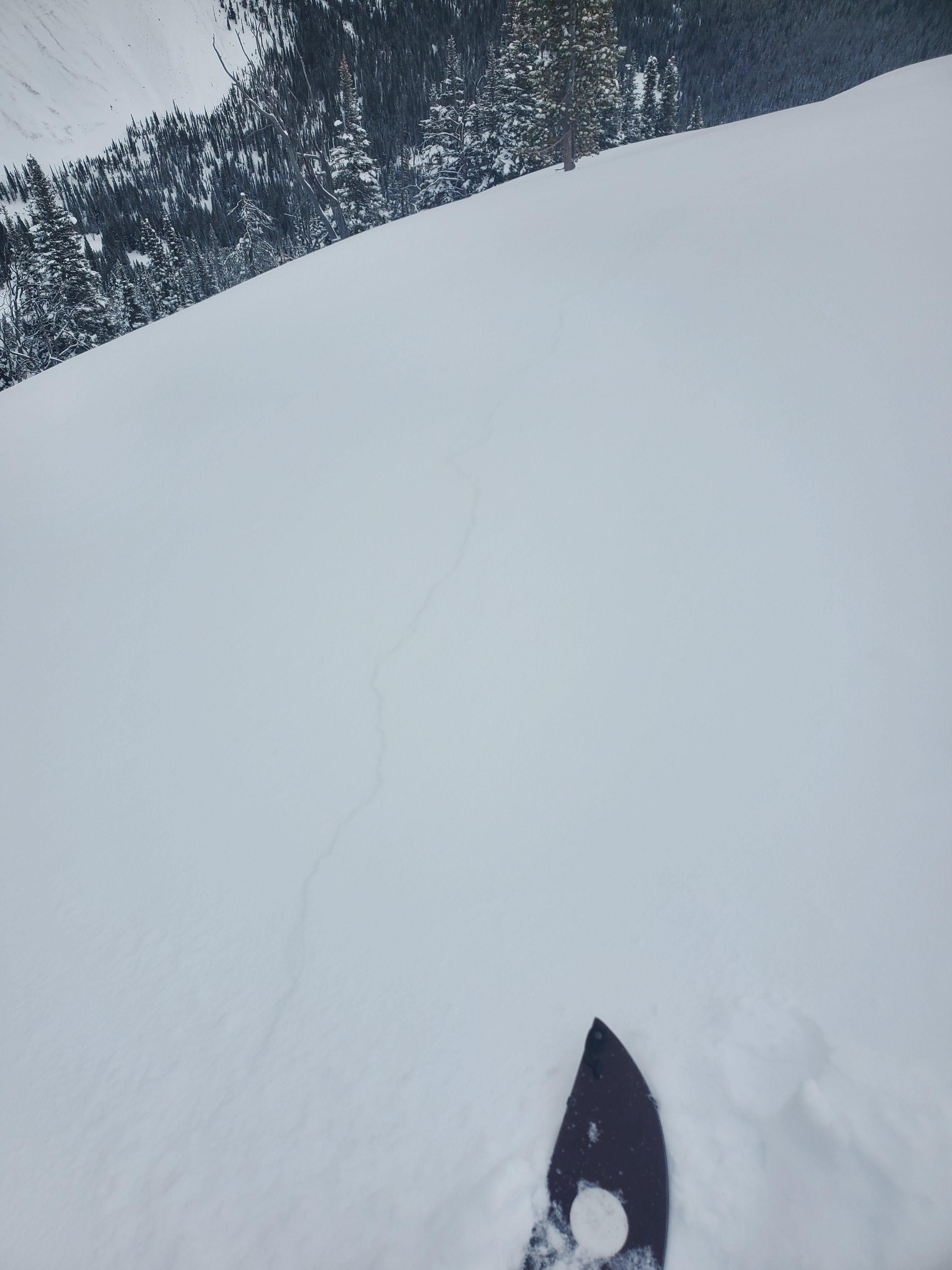
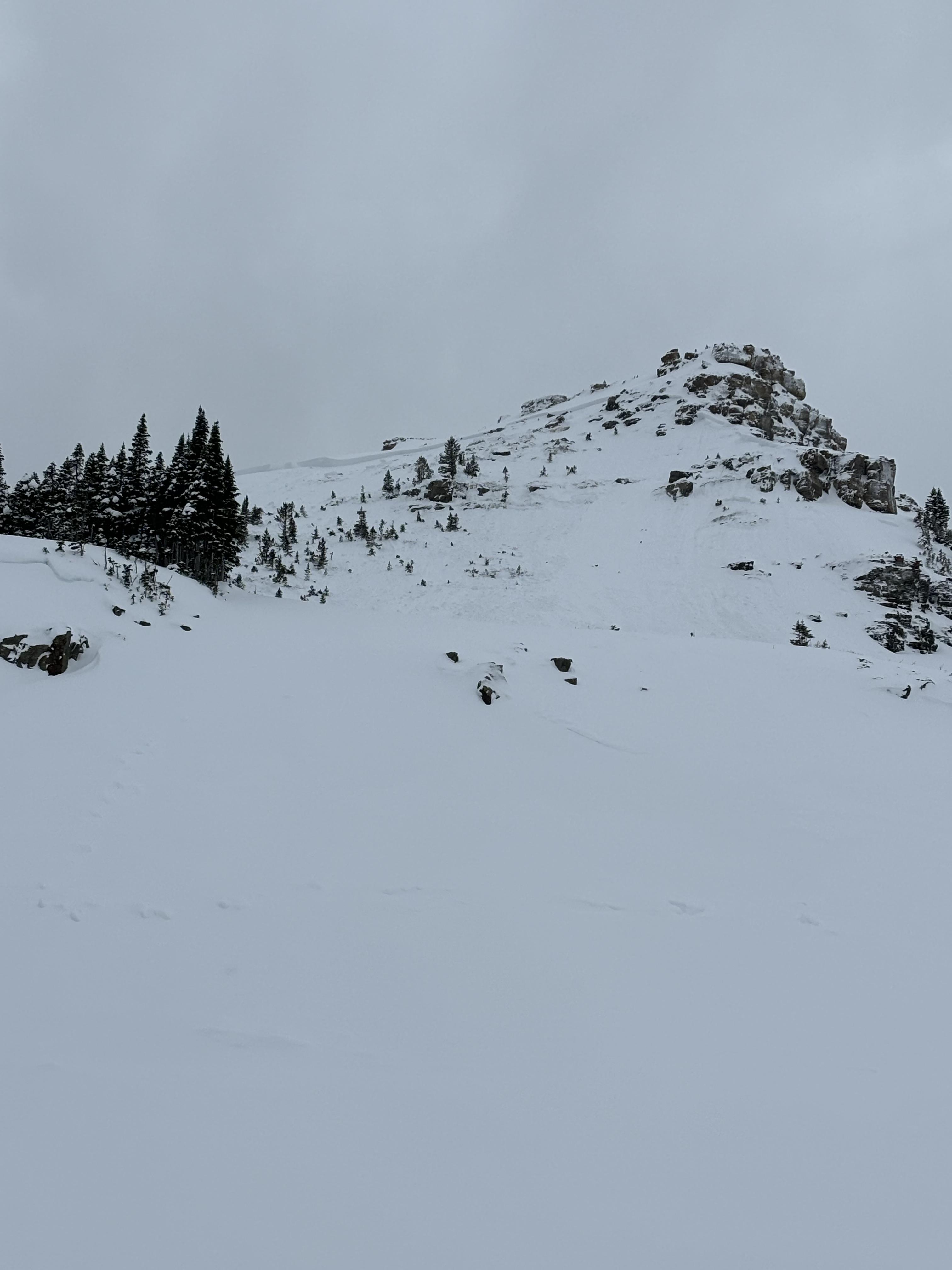
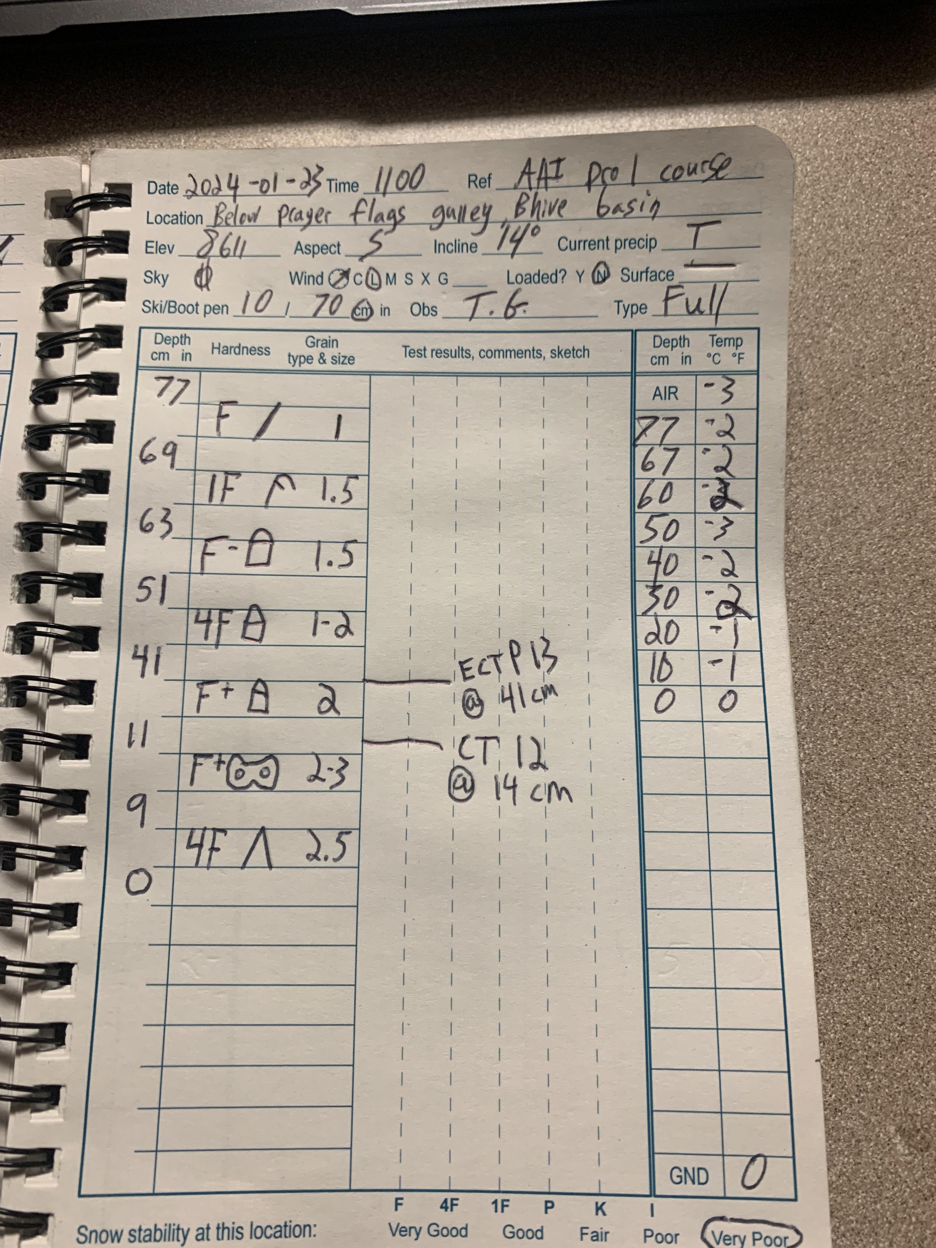
We toured up the ridge between Beehive and Bear Basin today. There was about 2-3 cm of fresh snow capping a breakable melt-freeze crust from yesterday. The crust was present on nearly every aspect and slope angle we traveled on (W-S-E). I suspect on steeper east aspects, which we did not tour on, this crust may not have been present.
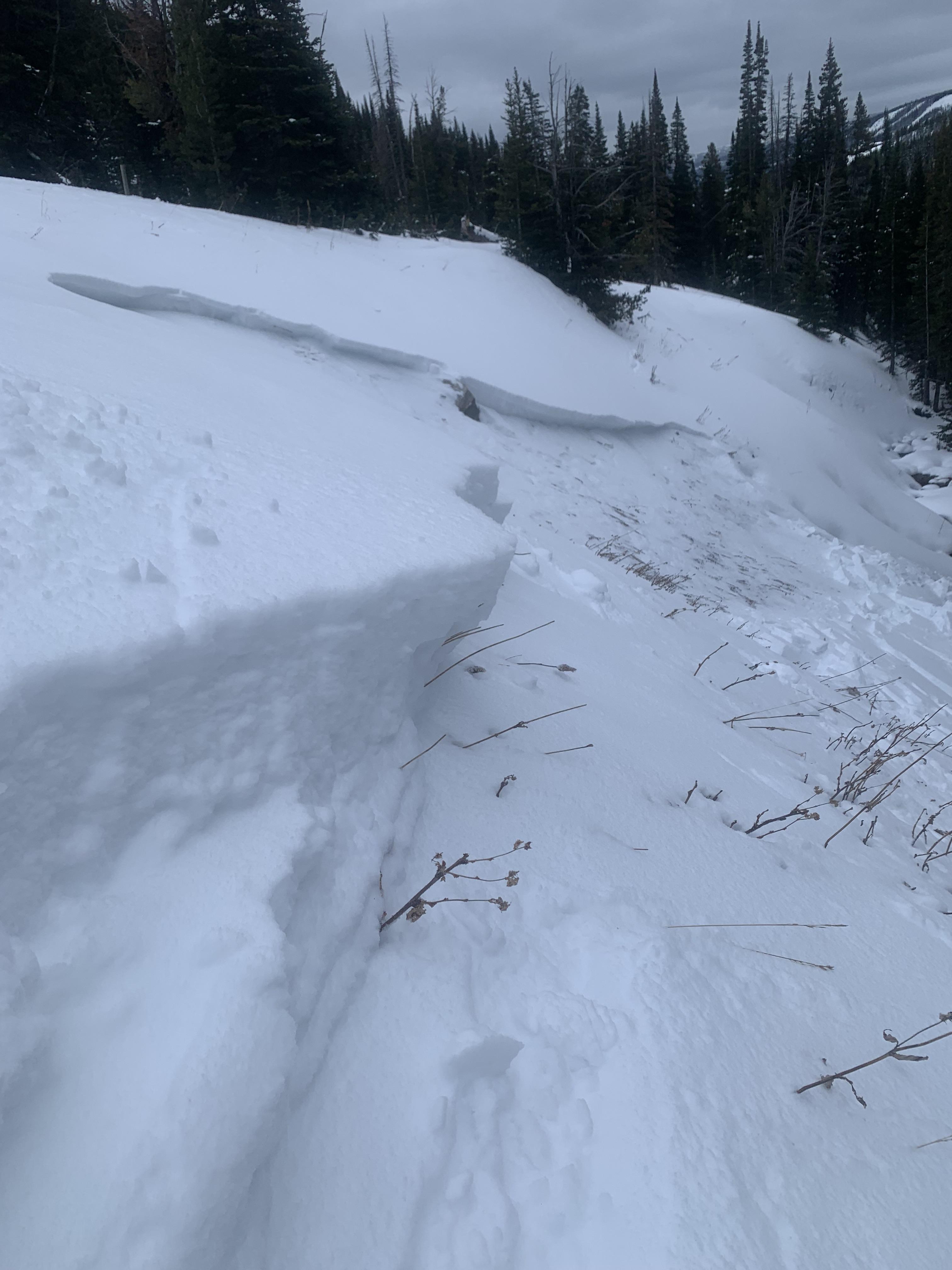
As we approached the cornice-triggered slide from yesterday below the prayer flags, we stomped around on a low-angle east-facing test slope just south of the slide to assess the presence and character of the slab. Stomping on the test slope yielded 15' plus shooting cracks from my ski tips and remotely triggered cracks about 30' further down the slope below a rollover. A subsequent test slope north of yesterday's slide produced a whumpf. A significant chunk of that cornice is cracked and ready to collapse. While jumping on the test slope almost 100 feet away from the cornice, a small piece broke off and fell onto the slope below.
HS on the test slope was about 70 cm. Below yesterday's crust was about a 15-20 cm 4F to 1F slab overlying a pile of facets. The failure plane was at the facet/slab interface and the slab has stiffened since my last time at Beehive a week ago.
Wx: Calm winds, warm temps, broken skies giving way to scattered skies in the pm. No precip.
Full Snow Observation Report