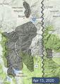
Advisory Archive

Since yesterday morning, the mountains near Bozeman and Big Sky got 2-4” of dense new snow with rain at lower elevations. There was no significant precipitation around West Yellowstone or Cooke City. This morning temperatures are 20s to low 30s F. Winds are northwest at 15-30 mph. Snow (and low elevation rain) showers will continue today. Tomorrow will be mostly sunny with light snow and rain returning on Sunday. High temperatures today will be in the 30s and 40s F with temps reaching into the 40s and 50s over the weekend. Winds will be generally westerly at 15-30 mph.


Yesterday the mountains got a trace of snow with light rain at lower elevations. Over the weekend temperatures reached mid-40s F with lows in the 20s F. This morning temperatures are mid-20s to low 30s F with west-northwest wind at 15-30 mph. Today through Wednesday will be mostly sunny with temperatures reaching mid-40s to 50 F and overnight temperatures in the high 20s to low 30s F. Wind will be west-northwest at 10-20 mph. On Wednesday wind will increase to 20-30 mph with a chance for snow and rain Wednesday night through Thursday.


This week’s storm totaled 8-12” in the Bridger, Madison, and Gallatin Ranges and 2-3” in the mountains around West Yellowstone and Cooke City. Winds ranged 5-15 mph with gusts of 30 mph from the northwest before shifting to the east and now back to the west. High temperatures in the mountains were in the 20s F and near 30 F in the Bridger Range.
The weekend will start off with sunny skies and warm temperatures before clouds build late Saturday afternoon with 1-2” of snow possible by Sunday. High temperatures will be in the upper 30s to 40s F with moderate winds 15-25 mph from the west to southwest until late Saturday when they will calm to 5-15 mph for the remainder of the weekend.


Snowfall began mid-day yesterday with 6-8” accumulating by this morning in the Bridger Range and near Big Sky, 4” in the northern Gallatin Range, and 1-2” near West Yellowstone and Cooke City. Winds are 10-15 mph out of the west-northwest with gusts of 30 mph. Temperatures this morning are in the high teens and low 20s F. With a cold front pushing through today, temperatures will only rise a couple degrees this afternoon. Snow will continue today, with an additional 3-7” falling today near Bozeman and Big Sky, and 2-4” near West Yellowstone and Cooke City.
Moderate west winds today will shift to the northeast as the cold front passes through this afternoon and evening. Tomorrow will bring a mix of sun and clouds, but the snowfall will be mostly done. Sunny skies and warmer temperatures will prevail by Friday and through the weekend.
Over the weekend the Bridger Range got 9-12” of snow with 3-7” elsewhere. Wind was easterly at 15-35 mph Saturday night through Sunday morning, then shifted north-northwest at 5-20 mph. This morning temperatures are single digits above and below zero F. Today temperatures will reach teens to low 20s F under partly cloudy skies with very light snow showers.
Today will be the coldest of the week, but winter isn’t going anywhere soon. The next few days temperatures will reach mid-20s to low 30s F with overnight lows in the teens F. Wind will remain north-northwest at 10-35 mph. Heavy snow is possible Tuesday night through Wednesday with 10-18” in the mountains near Big Sky, Bozeman and Cooke City and 4-6” near West Yellowstone.


There is no new snow this morning. Temperatures are in the high 20s to low 40s with winds 5-15 mph out of the west. Today will start off mostly sunny. High temperatures will be in the high 30s and 40s F. Winds will be westerly at 10-20 mph. Clouds will move in this afternoon ahead of an approaching cold front. Some rain and snow showers are possible this afternoon before snowfall ramps up tonight and tomorrow.
This weekend will remind us that we live in Montana and winter isn’t through with us just yet. Low temps will drop down to the single digits F with highs in the 20s F. By Sunday, expect 6-12” of new snow in the northern ranges and around Cooke City, with 2-4” falling near West Yellowstone. The bulk of the snow will fall during the day on Saturday. Skies may clear again by Sunday afternoon. A warming trend will return next week.


This morning the mountains near West Yellowstone and Cooke City have 1-2” of snow with none near Bozeman and Big Sky. Temperatures are high 20s F and wind is southwest at 10-25 mph. Today temperatures will be high 30s to low 40s F with west-southwest wind at 10-20 mph. Snow showers will continue this morning in the southern half of the advisory area with 1-3” today and a couple more tonight. Near Bozeman and Big Sky could get 1-2” of snow in the mountains with rain in the valley, and rain possible at higher elevations this afternoon.
Tomorrow skies will clear through the day. Wind will shift westerly this evening, and increase to 20-35 mph tomorrow afternoon. The middle to end of the week will be mostly sunny with temperatures overnight in the high 20s F and daytime temperatures reaching 30s to 40s F. There is a chance for snow next weekend.


Yesterday morning the mountains near West Yellowstone and Cooke City got an inch of snow with none elsewhere. Overnight, wind was south-southwest at 15-25 mph with gusts to 35 mph. This morning temperatures are 20s F and wind is southwest at 10-20 mph. Today temperatures will reach mid-30s F under partly cloudy skies with southwest wind at 15-30 mph. Light snow showers will drop a trace to an inch of snow in the southern ranges today, and another 1-2” is possible in the mountains by morning.


Yesterday morning it snowed 2-3 inches near West Yellowstone and Cooke City, while the mountains around Big Sky and Bozeman stayed dry. This morning temperatures are in the teens and low 20s F. Winds are southwest and west at 10-25 mph with gusts of 30-45 mph. Clouds will break up this morning leaving us with mostly sunny skies. Winds today will be 10-25 mph out of the southwest. Temperatures will rise into the mid-30s F. A dusting of snow is possible overnight.


After a couple cold wintery days, spring is on its way back today. We’ll have mostly sunny skies and mountains temperatures a bit warmer than yesterday, rising to around 30 F. This morning, there is no new snow and temperatures are in the single digits and low teens F. Winds are 5-20 mph out of the southwest and west. Light to moderate southwest winds will continue today. Snow showers are possible this afternoon and tonight, but expect less than an inch of new snow accumulation.