Good Morning. This is Eric Knoff with spring snowpack and weather information on Monday, April 16th at 6:45 a.m. The Gallatin National Forest Avalanche Center has stopped issuing daily avalanche advisories for the season. We will update weather and snowpack information every Monday and Friday for most of April. I will update this information Friday morning. This bulletin does not apply to operating ski areas. Bridger Bowl is closed for the season and backcountry conditions exist.
Avalanche Fatality
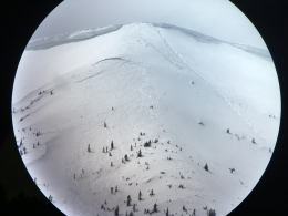
On Saturday, April 14th at approximately 10:30 a.m., a solo skier exited the south boundary of Bridger Bowl Ski Resort and hiked to the summit of Saddle Peak (elevation 9,100 feet). Around 10:50 a.m., the skier dropped off the summit of Saddle Peak and triggered the avalanche. He was caught and carried 1,500 vertical feet down a steep and narrow avalanche path. The victim was buried with his hand sticking out of the snow.
At the time of the slide, a skier riding Schlashman's Chairlift at Bridger Bowl Ski Resort witnessed the skier trigger and get caught in the avalanche. The witness was unsure if the skier escaped the avalanche, but informed ski patrol at the top of the lift. Members of ski patrol called Gallatin County Search and Rescue to inform them of the incident and mobilized for a search.
Approximately one hour later, members of the Bridger Bowl Ski Patrol located the buried victim. CPR was performed, but resuscitation efforts were unsuccessful. The skier was wearing an avalanche beacon, but had no partner. The avalanche is classified as SS-AS-R3-D2-I
You can view photos of the incident here. Our condolences go out the victim’s friends and family.
There is no new snow to report over the past 24 hours. This morning skies are mostly clear and temps range from the upper 20’s to mid-30’s F. Winds are blowing 15-30 mph out of the SW with gusts around Hyalite and Big Sky breaking 50 mph. Today, skies will become increasingly cloudy as a cold front approaches the region. Valley rain and mountain snow are likely this afternoon with the frontal passage. There’s also the possibility of a thunderstorm. The mountains south of Bozeman will see 2-4” by tomorrow morning while the Bridger Range will see 1-3”. Highs today will climb to the upper 30’s to low 40’s before the cold front reaches the area. Winds will remain moderate to strong out of the SW. Winds will shift to the W-NW behind the front. Cloudy skies and cooler temps will remain over the region through Wednesday.

Below average temperatures and above average precipitation this spring has kept the snowpack cold and dry. Typically, the pack has undergone multiple freeze-thaw cycles and is well on its way to becoming a warmer and wetter spring pack by now. That is not the case this year.
The avalanche fatality on Saddle Peak this past Saturday is a somber reminder that avalanche season is far from over (video, photos). Snow stability is complicated this time of year and conditions can change very quickly. Sun, snow, rain, gusty winds, and rapidly warming temperatures are all factors in the spring. It is not uncommon to have a wide variety of conditions in a single day, especially in Montana. Anticipate rapidly changing conditions and plan accordingly.
With more snow and wind in the forecast, wind slabs and dry loose avalanches will be the primary avalanche problems to keep an eye out for. Wet loose avalanches will also be possible if it rains or if the sun shines for an extended period of time (photo) – however, this problem should be short lived as cooler temps, snow and wind are in the forecast for the middle of the week. Also, watch for and avoid large cornices along the ridgelines.
If you have not done so already, check out our spring avalanche advice below.
Share your observations with us on Instagram! #gnfacobs
Posting your snowpack and avalanche observations on Instagram (#gnfacobs) is a great way to share avalanche and weather information with us and everyone else this spring.
You can also drop a line via our website or email (mtavalanche@gmail.com) and we will share pertinent avalanche, weather and snowpack info as timely as possible.
Spring weather can be highly variable and create a mix of avalanche problems to watch out for. Snow conditions and stability can change drastically from day to day or hour to hour. Heavy snow in the mountains (graphic) will make avalanches possible for the next few months. Continue to assess the snowpack, weather, and terrain carefully and practice safe travel techniques for the remainder of the season.
NEW SNOW AND WIND LOADED SLOPES
Spring storms are notorious for depositing heavy amounts of snow in the mountains. Even with a deep and generally stable snowpack throughout the advisory area, heavy and rapid loads of new snow will decrease stability. The main problems to look out for are avalanches breaking within the new snow, wind slabs, and loose snow avalanches. The likelihood of triggering an avalanche spikes during and immediately after snow storms. New snow instabilities tend to stabilize quickly, but it’s a good idea to give new snow a day to adjust before hitting big terrain. New snow instabilities can be difficult to assess, and spring storms bond to old snow differently across aspects and elevations. Conservative terrain selection is essential during and immediately following storms. Wind loaded slopes and slopes steeper than 35 degrees should be avoided for 24-48 hours after new snow and wind.
New snow can quickly change from dry to wet on a spring day, and stability can decrease rapidly with above freezing temperatures or brief sunshine. New snow may bond well early in the morning, and then easily slide later. Wet loose slides are likely during the first above freezing temperatures or sunshine immediately after a storm. Anticipate changes in snow stability as you change terrain and over the course of the day. An early start is always an advantage. Be ready to change plans or move to safer terrain at the first signs of decreasing stability.
WET SNOW AVALANCHES
Spring and wet snow avalanches go hand-in-hand. Above freezing temperatures, rain, and/or intense sunshine cause the snow to become wet and weak, and make wet avalanches easy to trigger or release naturally. Conditions tend to become most unstable when temperatures stay above freezing for multiple days and nights in a row.
Avoid steep terrain, and be aware of potential for natural wet avalanches in steep terrain above you, if you see:
- Heavy rain,
- Above freezing temperatures for more than 24 hours,
- Natural wet avalanches,
- Roller balls or pin wheels indicating a moist or wet snow surface,
- Or if you sink to your boot top in wet snow.
In general, if the snow surface freezes solid overnight, the snowpack will be stable in the morning and stability will decrease through the day as snow warms up. The snow surface hardness, rate of warming, duration of sunshine, aspect and elevation determine how fast stability will decrease through the day. Be aware that sunny aspects may have a wet snow avalanche danger while shadier slopes still have a dry snow avalanche danger. Getting off of steep slopes should be considered when, or before, the above signs of instability are present. Wet snow avalanches, whether loose snow or slabs, can be powerful, destructive and very dangerous. Conservative terrain choices, starting early in the day, and careful observations can keep you safe. See Eric’s recent video, and this article for more spring travel advice.
CORNICES
Cornices along ridgelines are massive and can break under the weight of a person (photo). Prolonged above freezing temperatures and rain make them weaker and possible to break naturally. They can break off suddenly and farther back than one might expect. Cornice falls can also entrain large amounts of loose snow or trigger slab avalanches. Stay far back from the edge of ridgelines and minimize exposure to slopes directly below cornices. Regardless of whether a cornice triggers a slide or not, a falling cornice is dangerous to anyone in its path.
DISCLAIMER
It does not matter if new snow falls or not, avalanches will continue to occur until the existing snowpack is mostly gone. Always assess the slope you plan to ride with diligence and safety in mind. Do not let your guard down. Travel with a partner, carry rescue gear and only expose one person at a time in avalanche terrain.
Have a safe and enjoyable spring and summer!
Doug, Eric, and Alex
Info and Announcements
May 3-4th, Give Big online fundraising campaign! A 24-hour fund-raising campaign for the Friends of the Avalanche Center and other local nonprofits.
Hyalite Canyon road is closed to vehicles and reopens May 16th.
On April 12, 2018, Fisher Creek SNOTEL reached its most SWE on record for one season!!!
Sledders, mark your calendar for May 19, the 2nd Annual Sled Fest in Cooke City. It’s a fundraiser for the Friends of the Avalanche Center and there will be a DJ, raffle prizes and BBQ on the mountain.
May 3-4th, Give Big online fundraising campaign! A 24-hour fund-raising campaign for the Friends of the Avalanche Center and other local nonprofits.