Advisory Archive

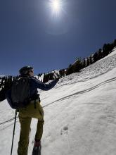
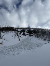
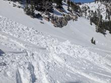
Spring weather can be highly variable and create a mix of avalanche problems to watch for. Snow conditions and snow stability can change drastically from day to day or hour to hour. Anticipate rapid change and plan accordingly. Plenty of snowfall over the winter with more spring snow to come makes avalanches possible into summer.
This week started with a decent storm that dropped up to 5-7 inches of snow containing a lot of water. Another 2-5 inches of snow fell Tuesday night, and some places were dusted Wednesday night. At most upper elevation SNOTEL sites, the snowpack has reached its peak water content which should start quickly going down in coming weeks.
In the springtime battle between winter and summer, it seems like summer is starting to win more lately…but last year the final snowfall in Bozeman was on June 17th.
Temperatures - Air temperatures in the mountains dipped below freezing Tuesday and Wednesday nights. Last night (Thursday night), low temps were on either side of freezing, but clear skies should have helped refreeze the snowpack a little but.
This weekend and early next week - An upper level ridge of high pressure will bring warm, sunny weather today, Saturday, and Sunday morning. Clouds and rain arrive Sunday afternoon, but cold air doesn’t arrive until Monday morning with winds from the north that shift to northeast and east. Snow should fall Monday morning through Tuesday morning. Most places should only get an inch or two of snow, but there may be isolated spots (Tobacco Root Mtns maybe?) that could get 5-8 inches.

This is a volatile week in the battle between winter and summer. With temperatures in the upper 20s to low 30s F, a wet spring snowstorm is impacting the area to start off the work week, with the Bridger Range receiving the most significant precipitation. As of Monday, at 6 AM, the Bridger Range has received a whopping 1.3” of snow water equivalent (SWE) in the last 12 hours, with a more nominal 7” of snow at the Alpine Weather Station. The Red Chair Cam at Bridger Bowl shows 14” of new snow. The mountains near Cooke City, Big Sky, including the Taylor Fork, and south of Bozeman have received 0.5” of water with 0-5” of snow (meaning it rained in some areas). Light rain fell in West Yellowstone and Island Park.
The first storm of the week winds down Monday evening after an additional 1-4” of snow falls during the day. Tuesday will be warm and dry, but rain and snow return to the area Tuesday night through Wednesday.
The tail end of the week will be lovely spring weather with mountain temperatures pushing into the 50s and low 60s F.
Since Monday, 2-3” of new snow have fallen in most of the advisory area, with no new snow around Bozeman. Winds have been generally easterly and moderate for the last couple days. Temperatures have been rising into the 30s and 40s and dropping below freezing at night.
Today will be mostly sunny, with high temperatures in the 40s F. There may be some thunderstorms this afternoon, particularly around Island Park and West Yellowstone, but any accumulations will be minimal.
Tomorrow will bring a mixed bag of spring weather. Temperatures will be a little warmer than today and there will be sun, clouds, and maybe some snow or rain showers - but again, not big accumulations.
Sunday will be cloudy, with snowfall starting later in the day. There could be some substantial snowfall Sunday night into early next week, but exact amounts are still quite uncertain at this point.

This morning there is 4-5” of new snow in the Bridger Range, Hyalite and Cooke City, 1-2” near Big Sky, and none elsewhere. Wind has been out of the west and southwest at 5-15 mph with a few gusts of 25-40 mph. Temperatures are 20s to low 30s F.
Today, under mostly cloudy skies, temperatures will reach low to mid-30s F with light snow showers, and some thunder possible this afternoon. Tonight temperatures will drop to the teens and low 20s F. Wind will remain light to moderate out of the west. There is a chance for 1-3” more snow by this evening near Bozeman and Cooke City.
Tomorrow skies will be mostly sunny, and the rest of the week skies will be partly sunny to mostly cloudy. During the middle of the week, daytime temperatures will reach 30s to low 40s F with overnight lows in the 20s F. There is a chance for light snow on Tuesday night and Wednesday with 1-2” possible. At the end of the week temperatures will warm to high 40s F with chances for rain and snow to start the weekend, then temperatures cool with higher chances for snow next Sunday and Monday.


This morning there are 1-2” of new snow near Big Sky and in the Bridger Range with zero to a trace elsewhere. Temperatures are mid-20s to low 30s F. Wind has been from the northwest and southwest at 5-15 mph with gusts of 20-35 mph.
Today will be a spring mix with temperatures reaching 30s to mid-40s F under mostly cloudy skies. The sun might show briefly before some light showers (maybe rain, then snow) and possible thunder this afternoon. Wind will be generally light with some moderate gusts out of the west. By tomorrow morning 2-4” of new snow are possible near Bozeman, Big Sky and Cooke City with less elsewhere. More snow is forecast tomorrow into Tuesday.
Temperatures are in the teens and 20s F early this morning. Winds are mostly light out of the north and west, but a little stronger in the Bridger Range, gusting up to 35 mph. There hasn’t been any precipitation in the last 24 hours.
Today will start out mostly sunny, with clouds moving in later this afternoon around Bozeman and Big Sky. Temperatures will rise into the high 30s and 40s F. Mostly light west winds will continue today. Overnight, skies will cloud up everywhere and snow showers will drop a trace to 2” of new snow.
Snow (and lower elevation rain) showers will continue tomorrow before more substantial snowfall kicks in Sunday night into Monday.

Since yesterday morning, 3-6” of new snow fell around Big Sky and West Yellowstone, with 1-2” across the rest of the advisory area. Winds are 5-10 mph out of the north and east, with gusts up to 30 mph. Temperatures this morning are in the single digits and teens F.
Today will be mostly sunny, with any lingering clouds clearing up by mid-morning. High temperatures will be in the 20s and 30s F. Light winds will continue out of the north and east, blowing a bit harder around West Yellowstone and Island Park.
Expect sunny skies again tomorrow with temperatures rising a bit higher before snowfall returns on Sunday and Sunday night.
Winter is back with a vengeance as temperatures started plummeting yesterday around 5pm and it’s snowing hard this morning. Temperatures this morning are mostly in the mid teens F. Winds this morning are blowing 5-10 mph gusting to 20 mph at ridgetops mostly from the north except in the Bridgers where winds are coming from the east with gusts hitting 40 mph.
6am snow totals are:
- 7” snow (0.6” water) - Bridger Range
- 5” snow (0.5” water) - Cooke City area
- 3” snow (0.2” water) - Big Sky area
- no new snow near West Yellowstone and Island Park
Today will be cold, cloudy, snowy, and windy as the center of a low pressure trough circles overhead. Expect winds to increase by midday blowing from the north-northeast 20 mph gusting to 40 mph. Temperatures will struggle to break into the low 20s F.
Snowfall should end tonight with most places getting another 2-4”, but the Bridgers could get a bit more. Clearing skies tonight could allow temperatures to drop into the single digits F. The Beartooth Mountains and Red Lodge area could do well with snowfall today. (Red Lodge Mountain opens for skiing and riding tomorrow through the weekend)
Looking ahead - The jet stream is a bit disorganized with no major systems lined up, but the overall trend through the rest of April is cool and wet. Friday & Saturday have clear skies, then snowfall returns early Sunday morning into Monday.
This morning temperatures are in the 30s F. Yesterday temperatures reached low 40s to mid-50s F. Wind has been out of the southwest, west and northwest at 5-25 mph with gusts of 25-35 mph. There is no new snow.
Today, temperatures will reach 40-50 F with increasing cloud cover. Wind will start from the west and southwest at 5-15 mph with gusts of 20-30 mph. This afternoon and tonight the wind will increase and shift to the north and northeast. Some rain and thunder are possible this afternoon with snow expected in the mountains tonight through Friday morning.
By morning, 4-8” of new snow is possible near Bozeman, Big Sky and Cooke City with 1-2” near West Yellowstone and Island Park. By Friday morning 1-2 feet are possible in the mountains near Bozeman and Cooke City with at least 8-12” in most areas.