This is Alex Marienthal with pre-season avalanche, weather and event information for the Gallatin National Forest Avalanche Center on Thursday, October 3rd. This information is sponsored by The Friends of the Avalanche Center and Yellowstone Club Community Foundation.
Cold and snowy weather the past week gave the mountains a fresh white coat, but total snow amounts were nowhere near the multiple feet our northern neighbors received (photo). Our advisory area got up to 16” near Cooke City with 6-8” elsewhere (weather log). Temperatures have been high teens to low 30s F. Wind was calm to moderate (5-25 mph) most of the week, and increased this morning with gusts to 30 mph.
Today temperatures will reach low 40s F under mostly sunny skies. Tomorrow afternoon a cold front will bring snow tomorrow night through Saturday morning. The mountains could get 6-12” of snow near Big Sky and Bozeman with 3-6” elsewhere. Wind on Friday and Saturday will be 20-35 mph out of the west-northwest. Temperatures will be 20s-30s F through the weekend, and will reach mid-40s F to start next week under clear skies. The next chance for snow is Tuesday night and Wednesday.
We will update 24 hour snow totals on our regional pages and weather log each morning. Also check our weather stations in Cooke City and Hyalite for hourly temperature and wind data, and find snowfall data via SNOTEL sites throughout our advisory area.

All Regions
Settled snow depth is 6-12” in the mountains, which is hardly enough to protect you from hitting rocks or dirt (photo). Slopes where snow is drifted deeper may provide better coverage for skiing, but are also the most likely place to trigger an avalanche (photo). New snow and wind during Friday night’s storm will create fresh drifts that are easy to trigger, and will avalanche on steep slopes. Avalanches will likely be small, but the many exposed rocks and hazards make small slides season ending at best and deadly at worst. Avoid steep slopes with thick drifts of snow, and prepare for avalanches like you would in the middle of winter:
- Carry a beacon, shovel and probe at a minimum. Helmets are a necessity as well.
- Travel one at a time in avalanche terrain.
- Cracking and collapsing of the snow is bulls-eye information that the snow is unstable.
Avalanches are not uncommon with early season snow and have injured skiers, climbers and hunters in the past. The tragic fatality two years ago in early October is a somber reminder of the potential consequences of even a small avalanche, and this accident report from October 2012 in the northern Bridger Range is chock full of useful lessons.
We are preparing for winter, scheduling avalanche classes, and setting up weather stations. If you have avalanche, snowpack or weather observations to share. Please submit them via our website, email (mtavalanche@gmail.com), phone (406-587-6984), or Instagram (#gnfacobs).
Upcoming Avalanche Education and Events
Our education calendar is full of awareness lectures and field courses. Check it out and plan to attend one or two this winter: Events and Education Calendar.
Jump start your thinking about winter recreation at the 5th Annual MSU Snow and Avalanche Workshop on October 9th in SUB Ballroom A.
Don’t forget to get tickets for the 21st Annual Powder Blast Fundraiser on October 25th at The Emerson Ballroom.
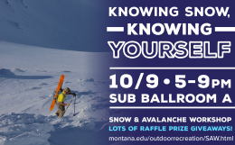
Join us at the 5th annual MSU Snow and Avalanche workshop on Wednesday 10/9 from 5-9pm in SUB Ballroom A.