Good morning. This is Alex Marienthal with the Gallatin National Forest Avalanche Forecast on Sunday, December 1st at 7:20 a.m. Today’s forecast is sponsored by Your Montana Chevy Dealers and Bridger Bowl. This forecast does not apply to operating ski areas.
*Note: Bridger Bowl Ski Area is closed and there is no avalanche control or ski patrol services. Backcountry conditions exist. Workers are setting up for the season and making snow. Please stay clear of work areas, snow guns, chair lifts and other equipment.
Early yesterday morning the mountains got 1-2” of new snow as the storm ended. Yesterday afternoon winds increased to 10-20 mph with gusts to 30 mph. This morning temperatures are single digits to teens F. Today, temperatures will reach mid-20s F and wind will be westerly at 20-30 mph. Tonight there is a chance for snow in the southern ranges and mountains near West Yellowstone with 2-3” possible by morning.

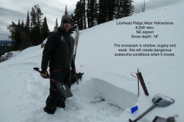
Between Wednesday night and yesterday morning the mountains near West Yellowstone, the southern Gallatin and the southern Madison range received 12-16” of snow equal to 1.4” of snow water equivalent (SWE). This heavy load fell onto a shallow, sugary, weak snowpack and created unstable conditions (photo, video). Last night, moderate southwest winds drifted recent snow into thicker slabs. Today these slabs will be easy for a person to trigger, and they could break naturally as wind continues to drift snow deeper over an unstable snowpack.
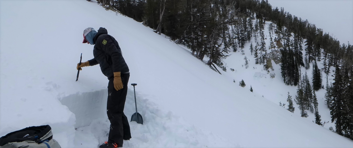
Yesterday a skier on Lionhead Ridge reported widespread collapsing of the snowpack in flat terrain (details), and a separate group found very poor snow structure and wisely avoided travel on and underneath slopes steeper than 30 degrees (photo).
Today, large avalanches are easy to trigger on steep, wind loaded slopes. The snowpack is adjusting to the recent load on non-wind loaded slopes, but a very poor snowpack structure makes it possible to trigger large slides from low angle terrain below or adjacent to steep slopes. For these reasons, avalanche danger is rated CONSIDERABLE. Avoid travel on and underneath steep slopes and be extra cautious of freshly wind loaded slopes.

In the mountains near Bozeman, Big Sky and Cooke City avalanche concerns involve the recent 5-8” of snow. Last night, moderate westerly winds drifted recent snow into fresh slabs that are possible to trigger today. Be cautious of wind loaded slopes and avoid them if you see cracking of fresh drifts or natural avalanche activity.
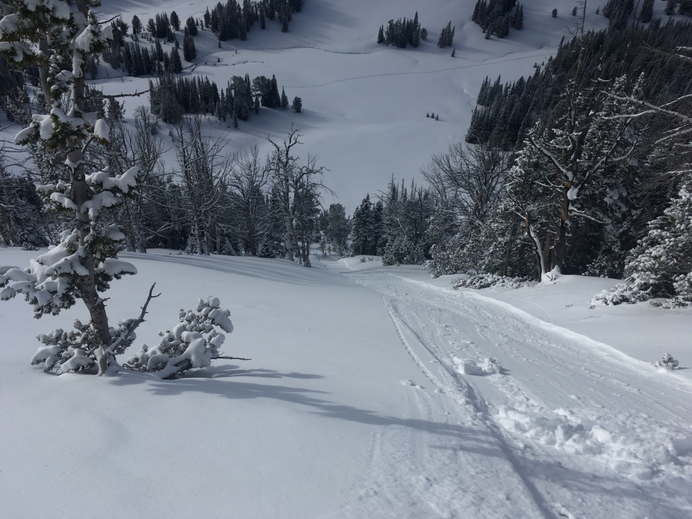
Yesterday my partner and I skied in Beehive Basin. We saw some cracking of the new snow, and we were able to trigger small dry loose avalanches on slopes steeper than 35 degrees (video, photo). Skiers at Bridger reported similar dry loose activity in the new snow (details). We found the snowpack at Beehive is generally stable below the new snow, similar to what Doug and Dave found in Cooke City (video, video, photo). There are some layers of facets directly below the new snow which are worth digging a foot down to assess, especially after the mountains get more snow (photo, photo).
Today, fresh drifts of snow and dry loose avalanches are possible to trigger and avalanche danger is rated MODERATE. Be cautious of fresh drifts on steep slopes, and carefully assess terrain for consequences of even a small slide.
Please send us your observations (no matter how brief) of avalanches, snow structure and stability, new snow amounts or wind effects. You can fill out an observation form, email us (mtavalanche@gmail.com), leave a VM at 406-587-6984, or Instagram (#gnfacobs).
Dashboard Talks
Episode 1: On our drive back from Cooke City, Dave and Doug discuss what they look for when they go to an area for the first time.
Episode 2: Dave explains why the snow is unstable in West Yellowstone.
Upcoming Avalanche Education and Events
Our education calendar is full of awareness lectures and field courses. Check it out and plan to attend one or two: Events and Education Calendar.
COOKE CITY
Every Friday and Saturday, Snowpack Update and Rescue Training. Friday, 6:30-7:30 p.m. at the Soda Butte Lodge. Saturday anytime between 10-2 @ Round Lake.
BOZEMAN
4 & 5 December, Introduction to Avalanche w/ Field Course, Evenings of December 4 & 5 plus one field day either December 7, 8 or 14. Snowmobile specific field day offered December 14. More info and Register Here.
December 11, 1-hr Avalanche Awareness, 6-7 p.m. at REI.
December 12, Avalanche Awareness + Beacon Practice, 6-8 p.m. at Story Mill Community Center.
WEST YELLOWSTONE
9 & 10 December, Snowmobile/Ski Introduction to Avalanche w/ Field Course, 12-5p Dec 9 and field day Dec 10. More info and Register Here.
MANHATTAN
December 9, 1-hr Avalanche Awareness, 7-8 p.m. at Manhattan High School.
See Episode 2 of Dashboard Talks for Dave and Doug’s discussion of the unstable snowpack at Lionhead.