Good Morning. This is Alex Marienthal with the Gallatin National Forest Avalanche Forecast on Sunday, February 9th at 7:00 a.m. Today’s forecast is sponsored by Gallatin County Search and Rescue and Map Brewing. This forecast does not apply to operating ski areas.
Since yesterday morning 10” of new snow fell in Hyalite, 5” in the Bridger Range, 2-4” near Big Sky and Cooke City and zero near West Yellowstone. Yesterday west-northwest wind was 15-25 mph with gusts of 40-50 mph. This morning wind decreased to 5-15 mph and temperatures are single digits to low teens F. Today temperatures will reach mid-teens to low 20s F under mostly sunny skies. Wind will be north-northwest at 5-15 mph and increase to 15-25 mph this afternoon. Expect snow overnight to drop 3-5” near Bozeman and Big Sky and 1-2” elsewhere by morning.

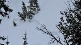
During the last three days of high avalanche danger there were 12 reported natural and human triggered avalanches, and 29 reported since the start of February (avalanche log). Recent avalanches broke up to 3 feet deep within snow from the last four days (photos, photos), and some broke over 8 feet deep on weak layers at the base of the snowpack. Either way, avalanches ran long distances and snapped trees. Yesterday I went to the crown of a 4-8’ deep avalanche on Saddle Peak that broke naturally at the start of the storm (video, photo). Another deep slab was seen near Buck Ridge that ran naturally during the storm (details and photos). Today similar avalanches can be triggered or break naturally, and are likely on wind loaded slopes.
Yesterday snowmobilers triggered deep storm snow avalanches near Buck Ridge (photo), and on road cuts near Portal Creek (photos). On a road cut near a parking lot a child triggered an avalanche which was small, but potentially deadly (photo). Avoid small steep slopes that are often not considered hazardous. The recent snow is heavy and unstable, and small avalanches can pile up deep on a road cut or small gully.
Since Wednesday morning the Bridger Range, Hyalite and Big Sky got 3-4 feet of snow equal to 2.5-3.5” of snow water equivalent (SWE). This was the biggest storm so far this season and it pushed the snowpack to a breaking point. Wind drifted this snow into fresh slabs that can be triggered and add weight to deep weak layers. Today avalanches are likely, especially on wind loaded slopes. Avalanche danger is HIGH on wind loaded slopes and CONSIDERABLE on non-wind loaded slopes.

Since Wednesday the mountains near West Yellowstone and Cooke City got 2 feet of snow equal to 1.5-2” of SWE. Moderate west-northwest wind drifted this snow into fresh thick slabs which are easy to trigger, and could break deeper avalanches on weak sugary snow near the ground (photo). On any given slope, there will be minimal evidence whether a deep sugary weak layer is unstable or not. Avoid avalanche terrain while these weak layers adjust to the recent storm.
Today, sunny skies will increase the temptation of fresh powder. Stay safe and enjoy the snow on low angle terrain, away from steep slopes above. Human triggered avalanches are likely and avalanche danger is CONSIDERABLE.
If you get out, please send us your observations no matter how brief. You can fill out an observation form, email us (mtavalanche@gmail.com), leave a VM at 406-587-6984, or Instagram (#gnfacobs).
Upcoming Avalanche Education and Events
Our education calendar is full of awareness lectures and field courses. Check it out and plan to attend one or two: Events and Education Calendar.
COOKE CITY
Every Friday and Saturday, Snowpack Update and Rescue Training. Friday, 6:30-7:30 p.m. at the Soda Butte Lodge. Saturday anytime between 10-2 @ Round Lake.
BOZEMAN
February 10, 1-hr Avalanche Awareness. 5:30 p.m. at Gallatin Valley YMCA.
WEST YELLOWSTONE
February 22, 1-hr Avalanche Awareness, 7-8 p.m. at West Yellowstone Holiday Inn.
Make it a daily habit to check out our Weather and Avalanche Log. It’s a great way to get a quick snapshot of what’s been happening in the backcountry.