Good Morning. This is Alex Marienthal with the Gallatin National Forest Avalanche Forecast on Sunday, March 15th at 7:00 a.m. Today’s forecast is sponsored by Spark R&D and Montana State Parks. This advisory does not apply to operating ski areas.
Since yesterday morning the mountains got 8-11” of new snow near West Yellowstone and Cooke City with 5” near Big Sky and 2” in the Bridger Range and Hyalite. Wind has been south-southeast at 5-15 mph with gusts of 10-30 mph. This morning temperatures are teens to mid-20s F. today temperatures will reach high 20s F with southeast-southwest wind at 15-30 mph. Snow showers will continue, and by this evening expect 3-6” near West Yellowstone and Cooke City with 2-3” near Bozeman and Big Sky.

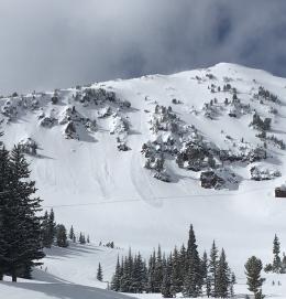
Over the last 24 hours the mountains near Cooke City, West Yellowstone, the southern Madison and southern Gallatin Ranges received 8-10” of snow equal to 0.8-1.1” of snow water equivalent (SWE). Avalanche danger will increase today with more snow and moderate winds. Avalanches can easily be triggered in the new snow, especially where it is drifted into thicker slabs by southerly winds. Keep terrain choices simple and not overly committing. Avoid wind loaded slopes, and carefully assess the stability of the new snow. Avoid all steep slopes if the new snow cracks or slides easily, or if you see natural avalanches. Today continued snowfall creates dangerous avalanche conditions and avalanche danger is rated CONSIDERABLE on wind loaded slopes and MODERATE on all other slopes.

Near Bozeman and Big Sky the mountains got 2-5” of snow equal to 0.2-0.5” of SWE. Avalanches are possible to trigger where moderate wind drifts this snow into fresh slabs. Today carefully evaluate wind loaded slopes. Be cautious of fresh drifts and avoid terrain where they can push you into trees, over cliffs or pile deep in a confined terrain feature. Expect drifts to grow with more snow and wind today.
Cornices are an additional hazard to watch for and avoid (photo). These overhangs of snow along ridgelines are large and can break back farther than expected. Avalanches breaking deeper in the snowpack are not expected, but a cornice fall could be what it takes to find the weak spot. Stay far back from the edge of ridgelines and avoid slopes directly below large cornices.
Today, avalanches are possible on wind loaded slopes which have a MODERATE avalanche danger. On non-wind loaded slopes avalanche danger is LOW.
If you get out, please send us your observations no matter how brief. You can fill out an observation form, email us (mtavalanche@gmail.com), leave a VM at 406-587-6984, or Instagram (#gnfacobs).
Upcoming Avalanche Education and Events
Our education calendar is full of awareness lectures and field courses. Check it out and plan to attend one or two: Events and Education Calendar.
Ever confused by a term we use in a forecast or a video? The Avalanche Encyclopedia is a great resource that has definitions for a whole lot of avalanche related terms.