Good morning. This is Dave Zinn with the Gallatin National Forest Avalanche Forecast on Tuesday, January 4th at 7:00 a.m. This information is sponsored by Spark R&D and onX. This forecast does not apply to operating ski areas.
The mountains of our advisory area have 3-4” of new snow this morning with 1” in the Northern Gallatin Range. Temperatures are in the mid-teens F with 25-30 mph winds from the west to southwest except in the Bridger Range where they are 10-15 mph. Today, temperatures will remain in the mid-teens F before falling this afternoon and the wind will be 15-20 mph from the west. Light snowfall will continue today intensifying tonight and the mountains will have 4-6” new by morning with 6-8” in the Cooke City area.

After a three-day break in snowfall, the southern ranges of our advisory area received 3” of snow equal to 0.3” of snow water equivalent - SWE and strong winds are transporting it into unstable drifts. While small avalanches within the several inches of new snow will be the most likely indicator of instability, the real concern is buried deeper in the snowpack in the form of a weaker layer of snow crystals called facets. Avalanches could break 4-5’ deep on this weak layer like the slide on Mount Abundance several days ago (photo, photo) or 1-2’ deep within the recently drifted snow. With weak layers deep in the snowpack, we will be slower to trust steep terrain and, as the snow builds up today, keep a watchful eye out for signs of rising instability (Lionhead video).
Be cautious around wind-loaded slopes and carefully evaluate the snowpack and the consequences of the terrain because human-triggered avalanches are possible. Today, the avalanche danger is MODERATE.
The Bridger Range received 4” of new snow equal to 0.3” of SWE. The combination of new snow, recent wind-loading, and a weak layer of faceted snow buried 1-3’ deep makes human-triggered avalanches possible today (wind-loading photo, Saddle Peak video, northern Bridger video). While the new snow will not dramatically change the danger, avalanches failing 1-3’ deep on Saddle Peak last week are indicators of the continued concern (details, photo, photo). Look for signs of instability such as cracking or collapsing and dig a snowpit to assess buried weak layers before considering recreation in avalanche terrain today. The avalanche danger is MODERATE.

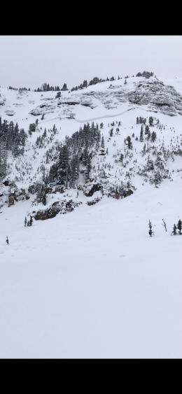
The snowpack in the Northern Madison and Northern Gallatin Ranges is generally stable and the 1-4” of new snow (0.1-0.3” of SWE) will not significantly change the danger. Yesterday at Divide Peak, my partner and I found stable conditions. The day prior, a group just to the north of us found an isolated area of unstable snow in technical terrain and choose to return home rather than proceed (video). Follow safe travel protocols to limit your exposure, look for signs of isolated instability and carefully consider the consequences of smaller avalanches in terrain that amplify the danger. The avalanche danger is LOW in the Northern Madison and Northern Gallatin Ranges.
If you get out, please send us your observations no matter how brief. You can submit them via our website, email (mtavalanche@gmail.com), phone (406-587-6984), or Instagram (#gnfacobs).
Upcoming Education Opportunities
Get your avalanche brain ready for the season at one of the many classes listed on our education calendar, and list of upcoming events below.
January 20 + Field day. Our popular Avalanche Fundamentals with Field Course is perfect as a refresher or an introduction to avalanches. We are introducing a new format with four pre-recorded lectures to watch at your convenience, a live question and answer session, and a choice of a snowmobile or ski/ board based field day occurring the following two weekends.
Every Saturday near Cooke City, 10 a.m.-3 p.m. FREE snowpack update and transceiver/rescue training. Stop by for 20 minutes or more at the Round Lake Warming Hut.
On Monday, December 27th, two snowmobilers were caught and killed in an avalanche on Scotch Bonnet Mountain, north of Cooke City. We have completed our report, which is available HERE.