Good morning. This is Doug Chabot with the Gallatin National Forest Avalanche Forecast on Thursday, February 17th, at 7:00 a.m. This information is sponsored by Knoff Group Real Estate and Werner Wealth Management (Advisors with DA Davidson). This forecast does not apply to operating ski areas.
Since 6 a.m. yesterday, Bridger Bowl received 5” of snow with 1-2” everywhere else. Wind has increased out of the west to northwest and is blowing 15-25 mph with gusts of 30-40 mph (50 mph at Bridger Ridge). Mountain temperatures are in the single digits F. Wind will get stronger during the day, temperatures will rise into the high teens and tonight we can expect 1-2” of snow with Cooke City getting 3-4”.

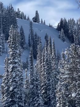
The Bridger Range and mountains around Big Sky have the most new snow and the strongest wind. Bridger Bowl’s storm total is 19” equal to 1.5” of snow water equivalent (SWE) and Big Sky’s total is 12” equaling .6” SWE. Some slopes got more than this, others a bit less, but the avalanche story is the same: fresh snow and strong west wind gusting 40-50 mph will drift snow that can avalanche. Wind-loaded slopes near the ridgelines or in gullies are the most dangerous. This snow fell onto a weak snowpack and in areas where it is piled up deep from the wind a person can trigger avalanches large enough to kill. Our field videos in Beehive Basin and in the Bridger Range right before the storm show this concern. Yesterday, folks in an avalanche class in Beehive dug 20+ pits and only got 2 unstable test results and they saw no slides. Today’s wind will change that. Shooting cracks in wind drifts on low-angled terrain is a sign that steeper terrain will avalanche. For today, on slopes that are wind-loaded the avalanche danger is rated CONSIDERABLE. On slopes with fresh powder that is untouched by the wind the danger is rated MODERATE. This is not “turn your brain off, look at me,” powder riding because triggering slides remains possible.

Storm totals in Hyalite, the southern Madison Range, Lionhead area and Cooke City were 5-7” measuring .5” of SWE. Wind-loading will make some slopes susceptible to triggering because all these ranges have 1 thing in common: the upper 1-2 feet of the snowpack is weak with layers of sugary facets and feathery surface hoar. These layers became unstable in Cooke City last week which is a preview of what can happen elsewhere from this recent storm (Avalanche Activity list). The new snow is not enough of a load to create widespread instability, but it is enough to make avalanches possible on a few slopes that have been wind-loaded or are a bit weaker. Signs of instability like cracking of drifts or natural avalanches will be unlikely, so traveling in avalanche terrain will require homework. In some areas slopes were scoured to dirt, in others wind drifts are hard as concrete, and yet in others the weak layers are preserved. You have to dig down to know what’s under you. In Taylor Fork/Lightning Creek on Sunday I did a cursory stability test before skiing a steep slope, and was glad I did because it revealed instability I was not expecting (video). For today, since avalanches remain possible, the danger is rated MODERATE on all slopes.
If you get out, please send us your observations no matter how brief. You can submit them via our website, email (mtavalanche@gmail.com), phone (406-587-6984), or Instagram (#gnfacobs).
Upcoming Education Opportunities
See our education calendar for an up-to-date list of all local classes. Here are a few select upcoming events.
February 19, Women’s only Companion Rescue Clinic sponsored in partnership with SheJumps! Register Here.
March 4, Companion Rescue Clinic with the Bozeman Splitfest. Information and registration HERE.
Every Saturday near Cooke City, 10 a.m.-3 p.m. FREE snowpack update and transceiver/rescue training. Stop by for 20 minutes or more at the Round Lake Warming Hut.
In this article, Beyond the beacon: Thoughts and gear for a safe backcountry experience, Dave Zinn recounts his recent backcountry accident and how being prepared made a difference.