Snow Observations List
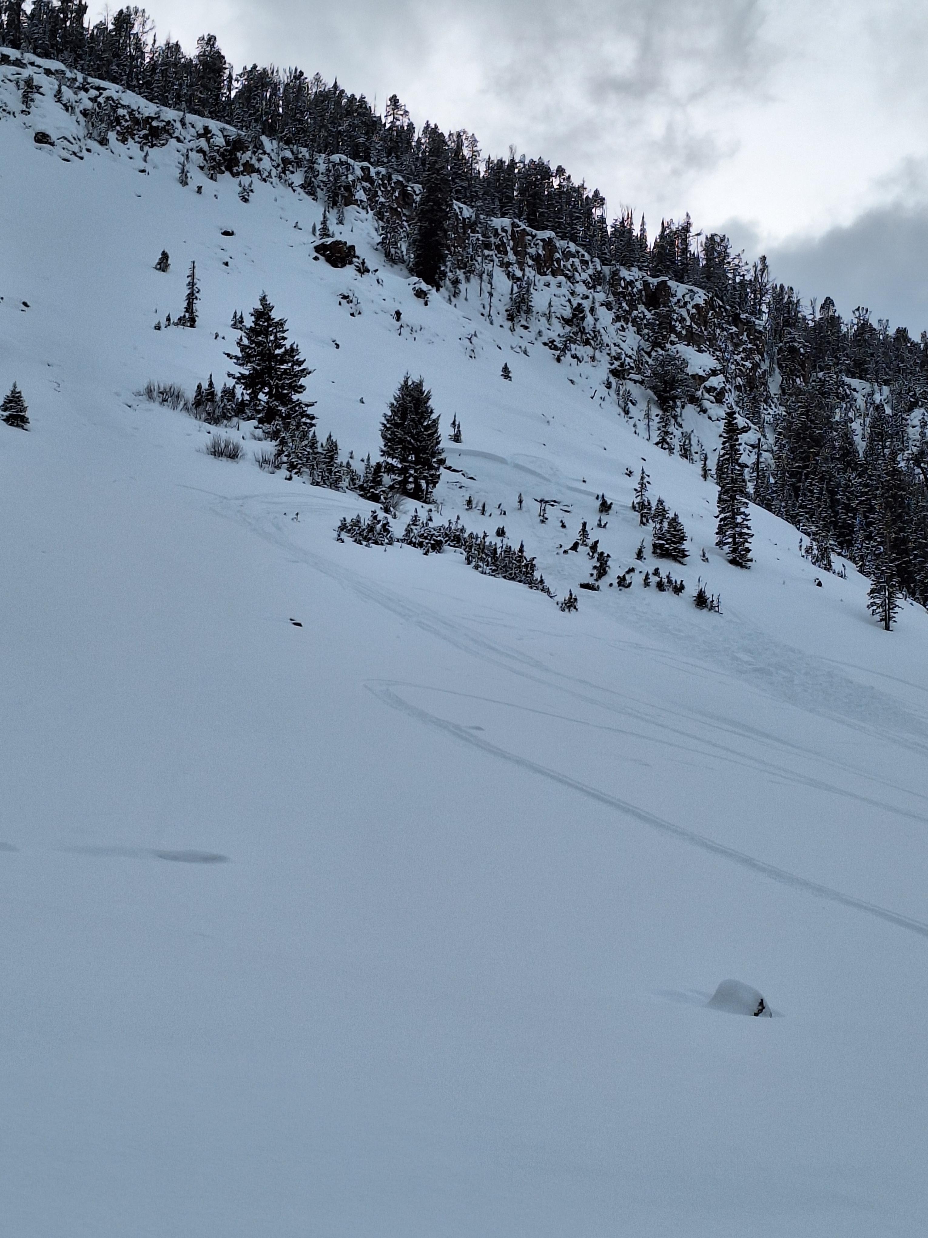
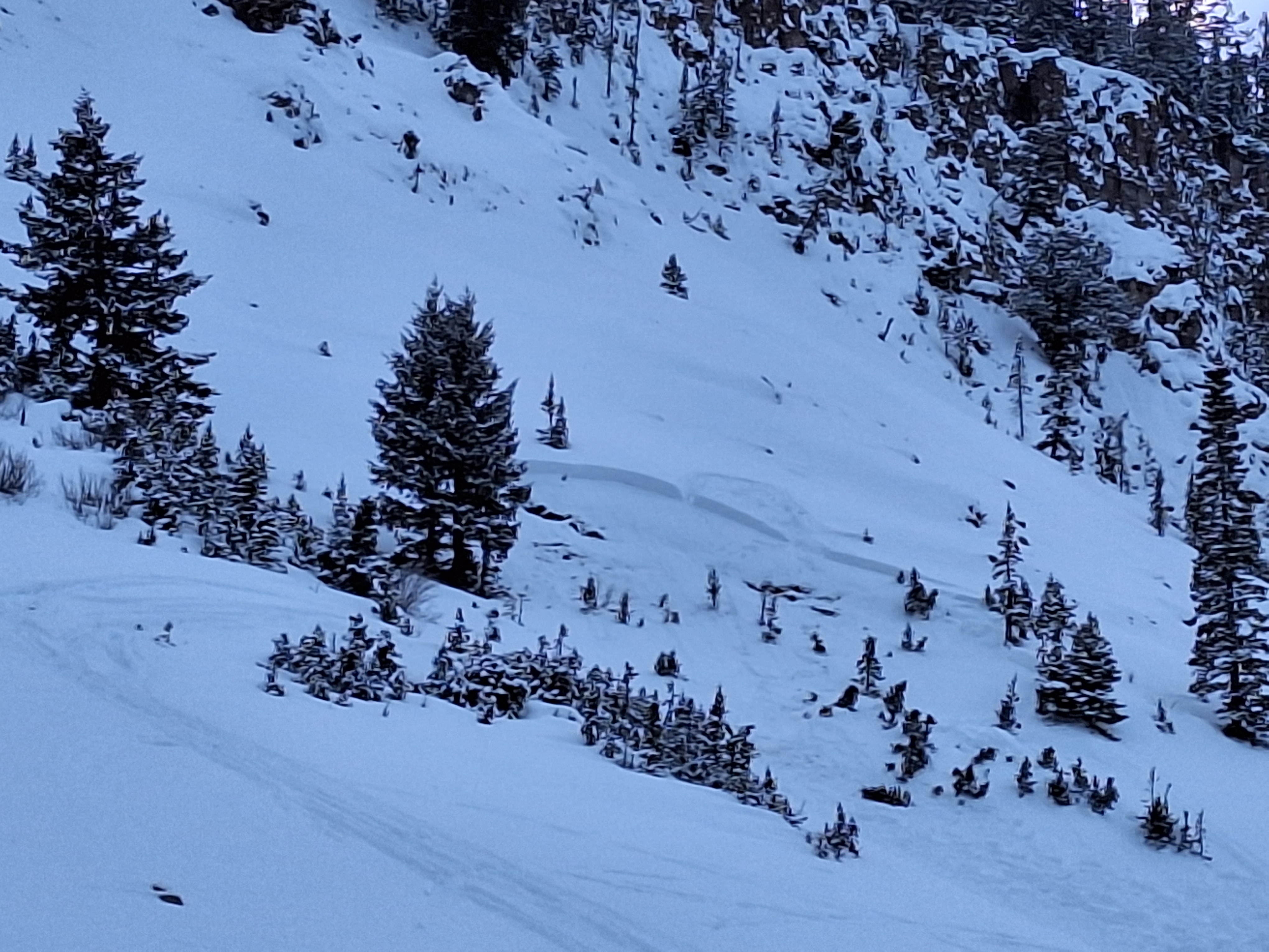
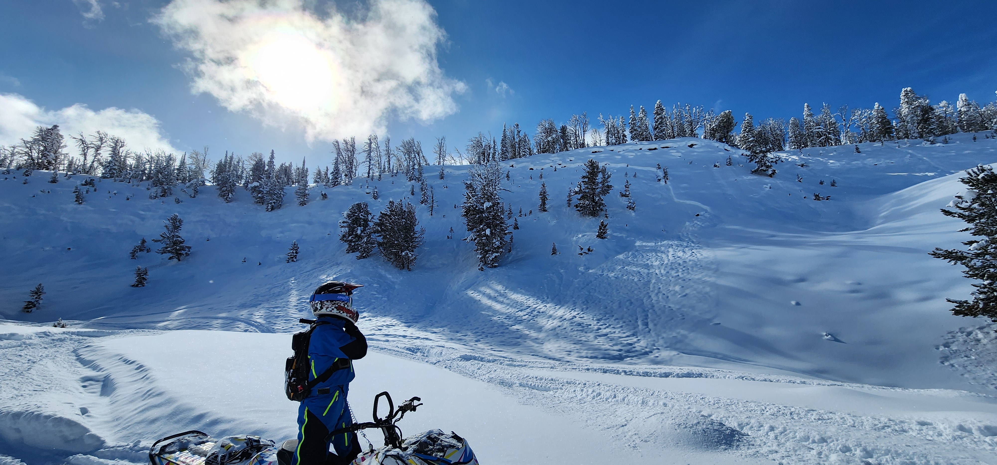
Member in our group was on the flank of the slope. Crack shot from beneath sled and triggered the slope from ~ 100’ away. Broke about 75 yards wide, ripped to dirt and travelled a short ways to toe of the slope. North facing, 9220’
Full Snow Observation Report
Was up at Beehive today from 8am-2pm. On our way up, snow was consistently whumping underfoot and in one of these instances, we triggered a small slide that went for 10-15 feet around the coordinates (45.34789, -111.39892) towards the top of the basin. Decided to dig a pit a bit further up the hill for some practice and discovered a weak icy layer a couple feet down, with a couple feet of minor to moderate facets 4-5 feet down.
Full Snow Observation Report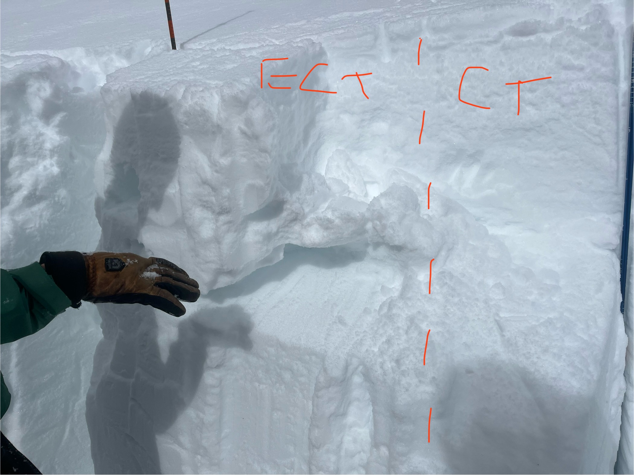
Toured up Brackett Creek to 8000’ on the E shoulder of Ross Peak. Depth of 90-120cm near 8000’. No propagation in ECT (ENE 7900’). Lots of trail breaking and no collapsing or whumps. No avalanches observed.
Full Snow Observation Report
Witnessed multiple natural avalanches on slopes that exceeded 30deg of incline. When riding on test slopes with similar conditions we saw shooting cracks all around the sled. We broke a couple slabs on hills around 25degs right at the crest of the hill but only the crest broke or showed signs of instability.
Full Snow Observation Report
Snowmobiler triggered an avalanche. She climbed up the backside of Crown Butte and as she descended the slope the avalanche broke and ran down the slope behind her. No one was caught or injured
Full Snow Observation Report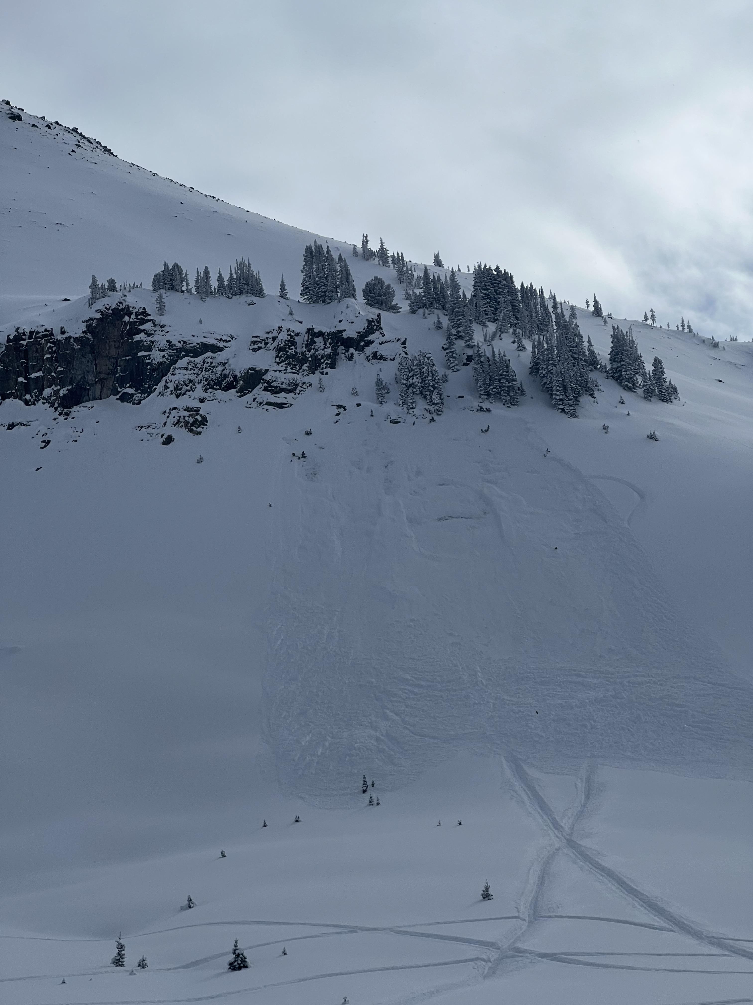
From facebook: "We saw 4 different avalanches today at the west end of lions head. One triggered close to us. We were at the bottom in a safe spot on a high spot. North 44.73482. West 111.36946. 100 feet wide 100 feet vertical. Broke to the ground. Afterwards we watched 4 more go from a 1/4 mile to 1/2 mile away from us as we were in a safe position on a high spot watching them go. I'm sure we triggered the first one from the bottom, but we were 100 feet from the slope toe."
Full Snow Observation ReportTest snow profile. The snow was surprisingly deep at HS 180, most likely from wind loading. Felt and heard various collapses of the snow during the day while riding snowmobiles. Approximately 30CM of fresh snow over a thin MFC followed by a dense thick snow slab. CT and ECT indicate this MFC is the weakest layer. CTM(16)SC down 30, ECTN(6) down 30
Full Snow Observation Report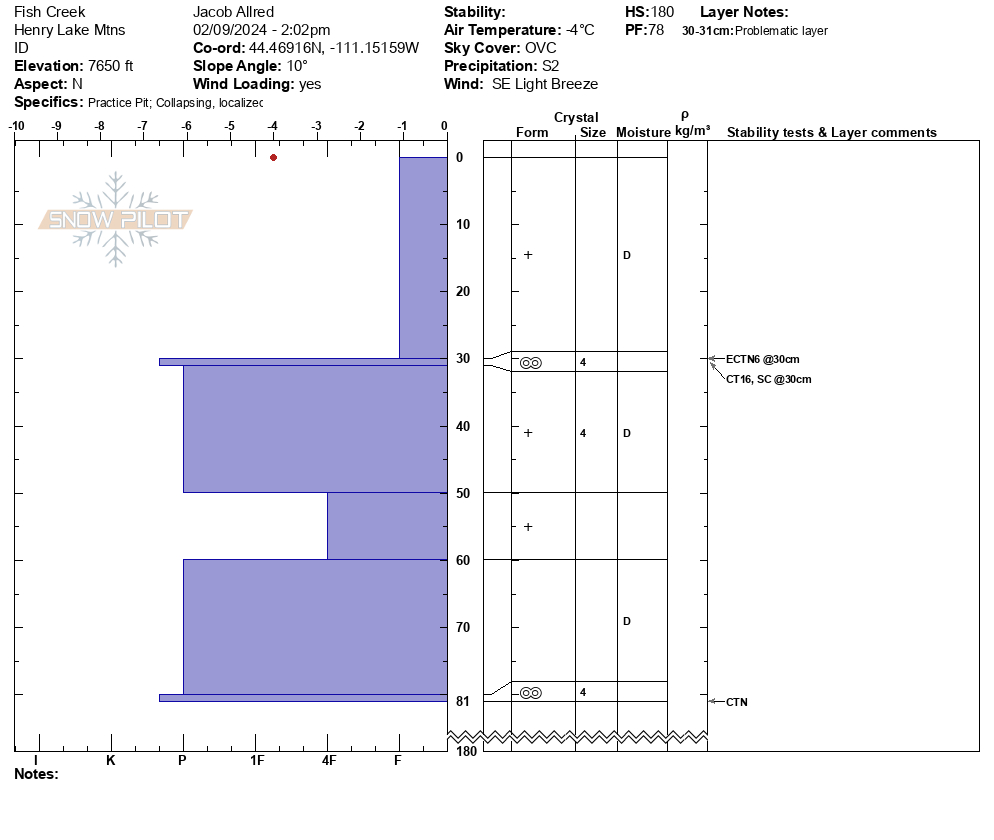
The Bozeman Snow Ranger crew rode Buck Ridge today as far as Slatt's Hill/ 2nd Yellowmule. At the bottom of the trail there was about 3" of new, low density snow, while up on top there was at least 6-10" of new snow from the last 24 hours or so. There was no wind effect yet and there looked to be another wave of snow moving in from the SW as we were leaving. We peeked into Beaver Creek and the Slatts area and did not see any recent avalanches though I did notice the snow settling significantly as I rode around on the flats in the Slatt's hill area- the SE facing basin opposite 2nd Yellowmule. Plenty of fun to be had in the flats and gentle meadows right now.
Full Snow Observation ReportWhile splitboarding south of Cooke City today I remote triggered an avalanche. I stopped to transition, stepped into the snow, triggered a massive collapse and a slope about 100ft away slid. I stopped right there to dig a pit. HS 110, south facing, 9,000ft, non wind loaded slope. I got an ECTP 14 and an ECTP 13 both 60cm down, right at the top of the big ol facet layer making up the lower 50cm of the snowpack.
Other than the remote trigger, lots of small loose dry natural avalanches on all aspects, mid and upper elevations. I also saw a few small D1 natural slab avalanches in the area on east and north facing aspects, mid elevation. Hard to tell when these all happened, but I'd guess within the last 24hrs. Flat light, hard to see definition Large collapses often and throughout the whole area, on and off established skin tacks.
Full Snow Observation Report
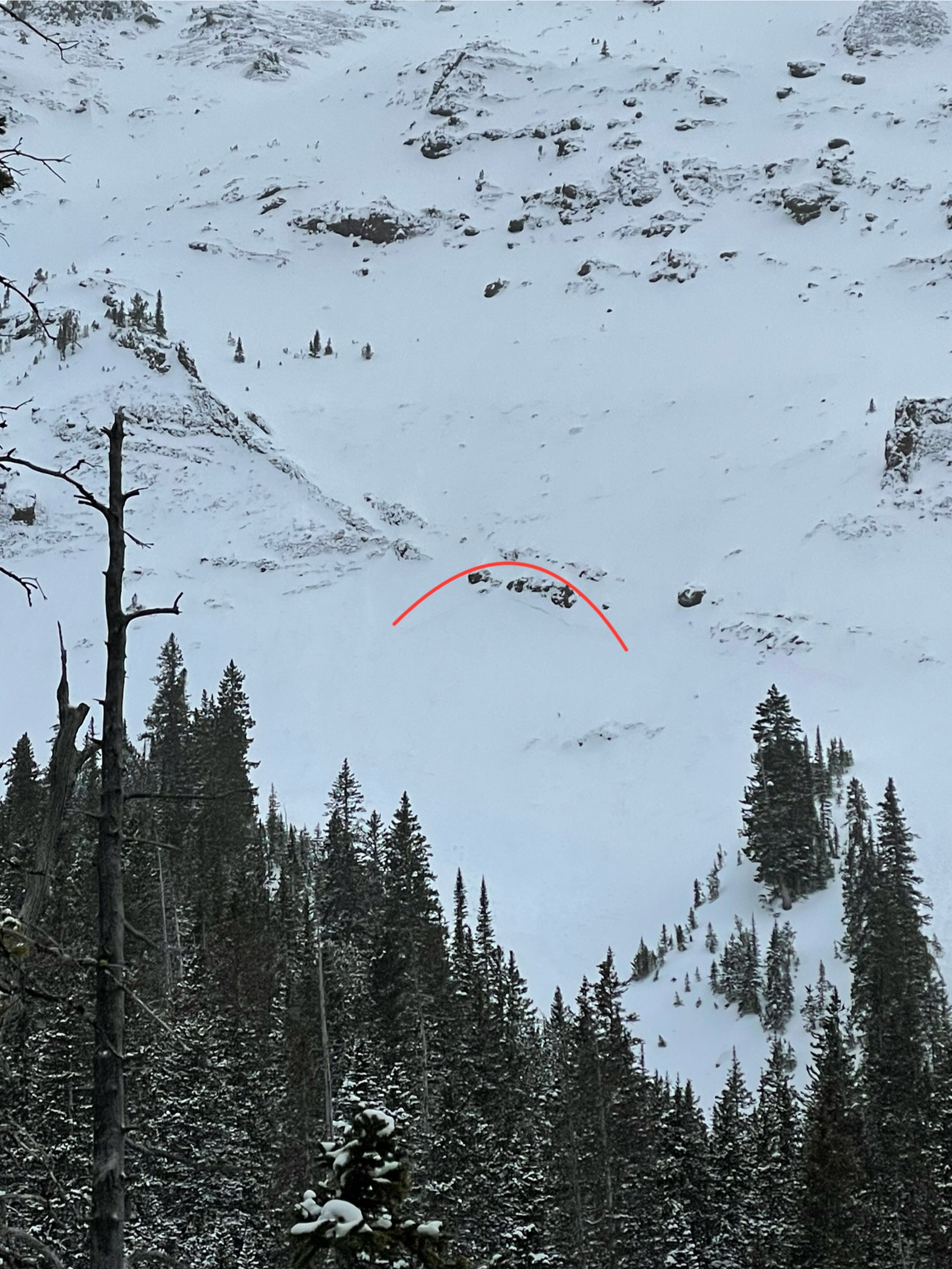
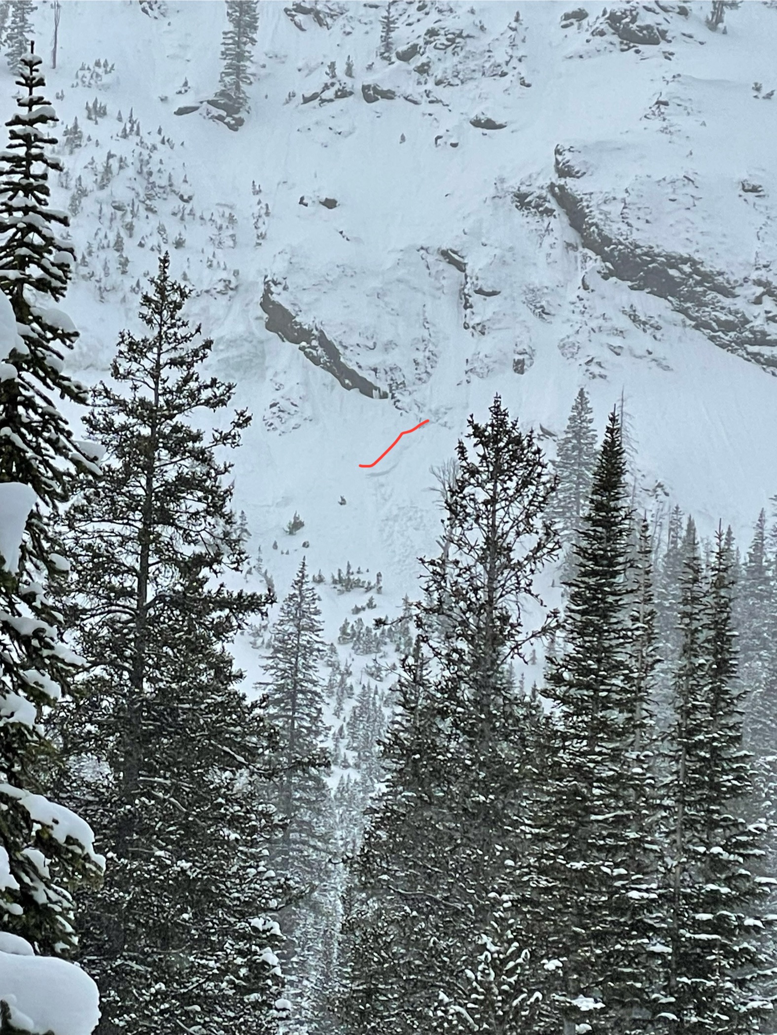
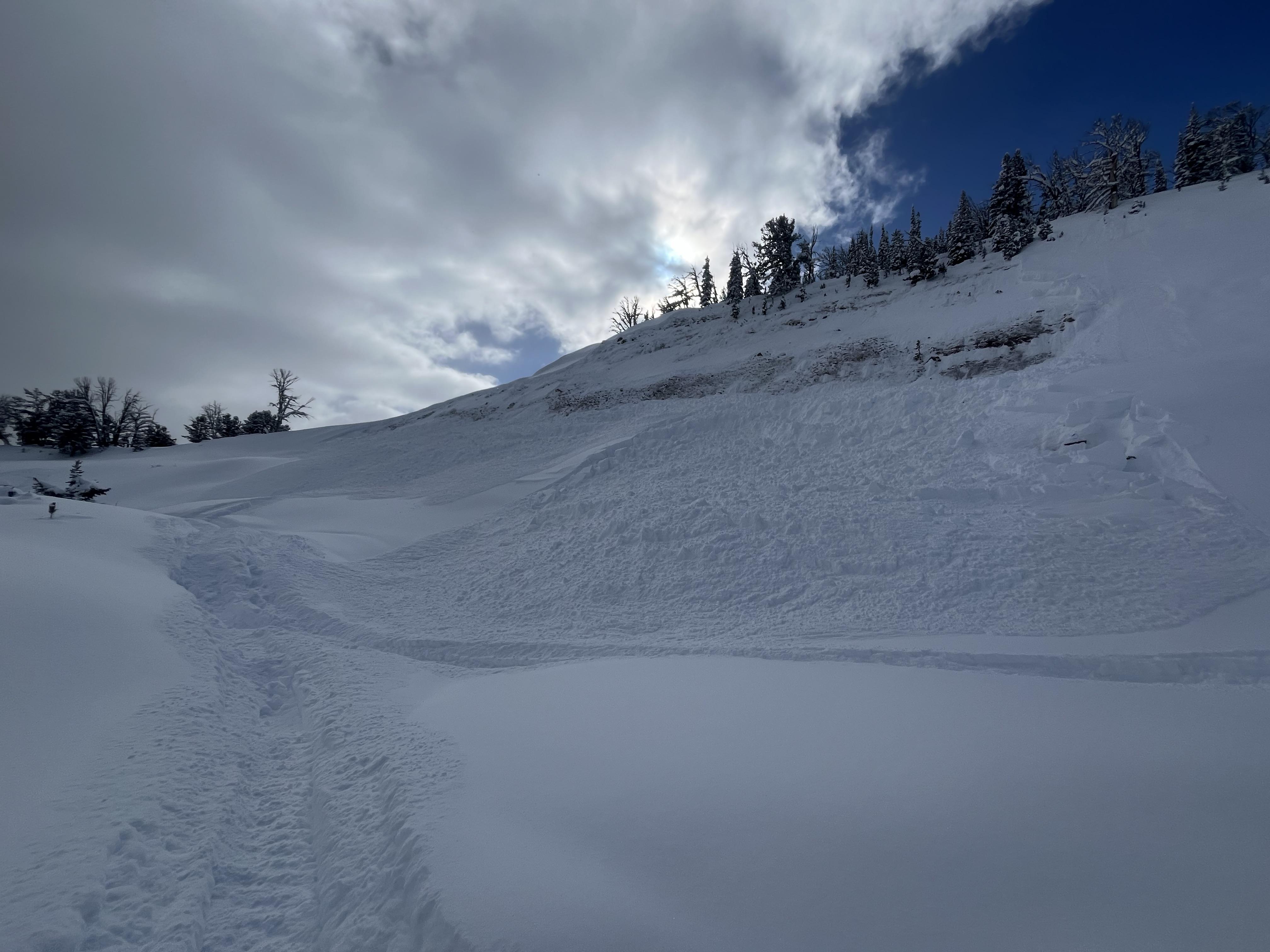
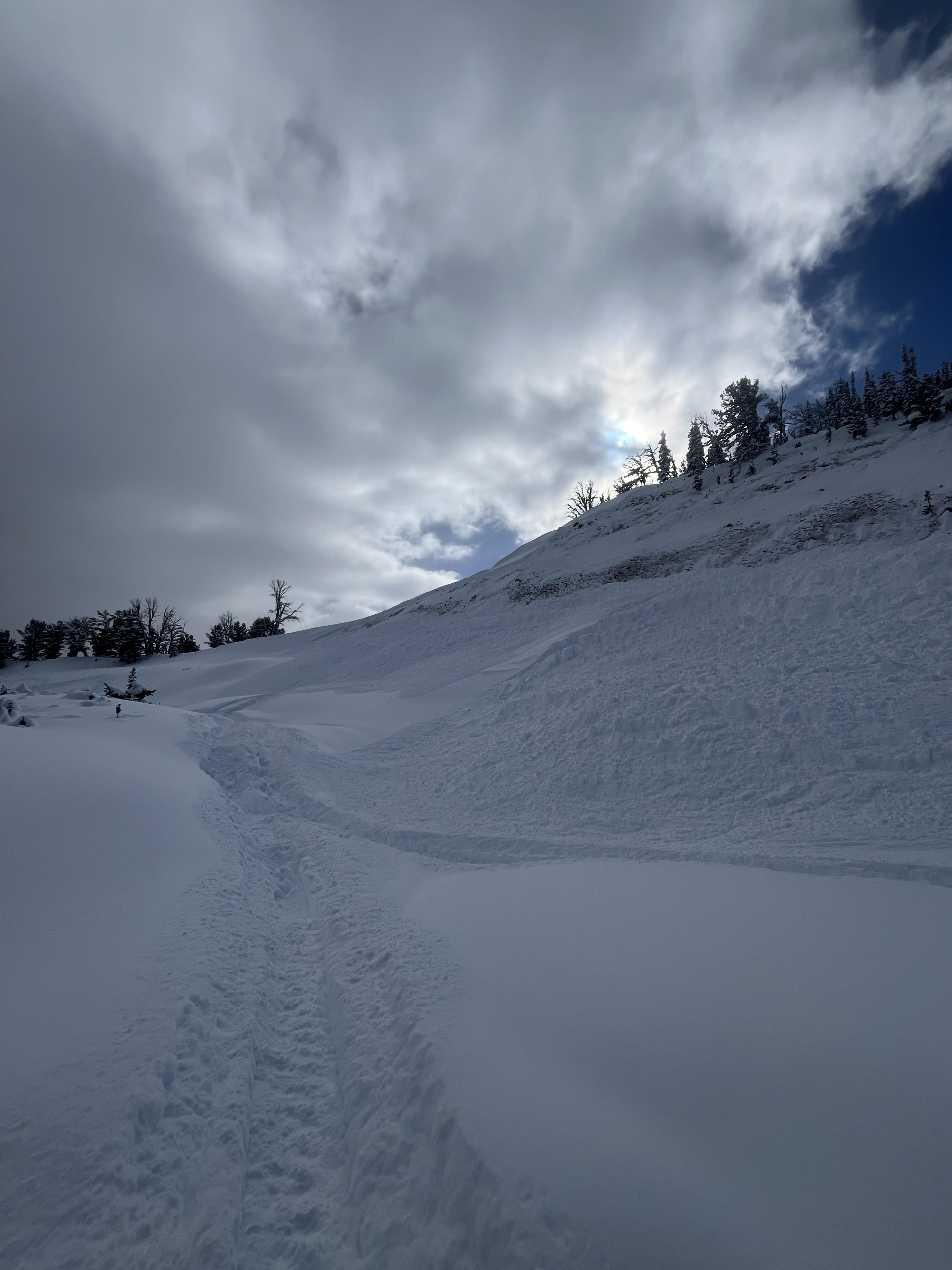
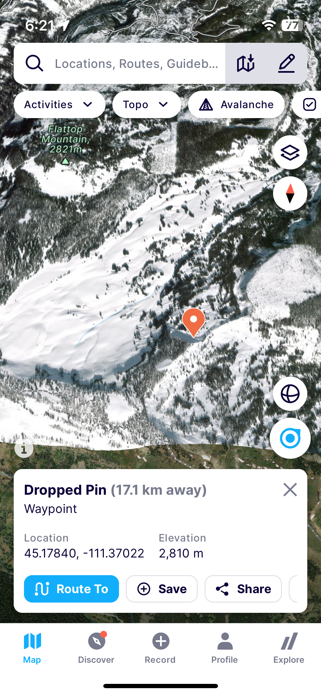
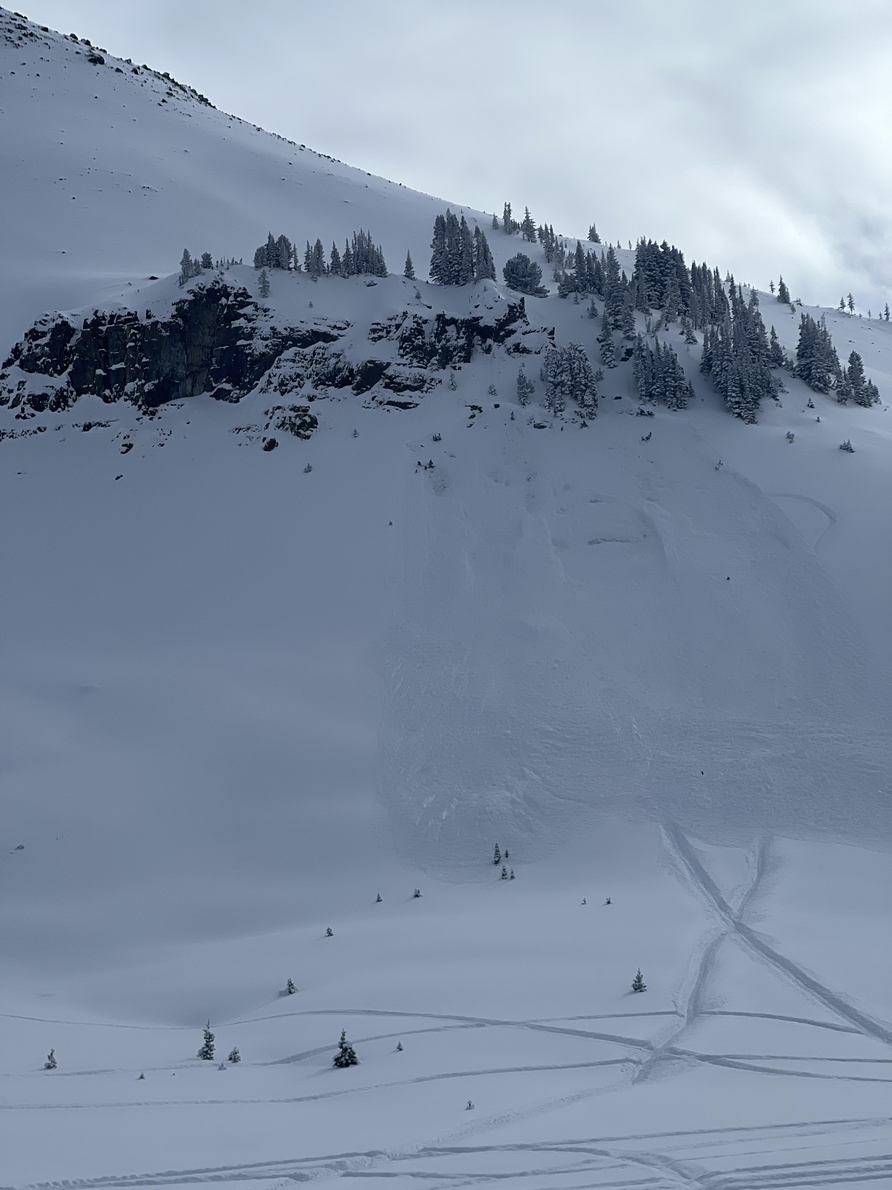
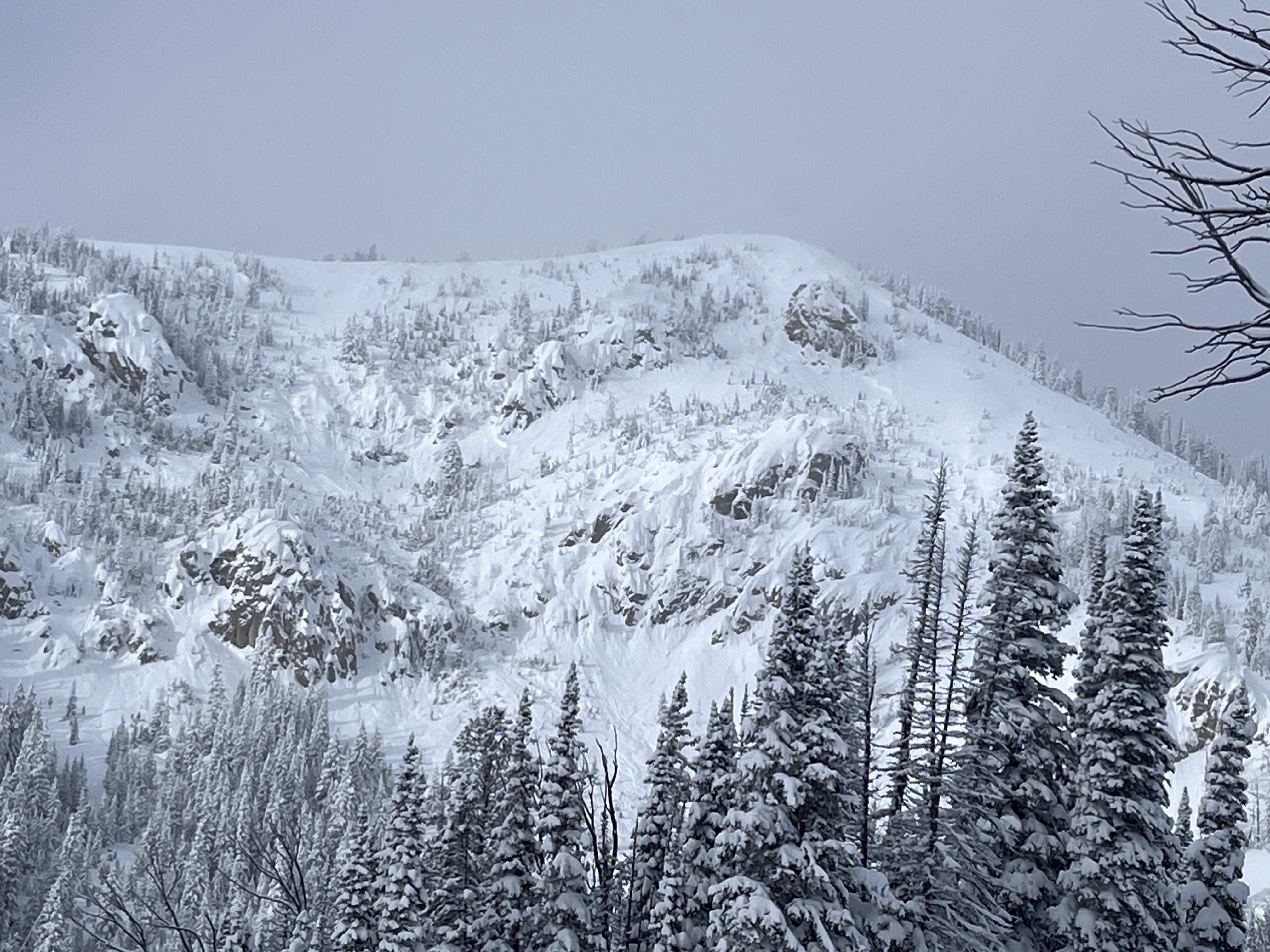
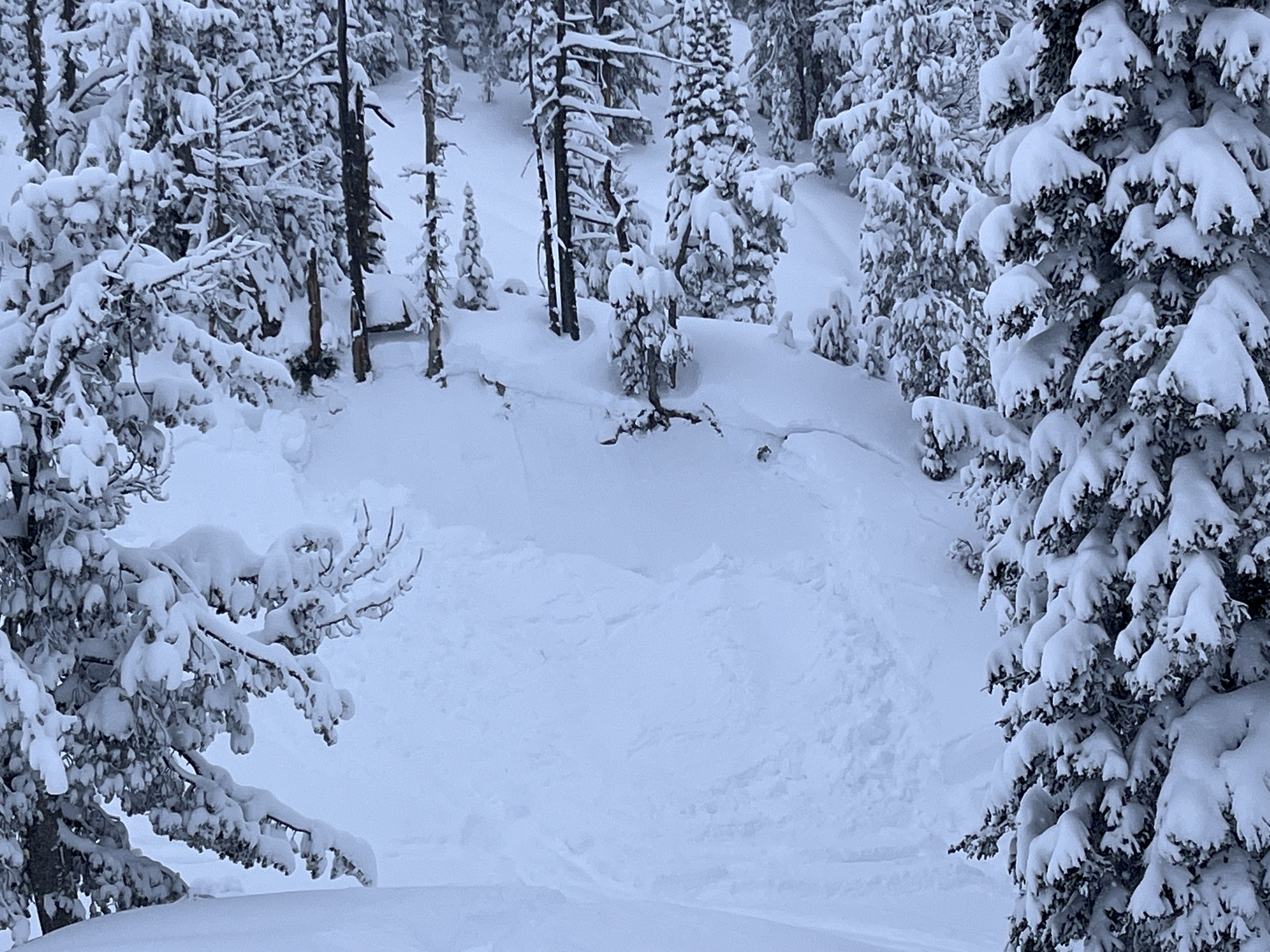
We rode into Tepee Basin and stopped at a recent rider-triggered avalanche that happened on 02/07/2024, ob and video. This avalanche was very large in size, we estimated it to be 3/4 of a mile long, 3-4' deep and ran full path the flats below. The clouds parted long enough for us to seen the entire crown from afar, it was quite continuous and connected multiple smaller avalanche paths.
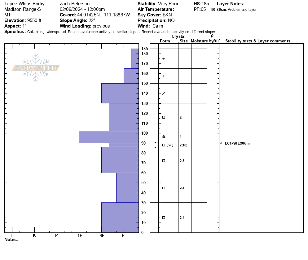
We continued riding to the wilderness boundary. While walking down to our pit side we felt as large collpase and saw snow fall from the trees around us. Our snowpit was on a N facing slope at 9500'. Here, weak snow low in the snowpack is now buried about a meter deep. We got unstable results of ECTP26. While riding away from our snowpit and stepping off snowmobiles we again triggered a large collapse. Collpasing continued as we worked through the trees.
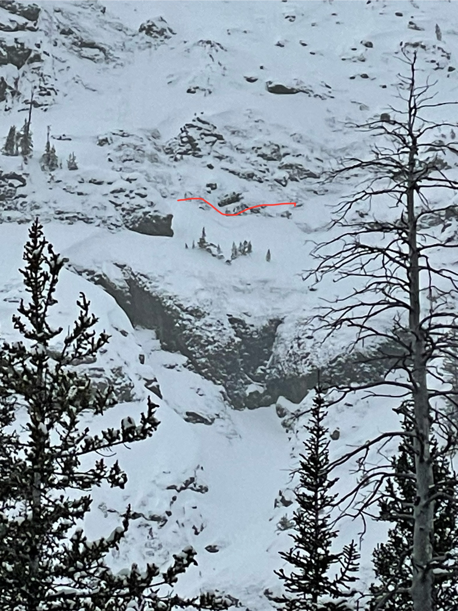
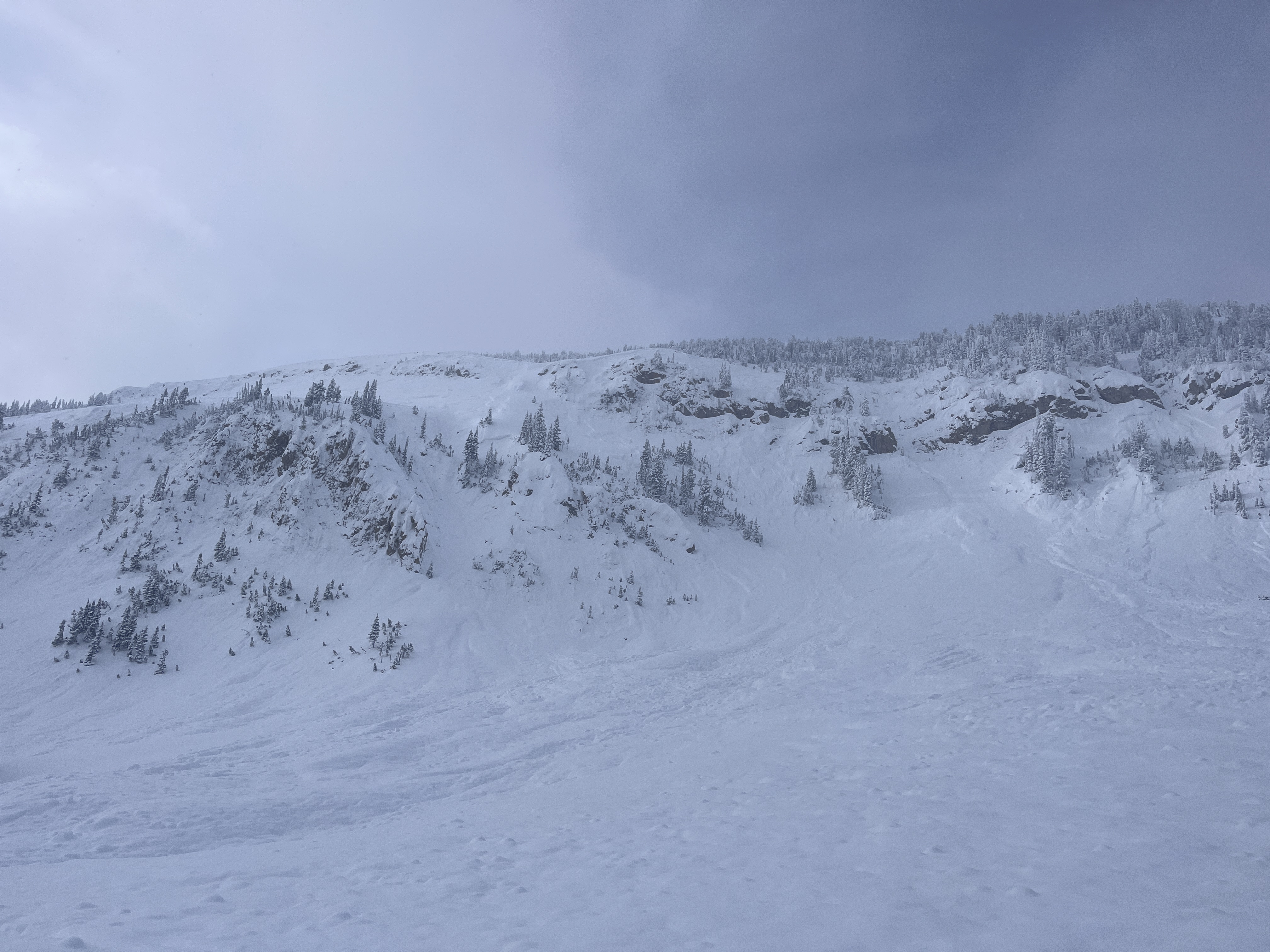
From here we rode along the wilderness boundary towards another area to look for more recent avalanche activity. While crossing a flat meadow above a steep slope the rider breaking trail triggered an avalanche from 30' away. This avalanche broke several hundred feet wide, 2-3' deep and ran full path to the valley bottom. Additionally, around the corner we saw another recent avalanche that likely occured naturally within the last few days.
Overall conditions felt very unstable today. Recent avalanches and collapsing were clear signs on instability. Even if we didn't see these signs of instability, knowing the snowpack is weak and has recently received a lot of new snow was enough information for us to plan to stay off of and out from underneath avalanche terrain today.
Full Snow Observation ReportThe buttermilk lot is plowed. And the trail to the cabin/tepee split was groomed.
Definitely felt appropriate to have a warning out today.
Went for a quick tour into wolverine bowl today. Found new snow totals of around a foot in most places and a very thin melt freeze crust from high-pressure system on all shadier aspects while sunnier aspects had more of a noticeable crust beneath the new snow. Dug a 130 cm pit adjacent to the refrigerator chutes and got a CT15 Q1 @ 99cm and CT21 Q1 @ 30cm. Shallower result failed on facets beneath the recent melt freeze while the deeper result failed on the old melt freeze interface from earlier this season. Snow was coming down heavy by the time I left the bowl and wind was calm.
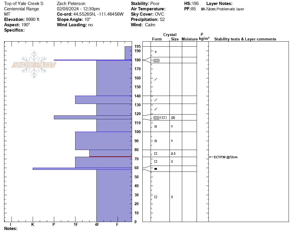
Full Snow Observation ReportWe rode into Yale Creek today. At the head of the creek, we stopped and dug on a south-facing slope at 9000'. We found 30" of new snow that has fallen over the last week on top of an already unstable snowpack. From here we continued up Yale Creek and on a small NE-facing slope, we saw an avalanche that was triggered by snowmobilers within the last couple of days. This avalanche was 2-3' deep and 100 feet wide and failed on weak faceted snow near the ground. It did not run far vertically because it was such a small slope. We dug near here on a SE facing slope and saw a similar setup as earlier with 30"+ of new snow overlaying weak snow.
On our way out, we saw a small freshly triggered avalanche. This was in a small gully and failed on weak snow near the ground 1-2' deep. With poor visibility, we did not get an opportunity to see any avalanches on larger slopes. However, seeing avalanches on small protected slopes is a good indicator that there are likely avalanches on larger steep slopes we could not see.
Wind was calm to light out of the south and snow continued through the day, with 1-2" of snow falling while we rode.
Full Snow Observation Report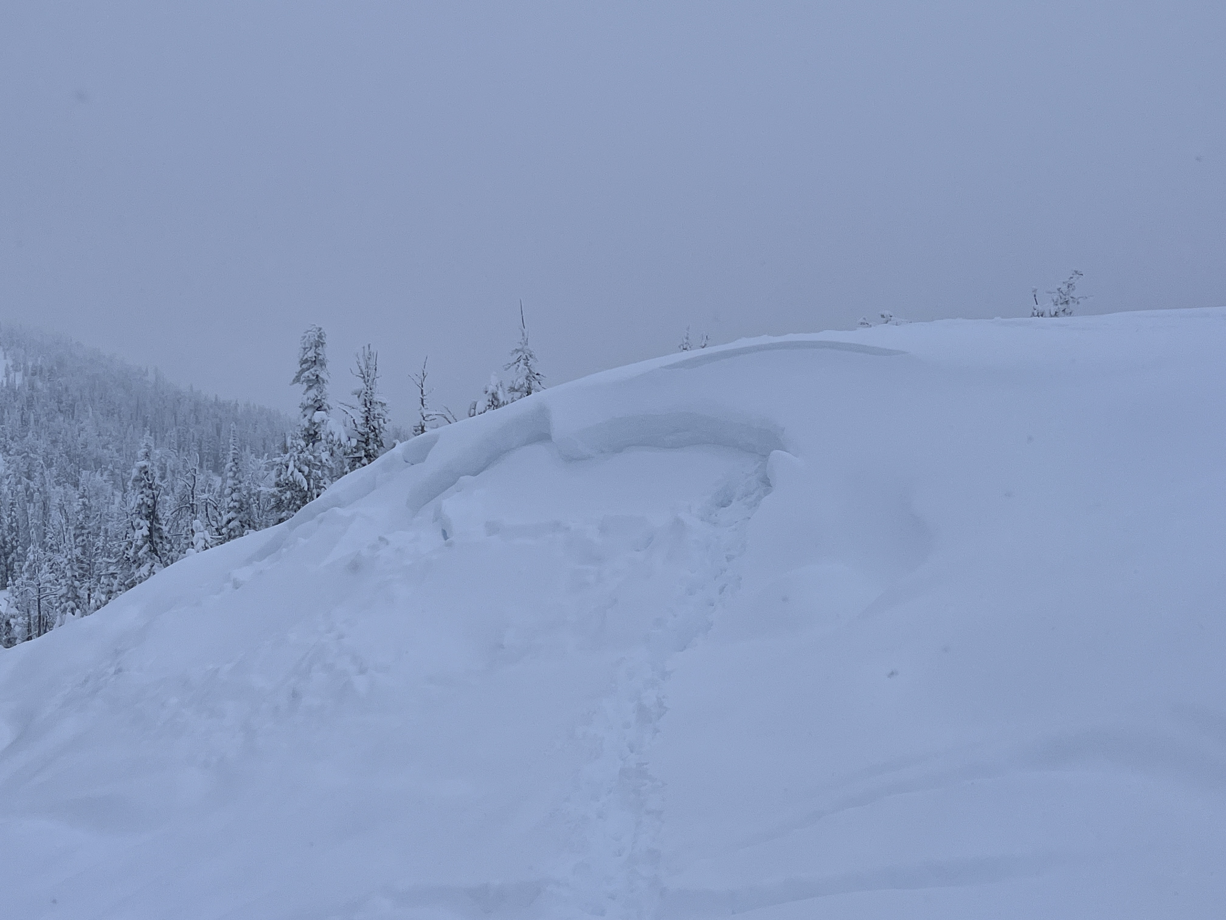

Dug a very quick pit on a SE slope at 9600ft HS 90 cm. Boot pen to the ground. SKY OVC. Wind L.
Visibility was minimal, but I observed no signs of significant, recent wind loading. With that said there is a ~5-8 cm (small) 1F wind slab under ~5cm of + at the top of the snowpack and above the Jan. crust.
ECTN26 below the Jan. crust
PST 30/100 End on 2-3mm facets down ~50cm (below the jan crust)
Where the crust exist, it may be ever so slightly harder to impact these deeper, weaker layers, but I would certainly not place any faith in it especially with spacial variability and change in aspect/elevation.
After doing the ECT and not observing any propagation. I pulled the block off with my shovel and it broke deeper (Q1/2) on the same facets I performed the PST on.
I dug in this same meadow earlier in the winter. Basal facets/ depth hoar have advanced significantly. I didn't put them on a card,but striations were visible to the naked eye.
This snowpack has a lot going on in it, but strength is certainly not one of them. Out of the entire snowpack maybe only 10-15cm of snow had hand hardness greater than 4F+.
Full Snow Observation ReportToured up bacon rind via the ridge ascent. Noted a small melt freeze crust below 7800’ with 2-3” above it. Low density snow capped a denser slab above the weak snow on the ground. signs of instability were less obvious than they have been. Still trigged several tree shaking collapses, with cracking up to 100ft above me. Riding quality was quite nice.
noted a large avalanche that broke in the E,NE bowl off Ernest Miller, appeared to be hundreds of feet wide and several feet deep.
Cracking about 20ft long observed during our tour when crossing over a gully/stream at 35 degree slope angle. Crust about 25-30 centimeters below soft snow showed instability along with the faceted base toward the bottom of the snowpack.
Full Snow Observation Report
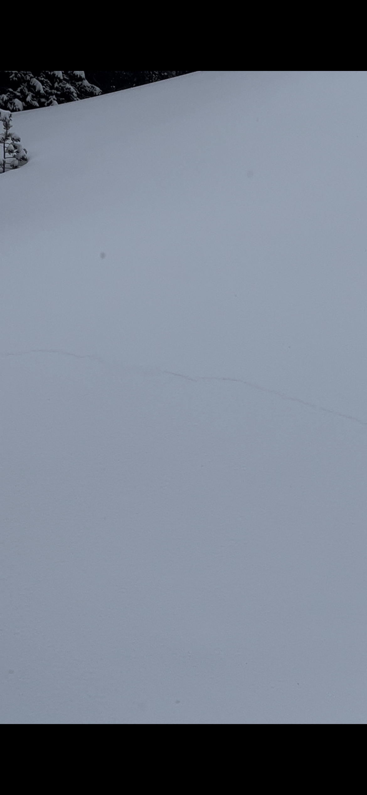

Natural avalanche on East Side of Henderson Mtn. seen late on 2/7/24. South of the two that Doug saw last week, along the ridge. Could have happened yesterday or last night. I didn’t see it yesterday when riding up and down Fisher creek, but visibility was mediocre. The debris and bed had at least some new snow on it.
Also had a large rumbling collapse near 10,000’ west facing when following one skiers old skin track. And had a few large collapses on south facing slopes between 8,000-9000’.
Full Snow Observation Report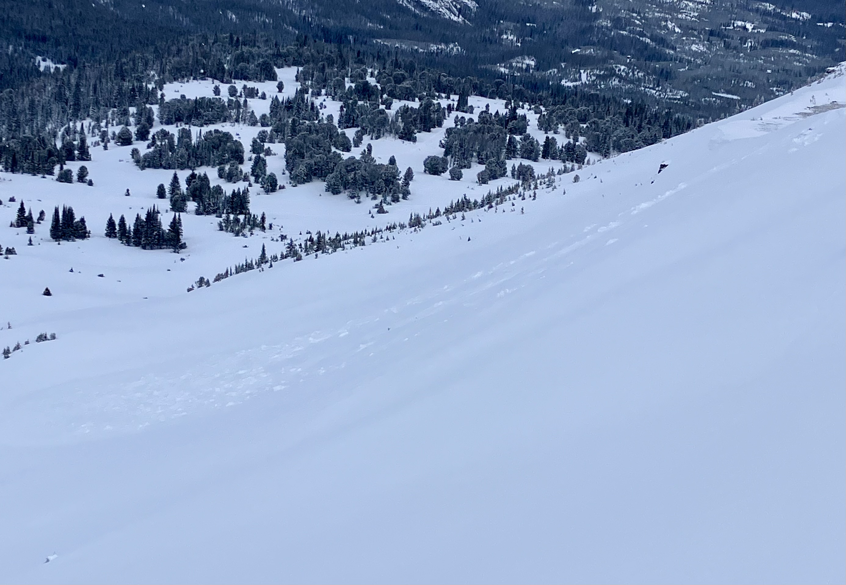
From email: "My friend and I toured in Cooke City today. We skied the low angle glades on the South side of Henderson Mountain. Breaking trail, we experienced at least 20 collapses, several of which were large enough to knock snow off the trees around us. Above 9200’ where the snowpack started to deepen, we did not get any collapses or cracking. We dug a quick pit at 9750’ on a SSE aspect. The site we dug on had been wind loaded substantially before the high pressure cycle last week. Skies were mostly cloudy with the sun poking out occasionally, light winds out of the west. Our ECT did not have propagation, but the results from our CT test were poor. Given the sketchy conditions, we stuck to low angle terrain."
Full Snow Observation Report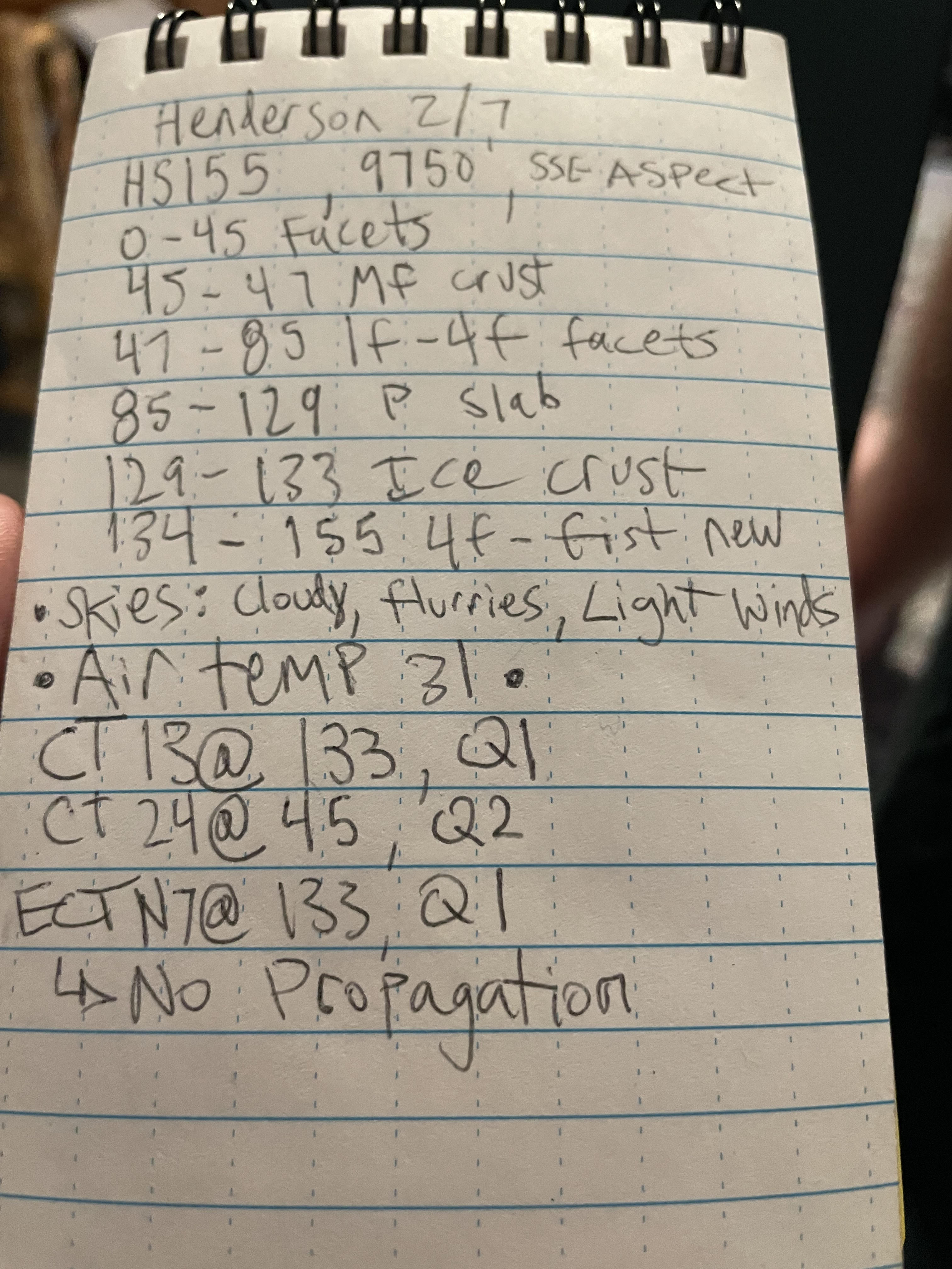
We rode into Taylor Fork today 02/07/2024. We found 12" of new snow that has fallen over the last few days. This new snow fell onto a very weak snowpack and our stability tests yielded poor results, ECTP 14 on a south-facing slope at 9200'. Southern aspects have a stout 2" crust that formed from last week's warm temperatures, over weak faceted snow. This is where we saw failure in our stability tests.
With poor visibility, we were not able to see any recent avalanche activity. However, we know the recipe is there. A uniformly weak snowpack has received a large amount of snow pushing it to the edge. Getting on or below terrain steeper than 30 degrees is not recommended.
Low clouds moved in by early afternoon and the wind was steady and moderate from the southwest. No new snow fell while we rode today.
Full Snow Observation Report
Skied a northeast face that was around 35-40 degrees at around 9000 ft. Entire slope fractured on second ski cut but did not slide. A dusting of new snow, with a good bit of powder on the ground.
Full Snow Observation ReportObserved an avalanche above Highway 212 ("the plug") just north of the Wyoming/Montana border. that appeared to be triggered by a snowmobile. It looked fresh, likely from the afternoon of 2/6/2024. Northeast facing slope, 8200'. Technically out of the advisory area.
Full Snow Observation Report