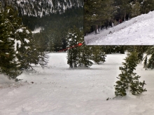
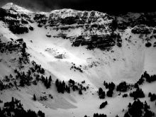
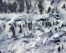
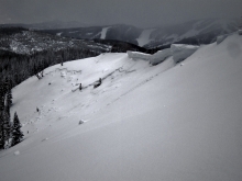
Advisory Archive
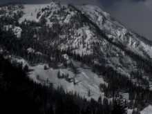
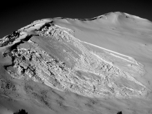
Over the past 24 hours the Bridger Range received 23 inches of new snow. The mountains around Big Sky including the northern Gallatin Range picked up 4-6 inches while the mountains around Cooke City and West Yellowstone picked up 1-3 inches.
Light snow showers will linger this morning, but will end by noon. At 4 a.m. temperatures are in the single digits above or below zero F, but will drop to ten below zero F or colder by this afternoon. Currently, winds are blowing 10-20 mph out of the WNW with localized gusts reaching into the thirties near Big Sky.
A weak ridge of high pressure will build over the area today and tomorrow producing calmer and drier conditions. Fortunately this cold snap will be short lived and temperatures will warm into the mid-teens to low twenties F by tomorrow afternoon.

Winds yesterday reached hurricane speeds in many places. They blew steady at 30-50 mph from the SW and W with gusts up to 80 mph. This morning they have calmed and are blowing 10-15 mph from the WNW. Temperatures dropped into the single digits F. With such strong winds yesterday it’s hard to tell exactly how much snow fell. Near Cooke City 5 to maybe 12 inches of snow fell. Near Big Sky and Hyalite Canyon 3-4 inches fell while the Bridger Range and mountains near West Yellowstone got about an inch.
Today winds should continue at 10-15 mph from the WNW and could increase a little. High temperatures might reach the teens F but will drop to near 0 F by late afternoon. 2-3 inches of snow should fall near Bozeman, Big Sky, and Cooke City. The mountains near West Yellowstone should only get a dusting.

Yesterday was relatively warm, sunny and calm. Today will be the opposite. This morning the mountains near Bozeman and Big Sky had temperatures in the high 20s F. Winds were averaging 15-30 mph from the SW gusting to 50 mph. Near West Yellowstone and Cooke City, temperatures were in the teens to low 20s F and winds were blowing 15 mph gusting to 30 mph from the SW. Temperatures should slowly drop through the day and be in the mid teens F this afternoon. Winds will remain strong blowing 20-30 mph gusting to 50 mph from the W. By tomorrow morning most areas should have 4-6 inches of new snow.


Two more inches of snow fell yesterday morning in the northern Gallatin Range. Winds have been west to southwest at 20-30 mph with gusts of 35 mph. Today will be mostly cloudy, winds will remain steady and mountain temperatures will rise from the teens into the upper twenties by this afternoon. A cold front and snowstorm are slated to arrive tomorrow morning. Wind and snow are on the menu for Friday.

Since yesterday morning the mountains near Bozeman and Big Sky have received 5-7 inches of new snow. Areas further south near West Yellowstone and Cooke City received about 4 inches. Some areas received a little rain as well. Temperatures dropped overnight and this morning ranged from the mid-teens F to 20 degrees F. Winds were blowing 15 mph gusting to 35 mph from the WNW. A little more snow should fall this morning but not accumulate. Today temperatures will be in the low 20s F and winds blow 10-30 mph from the WNW. More snow should come Friday.


It is currently snowing in the mountains. Since yesterday morning all areas picked up 1-3 inches. Winds are blowing west to southwest at 20-30 mph with gusts reaching 60 mph in Hyalite. Currently, temperatures are in the low twenties in the northern mountains and teens in the southern regions. Today will be snowy and breezy. A moist northwest flow with good energy will drop 8-12” in the Bridger Range and Cooke City with 4-8” falling everywhere else. Winds will remain strong out of the west to southwest with temperatures barely fluctuating. Dare I say that this looks very promising for the Bridger Range? I don’t want to jinx anything, but you might want to go easy on bringing in the New Year if you want to ski deep powder tomorrow.
Over the past 24 hours the mountains around Cooke City have received 6-8 inches of low density snow. The rest of the advisory area has remained dry.
Currently, temperatures are in the mid-teens to low twenties F and westerly winds are blowing 10-20 mph. Today, a northwest flow aloft will continue to push weak bands of moisture over the area. No major accumulations area expected, but skies will remain mostly cloudy with a slight chance of mountain snow showers. The exception is Cooke City where 1-3 inches is possible throughout the day.
Temperatures will warm into the mid-twenties to low thirties F and winds will continue to blow predominately out of the west at 10-20 mph. A more potent storm system is forecasted to impact the area tomorrow into Wednesday.
Over the past 24 hours the northern Gallatin Range picked up 5-6 inches of low density snow totaling .4 inches SWE. The mountains around Big Sky picked up 2-3 inches while the rest of the advisory area picked up a trace to one inch.
At 4 a.m. mountain temperatures are ranging from the single digits to low teens F under mostly clear skies. Winds are blowing 5-10 mph out of the WNW. Today, a northwest flow aloft will remain over the area producing partly to mostly cloudy skies. Temperatures will warm into the upper teens to low twenties F and winds will remain light out of the WNW. Conditions will remain mostly dry today, but there is an increasing chance of snow tonight and tomorrow.
The weather will change drastically today. A cold front dropping from the north will arrive by late morning/early afternoon, producing light snow and colder temperatures. Winds will also spike during the frontal passage.
Currently, warm and windy conditions exist. Temperatures are in the mid to high 20’s F and winds are blowing 15-25 mph out of the WSW with higher gusts along the ridgelines. As the front approaches, winds will continue to increase out of the WSW. Gusts near 50 mph are likely with the frontal passage. Cold air and light snow will arrive behind the front. Temperatures will be in the teens F by this afternoon and the mountains should see 1-2 inches of new snow.

If you like warm weather, today’s your day. This morning near Bozeman temperatures were near 30 degrees F, near Big Sky in the 20s F, and near West Yellowstone and Cooke City in the teens F. Winds in most places were averaging 15 mph and gusting to 30 mph in a few different directions but mostly from the S and W. Today will have sunshine and temperatures in the 30s F with a few places like the Bridger Range possibly reaching 40 degrees F. Cold air and some snow will come from the NW on Saturday.