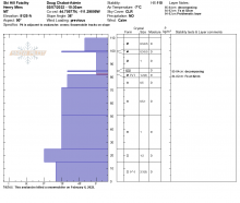
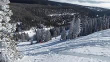
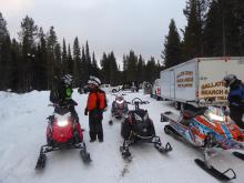
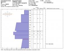
All Avalanche Incidents for Advisory Year 2021-22
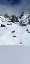
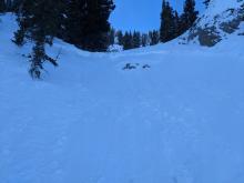
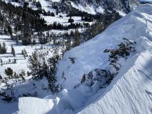
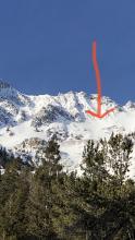
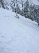
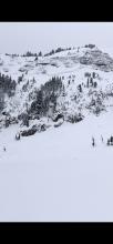
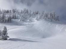
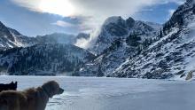
SS-AMu-R1-D1-I
Coordinates: 44.7145, -111.3180
Caught: 0 ; Buried: 0
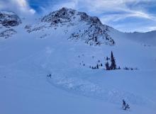
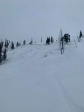
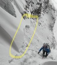
From obs: "Today I watched as a sledder dropped a cornice causing the cornice to fall triggering an
avalanche chasing him down the hill. The snowpack consisted of a wind slab on top of near-surface
facets and a couple of buried layers of surface hoar."
More Avalanche Details
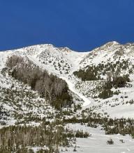
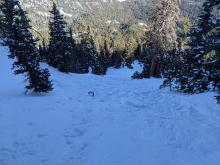
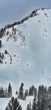
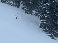
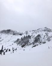
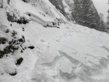
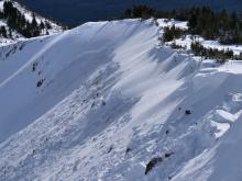
SS-AMu-R1-D2-O
Elevation: 8,100
Aspect: E
Coordinates: 44.7016, -111.2930
Caught: 1 ; Buried: 1; Killed: 1
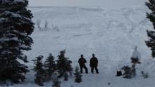
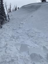
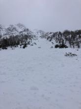
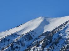
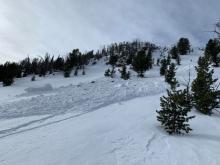
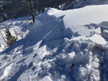
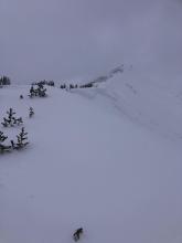
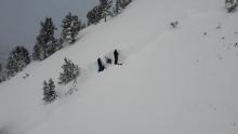
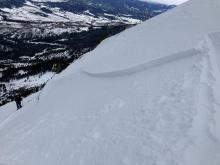
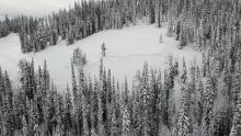
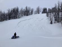
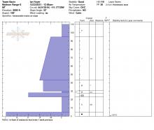
On Sunday, one snowmobiler in a group of four was caught and killed in a small avalanche on Ski Hill at the south end of Lionhead Ridge. He was on a 45-degree slope when it released and partially buried him against a tree. The slide was only 4"-11" deep, 75 feet wide and ran 300 feet vertical. His head was a foot under the snow. The avalanche was not witnessed and the victim was buried an estimated 15-25 minutes before he was uncovered. Rescue efforts were not successful. The group was familiar with the area and had rescue gear. The shallow, steep slide ended in trees, a terrain trap. Our deepest condolences go out to the family and friends of the rider.
A detailed report can be read here.
More Avalanche Details

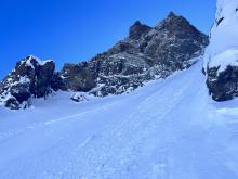
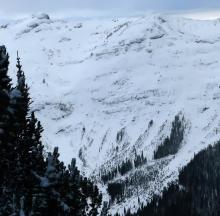
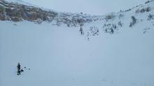
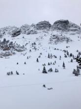
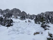
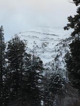
SS-N-R2-D2-I
Elevation: 10,250
Aspect: E
Coordinates: 44.9739, -109.9240
Caught: 0 ; Buried: 0
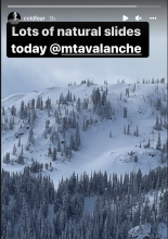
From Facebook, "East side of Woody Ridge has several natural slab avalanches this morning. All appear to be triggered by Loose Dry naturals and looked to be 1-2' deep. Main face of Climax went R3"
More Avalanche Details

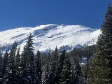
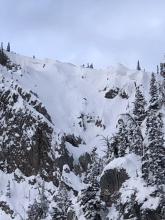
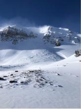
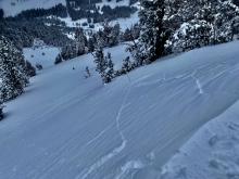
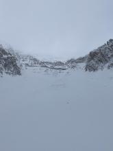
SS-N-R1-D1
Elevation: 8,700
Coordinates: 45.0202, -109.9380
Caught: 0 ; Buried: 0
photo from IG on 2/6/22
separate obs 26/22: "Small natural soft slab avalanche on a SE aspect at 8737'... Crown was 20cm deep and approximately 15m wide.I believe it ran on the NSF below the recent storm snow. I think it happened around 10am."
More Avalanche Details
SS-N-R2-D2
Elevation: 9,500
Aspect: N
Coordinates: 45.0465, -109.9770
Caught: 0 ; Buried: 0
We saw this natural avalanche on Feb 6, 2022 on the north side of Miller Mtn. near Cooke City. It appears to have broke near the end of the 10-14" snow storm that fell the prior day (2/5).
More Avalanche Details
Elevation: 8,500
Aspect: SE
Caught: 0 ; Buried: 0
From obs (2/5/22): "Very low visibility, but we observed at least 2 fresh storm slab/ wind slab avalanches on mid elevation SE aspects that appeared to run naturally during the day today. These slab avalanches didn't propagate wide, but... "
More Avalanche Details
SS-N-R2-D1
Aspect: E
Coordinates: 45.4402, -110.9310
Caught: 0 ; Buried: 0
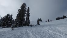
Climbers on the big sleep on Saturday reported strong wind and blowing snow. They witnessed a wind slab that broke above the climb, and estimated that it was large enough to bury, injure, or kill a person.
From obs 2/5/22: "We hiked into Flanders to check out the Big Sleep ice climb. It was super windy with lots of blowing snow and the ice was thin so we decided not to climb it.
We witnessed a sizeable wind slab or sluff pour over the big sleep. It covered the whole climb for a second and probably would've slammed a climber off the route. Maybe 20 x 20 x 6 in slab but thats loose estimate."
More Avalanche Details
AS-O
Coordinates: 45.0254, -110.0310
Caught: 0 ; Buried: 0
From obs. 2/4/22: "...Also, we had one significant collapse today on a mid elevation east aspect. A slope with just a touch of wind deposit. (first collapse I've had in months!) The snow that collapsed appeared to be about 30-40' wide. And a hasty pit showed the layer of concern to be buried SH...."
More Avalanche Details
Coordinates: 44.4636, -110.1350
Caught: 0 ; Buried: 0
On Friday (2/4/22), Skiers in Yellowstone National Park (outside our advisory area) intentionally triggered avalanches 4-12" deep on a touchy layer of surface hoar.
More Avalanche Details
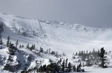
HS-N-R2-D2-O
Elevation: 10,000
Aspect: SE
Coordinates: 45.2596, -110.7020
Caught: 0 ; Buried: 0
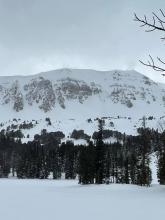
On Saturday, skiers on the SE couloir of Emigrant Peak found debris from a large natural avalanche. It appears to be more than 24 hours old.
From obs (2/5/22): "Attempted to ski the SE Couloir on Emigrant Peak today. As we approached, we noticed recent avalanche debris in the runout zone of the line. We approached carefully and it looked to be somewhat recent in the last few days. Not buried by much recent snow but also did not look fresh as of that day. I am guessing it was triggered by a collapsed cornice but with poor visibility it was challenging to see any sort of crown or broken cornice above us. We did not ski the couloir. I dug a pit in the open east facing bowl below at 9200 ft. The snowpack was between 55-75cm deep. In this location, the bottom 30cm of the snowpack were very large, well-developed facets with some depth hoar. I got ECTN 14 about 45cm up and ECTX on the facet/midpack interface (30cm up)."
More Avalanche Details
Aspect: NW
Coordinates: 45.0270, -110.0030
Caught: 0 ; Buried: 0
From obs on 2/4/22: "We also observed a fresh avalanche yesterday on the NW aspect of Meridian Peak. I couldn't discern a crown, due to our vantage point and a low cloud, but the debris pile looked relatively deep, and 12-48 hours fresh."
More Avalanche Details
SS-ASu-R2-D2-O
Elevation: 10,800
Aspect: SE
Coordinates: 45.1437, -109.9040
Caught: 1 ; Buried: 1; Killed: 0
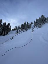
This morning while ascending a line on Sawtooth Mountain (Lower Novocain) we triggered an avalanche (ASu-SS-R2-D2-O) that caught and carried my partner an estimated 180M and partially buried him. His leg and hand were unburied and excavation of the head was done in less than 2 minutes of the incident. The avalanche only involved new snow from the last 48hrs and was triggered on a MF crust/facet combo 30cm down(formed 1/30/22). The avalanche was 30cm at its deepest and 20-30M wide and ran 250M. We were lucky to find both skis and poles a little ways downslope. No injuries were sustained.
We both agree that we were trying to outsmart the instability that was present on steeper S facing terrain and should have turned around much sooner, we were very lucky. There was 30+cm HST in favored areas and the high winds from 1/31/22 formed some sensitive windslabs in specific areas.
More Avalanche Details
SS-NC-R2-D2
Coordinates: 45.3270, -111.3250
Caught: 0 ; Buried: 0
From obs 1/29/22: "Avalanche appeared to have been caused by a breaking cornice on lookers left. Probably from Friday"
More Avalanche Details
L-ASc-R1-D1-I
Elevation: 8,700
Aspect: E
Coordinates: 45.7869, -110.9350
Caught: 0 ; Buried: 0
We triggered small dry loose avalanches and some ran naturally. They involved 1-2" of new low density snow and ran far on weak faceted snow underneath.
More Avalanche Details
HS-N-R1-D2-O
Elevation: 8,970
Aspect: E
Coordinates: 45.7943, -110.9360
Caught: 0 ; Buried: 0
GNFAC forecasters looked at the crown of this slide on 1/27/22. It broke on the night of 1/25 or earlier. It was a 6-8" deep P+ hard slab that broke on a layer of weak facets over a hard bed surface.
Approx. 1,100' wide, measured as on GoogleEarth
More Avalanche Details

SS-AS
Aspect: E
Coordinates: 45.1212, -109.9300
Caught: 0 ; Buried: 0
Skier-triggered avalanche reported on Mt. Fox. Details unknown
More Avalanche Details
SS-N
Coordinates: 45.0722, -109.9280
Caught: 0 ; Buried: 0
Natural avalanche reported on the east face of Sheep Mountain. Details unknown
More Avalanche Details
SS-ASu-R2-D1.5-I
Aspect: NE
Coordinates: 45.8426, -110.9290
Caught: 1 ; Buried: 0; Killed: 0
From Obs: "While skiing the playground, a northeast aspect in the Bridgers, my friends and I released a wind slab. The slab released on a rollover and was approximately 20 ft wide and 6-12" deep at the top. The slide carried my friend about 150 ft."
More Avalanche Details
SS-ASu-R2-D1.5-O
Elevation: 10,000
Aspect: N
Coordinates: 45.0066, -109.9600
Caught: 0 ; Buried: 0
From email 1/22/22: "This morning (20220122) I was ascending a steep North facing couloir up the N summit of Republic Mountain and on ascent (boot packing) about 1/2 way up the line I triggered a small soft slab from that propagated around the rock I was tucked behind, 40M above me and and 20M across. Luckily, my ascent line was sheltered from any above exposure and I was not caught or carried in anyway. The crown ranged from 8cm where I triggered it to an estimated 25cm at its deepest. The avalanche ran an estimated 200M. I believe the windslab ran on 1-3mm NSF's (evident on the bed surface) formed in the high pressure before the recent light precip."
More Avalanche Details
L-N-R0-D1-S
Elevation: 9,800
Coordinates: 45.0202, -109.9380
Caught: 0 ; Buried: 0
From obs: "Slides on north and northeast sides of Crown Butte. Also what appears to be ski/ snowboarder triggered small slides under Chimney Rock, west-facing slope."
More Avalanche Details
SS-NCu-R3-D2-O
Elevation: 9,300
Aspect: E
Coordinates: 45.3379, -111.3990
Caught: 0 ; Buried: 0
From email 1/9/21: "Skier triggered cornice failure avalanche. Broke at skis 10-12 feet from the lip. No one caught or injured."
More Avalanche Details
SS-N-R3-D2-I
Elevation: 10,000
Aspect: E
Coordinates: 45.0607, -111.2720
Caught: 0 ; Buried: 0
More Avalanche Details
HS-N-R2-D2
Coordinates: 44.9474, -111.1560
Caught: 0 ; Buried: 0
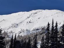
Several natural avalanches were observed on Red Mountain. These avalanches were seen on 1/13/22, but likely occurred around 1/8/22.
More Avalanche Details
N-R3-D2.5-O
Elevation: 10,450
Aspect: E
Coordinates: 44.9280, -111.2420
Caught: 0 ; Buried: 0
A group in Cabin Creek saw a very large crown from an avalanche that occurred on the east aspect of Sage Peak last weekend (1/7 or 1/8)
More Avalanche Details
SS-N-R2-D2-I
Elevation: 10,400
Aspect: E
Coordinates: 45.2664, -110.7040
Caught: 0 ; Buried: 0
From obs 1/10/21: "Saw this recent natural slide, probably a day or two old, while skiing on Emigrant. Start zone approx 10,400ft, E facing. We guessed the crown was 3-5ft deep. Evidence of wind loading on similar surrounding slopes, suggesting wind slab as culprit." Photo: T. Benson
More Avalanche Details
SS-N
Elevation: 9,700
Aspect: NE
Coordinates: 45.0344, -109.9840
Caught: 0 ; Buried: 0
From skiers in Cooke 1/9/21:
"Observed a couple of recent, new snow, wind slab avalanches that appeared to occur during the storm. Upper elevation, N-E aspects, all very steep, wind loaded terrain. Most appeared to be triggered by cornice falls, and nothing propagated very wide from what I could tell."
"Wind slab on East face of Sheep mountain today. D1.5,mid slope".
More Avalanche Details
SS-N-R1-D2-S
Elevation: 9,700
Aspect: NE
Coordinates: 44.9855, -109.9410
Caught: 0 ; Buried: 0
From obs: 1/8/21: "...One minor avalanche observed in Republic Creek. It was on a steep and rocky E, NE aspect around 9700'..."
More Avalanche Details
SS-N-R2-D2-S
Elevation: 10,000
Aspect: S
Coordinates: 45.0566, -109.9510
Caught: 0 ; Buried: 0
Skiers reported on 1/8/21: "Observed natural north Scotch Bonnett"
More Avalanche Details
SS-NO-R4-D4-O
Elevation: 9,400
Aspect: NE
Coordinates: 45.2817, -113.6810
Caught: 0 ; Buried: 0
More Avalanche Details
SS-AMu-R2-D2
Coordinates: 45.0202, -109.9380
Caught: 0 ; Buried: 0
From facebook: "This morning 1/7/2022 by lower lady I set off a avalanche about 2ft deep 100ft wide just a heads up out there the new snow is not very safe!! Glad my whole group stayed low, I was up there alone digging it out when it broke loose! Stay safe ride on!"
More Avalanche Details
HS-N
Coordinates: 44.9977, -109.9780
Caught: 0 ; Buried: 0
At least 6 natural avalanches reported on Wall Mountain (between Silver Gate and Cooke City).
More Avalanche Details
SS-N-R1-D1-I
Coordinates: 45.8512, -110.9480
Caught: 0 ; Buried: 0
Skiers in the northern Bridger Range and on the west side reported several natural and skier triggered slides breaking on the interface between the new and old snow. These slides were shallow and small.
More Avalanche Details

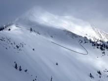
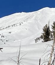
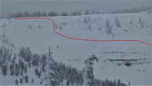
SS-N-R3-D2-O
Elevation: 9,000
Aspect: NE
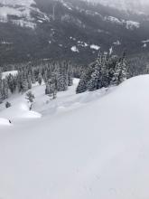
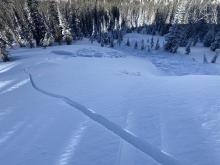
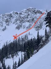
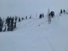
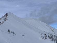
Coordinates: 44.7328, -111.3320
Caught: 0 ; Buried: 0
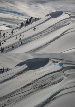
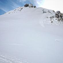
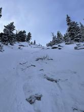
This avalanche broke wide in a northerly facing bowl off Lionhead Ridge. It looks to have broken a foot or less deep. The propogation indicates a uniform weak layer, likely near-surface facets or surface hoar.
More Avalanche Details
SS
Elevation: 8,000
Aspect: NE
Coordinates: 45.8322, -110.9280
Caught: 0 ; Buried: 0
While skinning towards the ramp we witnessed what looked like a natural slide that started right around Pete’s Pinnacle which ran down along the boundary line about 1000 feet. Unknown trigger.
More Avalanche Details
SS-ASc-R1-D1-S
Elevation: 8,000
Aspect: E
Coordinates: 45.7943, -110.9360
Caught: 0 ; Buried: 0
We were able to easily trigger small fresh drifts of snow on 1/1/22 as they formed from strong west wind.
More Avalanche Details
N-R2-D2
Elevation: 8,800
Coordinates: 45.7943, -110.9360
Caught: 0 ; Buried: 0
On 1/1/2022 we saw two recent natural wind slabs in addition to the two that were reported yesterday. One was on the north summit of Saddle Peak and the other was on the north side of Argentina Bowl. - GNFAC
More Avalanche Details

N-R3-D2.5-O
Elevation: 10,000
Aspect: E
Coordinates: 45.0773, -110.0210
Caught: 0 ; Buried: 0
Riders saw the crown of this slide on 1/2/21, and it appeared to be many days old.
More Avalanche Details
HS-N-R1-D2-O
Elevation: 10,200
Aspect: NE
Coordinates: 45.0722, -109.9280
Caught: 0 ; Buried: 0
More Avalanche Details
N-R2-D2
Elevation: 8,900
Aspect: NE
Coordinates: 45.7943, -110.9360
Caught: 0 ; Buried: 0
From skier obs on 12/31/21: 2 or 3 days ago Saddle went to the ground, big, between the peaks, full track....
Sometime yesterday on the east south east aspect just south of the ridge that separates football field from Saddle pulled out 100’ wide just under the cornice maybe 2+ feet deep, ran over the cliffs and dumped into bottom 2/3 of going home chute ran for a while then stepped down 2.5 -3’ and ran through that flats, but did not make the traverse back.
More Avalanche Details
N
Coordinates: 45.0344, -109.9840
Caught: 0 ; Buried: 0
From BPG obs 12/31/21: "We did observe a crown at the back of the valley to the south (climber's left) of "Tea and Crumpets". Only looked about 50-75' wide but deep, exposing rocks/ground in places. Couldn't get a good photo with limited visibility."
More Avalanche Details
HS-N
Coordinates: 44.5658, -111.5000
Caught: 0 ; Buried: 0
A large avalanche cycle occurred around Mt Jefferson, Reas Peak and Hellroaring Creek around the 28th of December. Slides ran on faceted snow near the ground and they propagated far and wide.
More Avalanche Details
N-R2-D2
Elevation: 9,000
Aspect: E
Coordinates: 45.7943, -110.9360
Caught: 0 ; Buried: 0
From skier obs on 12/31/21: 2 or 3 days ago [Saddle] went to the ground, big, between the peaks, full track. Yesterday quarter Saddle went big as well. Stepped down lower in the track.
the whole basin between the peaks [except a pocket that slid 3 days earlier] pulled out just under the cornice and went to ground until it went into the narrows and then rode up on a layer until about halfway down and then stepped down another 2-3’ and ran at least 2/3 of that run to the traverses back to schlasmans.
More Avalanche Details
AMu-R3-D2-O
Coordinates: 45.0772, -110.0210
Caught: 0 ; Buried: 0
Snowmobilers riding near Mount Abundance north of Cooke City unintentionally triggered two avalanches on Dec. 27th. No one was caught or injured.
More Avalanche Details
NC-R2-D2-O
Elevation: 10,000
Aspect: NE
Coordinates: 45.0532, -109.9470
Caught: 0 ; Buried: 0
Natural Slide... probably a cornice failure. Crown was maybe 4 or 6 feet at it's deepest.
More Avalanche Details
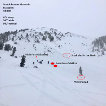
SS-AMu-R2-D2.5-O
Elevation: 10,000
Aspect: SE
Coordinates: 45.0566, -109.9510
Caught: 2 ; Buried: 2; Killed: 2
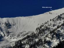
On December 27, two snowmobilers were caught and killed in an avalanche on Scotch Bonnet Mountain, north of Cooke City. A group of 8 snowmobilers from Minnesota were on their second day of riding when 2 of their machines got stuck on the SE face of Scotch Bonnet Mountain. Two members of their group rode up to help them dig out and the avalanche was triggered soon after. It broke 4-5 feet deep, ran 300 feet wide and 500 feet vertical and killed 2 riders, burying them under 4-5 feet of debris. Everyone had rescue equipment and they were recovered by their party. Park County Sheriff Search and Rescue brought the victims to town. The avalanche broke on a layer of facets 1.5 feet off the ground underneath a thick slab of wind drifted snow. The avalanche is classified SS-AMu-R2-D2.5-O.
More Avalanche Details

SS-NC-R1-D1.5-S
Elevation: 9,100
Aspect: E
Coordinates: 45.7943, -110.9360
Caught: 0 ; Buried: 0
A natural avalanche of wind-loaded snow released in the "Between the Peaks" area of Saddle Peak in the Bridger Range on Christmas Eve or early Christmas morning. The avalanche was relatively small and appears to consist of a thin slab of wind-drifted snow.
More Avalanche Details
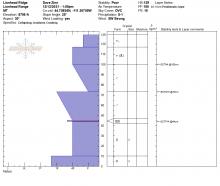
Coordinates: 44.9609, -111.1000
Caught: 0 ; Buried: 0
From email: "My partner and I went out to Ernie Miller today via the standard bacon rind uptrack. On the traverse across the moderate terrain, we experienced many whumpfs, some large enough to knock snow out of trees. We went up to about 9100ft on ole Ernest and dug a pit, performed an ect, and got propagation all the way across a layer maybe 4-6 inches above the ground at 25 whacks. On the same whack (the 25th), a layer about 12 inches above ground also collapsed and propagated across."
More Avalanche Details
HS-AE-R4-D3.5-O
Coordinates: 45.2760, -111.4360
Caught: 0 ; Buried: 0
Big Sky Ski Patrol used explosives to trigger an avalanche that broke 5 ft deep on weak layers near the ground.
More Avalanche Details
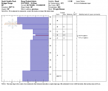
HS-ASc-R1-D1-I
Elevation: 9,000
Aspect: E
Coordinates: 45.7943, -110.9360
Caught: 0 ; Buried: 0
We were able to intentionally trigger this 6-8" deep wind slab on Saddle Peak on December 23, 2021, E aspect at 9,000'. It showed us that recently formed wind slabs were still reactive. This hard slab formed over low density new snow which made it unstable. While not large, these slides will easily push you down and can be harmful if they push you into hazardous obstacles or terrain traps. - GNFAC
More Avalanche Details
SS-N-R2-D2-O
Elevation: 10,200
Aspect: NE
Coordinates: 45.0724, -109.9260
Caught: 0 ; Buried: 0
From Beartooth Powder Guides: Saw this small natural avalanche today while coming back from the yurt. While being small on the relativity scale, it seems to have broke fairly deep.
More Avalanche Details
AS
Elevation: 7,800
Aspect: E
Coordinates: 45.0283, -111.0710
Caught: 0 ; Buried: 0
ECTP 8 @ 15cm 7800' E. on Specimen Ridge. LOC: Fist hard basal faces below a decomposing crust about 10cm off the ground Lots of whomping on lee and sheltered slopes. We noticed a few pinwheels at later in day below 7500'. Generally poor structure and poor strength. I don't know what SWAG notation for sagebrush is but lots of that...
More Avalanche Details
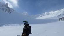
SS-ASu-R2-D1.5-I
Elevation: 7,700
Aspect: NE
Coordinates: 45.8156, -110.9230
Caught: 1 ; Buried: 0
On 12/16/21 A skier in a group of three triggered and was caught in an avalanche near The Apron at Bridger Bowl. The ski area is closed and backcountry conditions exist. Nobody was injured.
From e-mail: "We had a group of three skiing up at the Bridger Apron today. We skied a more main slope in the field north of the slope with hidden couloir, snow was very stable and has been getting a lot of tracks. For a second run we skinned up the main slope under hidden and started our run in the trees slightly south of this slope. Not many tracks over there and not a good enough evaluation of the snowpack. We were planning on skiing a northeast facing chute through the trees that had very nice looking snow similar to what we had skiied earlier. I skiied in and had about 3 amazing turns, definitely partially due to the wind loading at this aspect. After three turns my feet were taking out from under me and I got caught in a slide keeping skis perpendicular to slope for 15-20’. This avalanche carried me rapidly and cleared the snow to the rocks below in which I was able to come to a hault and watch the rest of the sluff slide past me. After looking at the conditions after, this windy aspect seemed to have a very faceted layer about 8” down that acted as the crown. No injuries, a lost ski pole in the runout which extended down the slope maybe another 40’. The wind scoop on top and seeing these facets should have been a clear sign prior to skiing. Must be more diligent even in areas of high traffic. When dropping in to ski on first turn or so I remember hearing a possible whumpf."
More Avalanche Details
SS-N-R1-D1-O
Aspect: E
Coordinates: 44.9041, -111.1850
Caught: 0 ; Buried: 0
There were many natural avalanches that were breaking on facets near the ground (4-6mm). The 3 feet of snow that fell created unstable conditions and avalanched during the HIGH danger. Most slides were less than 100 feet wide. By GNFAC.
More Avalanche Details

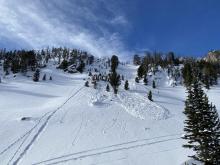
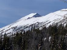
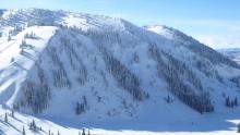
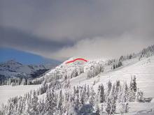
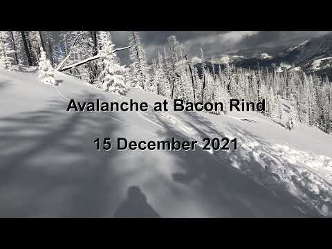
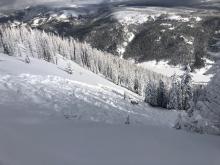
SS-N-R2-D2-O
Elevation: 9,400
Aspect: SE
Coordinates: 44.7145, -111.3180
Caught: 0 ; Buried: 0
This natural avalanche likely released after the large storm ended Wednesday, December 15. This slope is SE facing and the crown is about 9,400 feet. Faceted snow at/near the ground was the likely weak layer that avalanched.
More Avalanche Details
SS-AMu-R1-O
Coordinates: 45.1153, -109.9140
Caught: 0 ; Buried: 0
A sledder triggered an avalanche on a wind-loaded slope near Goose Lake. It was maybe 75-100 feet wide but only slid 3 feet before arresting. It was on a low-angled slope and failed on facets on a rocky band. They triggered it as they were sidehilling and rode off the slab. Doug interviewed the party in Cooke City.
More Avalanche Details
SS-AMr-R2-D1.5-I
Aspect: NE
Coordinates: 45.0607, -111.2720
Caught: 0 ; Buried: 0
A small avalanche (15ft wide, 1-2ft deep) was triggered from 100 ft away on 12/15 at the divide between Sage and Carrot Basins in the Taylor Fork. It broke beneath the recent storm snow.
6 other slides broke naturally during the storm along the Sage Basin ridge line. These slides broke 2-3 ft deep beneath the storm snow and ran 50-100 ft.
More Avalanche Details

SS-ASr-R2-D2
Elevation: 8,900
Aspect: E
Coordinates: 44.9609, -111.1000
Caught: 0 ; Buried: 0
Skiers remotely triggered an avalanche in the Bacon Rind area from the flats above the Skillet
More Avalanche Details
SS-ASu-R0
Elevation: 8,000
Coordinates: 45.8289, -110.9310
Caught: 0 ; Buried: 0
My partner had a 6" deep, about 15' wide slab release roughly 40 feet beneath him about halfway up the ramp, lookers right, on a NE facing, untouched aspect. Seemed more in line with wolverine bowl aspect vs the ramp. We dug a pit just a little further up the ramp and got a little movement about 15cm's from the top of the pack but not solid enough to call it a clean break. 60-65cm total depth in our pit.
More Avalanche Details
AS
Elevation: 8,650
Aspect: NE
Coordinates: 44.7081, -111.3070
Caught: 0 ; Buried: 0
We triggered shooting cracks through drifts while skinning along Lionhead Ridge and one collapse on a heavily loaded convexity.
More Avalanche Details

SS-ASc
Coordinates: 44.9613, -111.2980
Caught: 0 ; Buried: 0
From Obs 12/12/21: "Heavy wind loading from gusty SW winds and recent snowfall. Made for some touchy conditions. This was at 9100’ between Sage and Sunlight basins."
More Avalanche Details
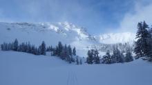
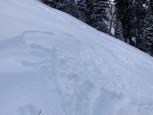
AF-O
Elevation: 8,000
Aspect: NE
Coordinates: 45.4505, -110.9190
Caught: 0 ; Buried: 0
From email obs: 12/12/21: "Shooting cracks and whoomphing in wind loaded areas. An approximately 15x30ft wind slab cracked along the bas of a rock band and settled at the base of P2 on high fidelity. Was triggered while traversing along the rock band to gain the second pitch, 1-2 inches of facets on the ground. Wind slab of 6-36in in the gullies."
(Second photo, believed to be from different group, sent on IG)
More Avalanche Details
SS-ASc-D1-S
Elevation: 8,000
Aspect: NE
Coordinates: 45.8288, -110.9310
Caught: 0 ; Buried: 0
In the Bridger Range on December 10, 2021 2-3" of low density new snow was drifted into small soft slabs that were easy to trigger.
More Avalanche Details

SS-N-R1-D1-S
Elevation: 10,100
Aspect: S
Coordinates: 45.0566, -109.9510
Caught: 0 ; Buried: 0
GNFAC forecasters witnessed this very small wind slab on 12/7/21 near Lulu Pass outside Cooke City.
More Avalanche Details
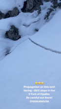
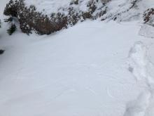
SS-AFu-R1-D1-S
Elevation: 7,600
Aspect: NE
Coordinates: 45.4539, -110.9210
Caught: 0 ; Buried: 0
The slide was on the ice climb in Comet Alley.
From email (12/5/21) : "Small avalanche triggered while approaching ice climb in East fork of Hyalite basin.
Another D1 natural avalanche was observed later in the day similar aspect/elevation
NE @7600’
SS-AFu-D0.5-I"
More Avalanche Details
WL-N-R2-D2
Elevation: 7,900
Aspect: NE
Coordinates: 45.8288, -110.9310
Caught: 0 ; Buried: 0
From text on 12/6/21: "Wet slide from [around 12/1/21]. When it was so damn warm. Velma's and Peter's point runout. Best I can tell from Below. Looked like snowballs off the cliffs possibly releasing at the top of the apron."
More Avalanche Details
SS-AE-D2
Coordinates: 45.2760, -111.4360
Caught: 0 ; Buried: 0
Big Sky Resort Ski Patrol reported triggering wind slab avalanches up to 1 ft deep below alpine ridgelines using explosives during avalanche mitigation work on 11/25/2021. Some of the slides broke down into older snow.
More Avalanche Details
Elevation: 9,700
Aspect: SE
Coordinates: 45.2648, -111.0000
Caught: 0 ; Buried: 0
Skiers on Mount Blackmore observed cracking within the freshly wind-loaded snow on a southeast-facing slope just below the ridge
More Avalanche Details
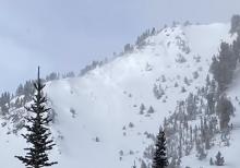
U-N
Elevation: 10,000
Aspect: N
Coordinates: 45.4712, -110.4670
Caught: 0 ; Buried: 0
This powder cloud from a large avalanche was seen on Black Mountain, up Pine Creek outside Livingston. Located outside our advisory area it is a sign of unstable snow, likely from wind-loading, that can be found throughout southwest Montana.
More Avalanche Details
SS-N-R2-D2-O
Elevation: 10,000
Coordinates: 45.0524, -109.9450
Caught: 0 ; Buried: 0
From email 11/15/21: "east Henderson had a fresh slab avalanche- on a NE aspect around 10,000'. It appeared to have failed on a weak layer near the ground, and I'd guess it was about 2-3' deep and 300'+ wide. (photo attached)
Also noted some other natural slab avalanches on some northerly aspects of Miller Ridge. (steep rocky starting zones). And noted a couple big slab avalanches on NE erly aspects up Republic Creek too. Similar thing there: steep, rocky, wind loaded starting zones."
More Avalanche Details
SS-N-R0-D1.5-I
Elevation: 9,900
Aspect: SE
Coordinates: 45.0566, -109.9510
Caught: 0 ; Buried: 0
From email 11/10: "noted two small cornice triggered slab avalanches on a SEerly aspect of Scotch Bonnet Mountain. They looked to be fresh this morning, involve just new snow, and were about 25' wide each."
More Avalanche Details
SS-N-R1-D2
Elevation: 9,000
Aspect: NE
Coordinates: 45.7943, -110.9360
Caught: 0 ; Buried: 0
From obs. 11/10: "Fitness skinning around Bridger Bowl yesterday and noticed a fairly large, new avalanche on the east face of the North peak of Saddle. Maybe 100 feet below the ridge, about 100 wide at the crown, ran thru the rock bands but not over the cliff. Was taken back by the clean propagation." -Albert
More Avalanche Details
L-ASu-R1-D1.5-S
Elevation: 9,000
Aspect: N
Coordinates: 45.8883, -110.9590
Caught: 1 ; Buried: 0
From e-mail 11/7/21: "Today, my partner and I set out to ski The Great One, with a plan to come up and over Sac Peak and then walk the ridge to Naya Nikki before skiing the Great One into Airplane Bowl. We found more snow than expected at the TH, about 6inches. On our way up to the pass just north of Sac we noticed the characteristic wind stripping down to scree on the trail to the pass. On one of the switch backs we were able to get about an 1-2” deep wind slab to propagate but not move down slope. Given the depth, we didn’t put too much stock into this. We proceeded to walk the almost snow free trail over to Naya Nuki before booting down to the top of the Great One. The skiers left side of the Couloir had some obvious wind load and after a few ski cuts felt comfortable continuing to ski. After my partner skied the majority of the top section, I followed and was entrained and taken for a slide in my own ‘slough’. I was carried about 40’ before I stopped, while the slough kept running for another 100-150’ arresting on the shallower angled slope before the break in the Couloir wall that feeds into Airplane Bowl. The entrained width of moving snow was about 3-5’ wide. There were no injuries, and we continued down to the base of the Couloir, deciding it would be more dangerous to try and go back up to get out. Once in airplane bowl we saw multiple large slides that ran last night, syn-storm. Most of which came down from the East face of Sac. A few 200-300’ wide and running the length of the bowl. Early season hubris, and is not even thinking about overnight wind totals has us more or less absent minded when we set out this morning. A mistake that could’ve been a lot worse if the slough had taken a larger wind pocket with it, and carried me over the same aspect that led to the fatality in the Great One last fall. No pictures of the slough, attached is a grainy cell phone pic of the slides in Airplane Bowl."
More Avalanche Details