Good morning. This is Eric Knoff with the Gallatin National Forest Avalanche Forecast issued on Friday, March 29th at 6:45 a.m. Today's forecast is sponsored by Stronghold Fabrication and Gallatin County Search and Rescue. This forecast does not apply to operating ski areas.
Since yesterday morning the mountains around Bozeman and Big Sky picked up 3-5” of new snow. The mountains near West Yellowstone and Cooke City squeezed out 1-2”. At 5 a.m. snow is diminishing and temps are in the upper teens to low 20’s F. Winds are blowing 5-15 mph out of the west-southwest. Today, skies will be mostly cloudy during the morning hours with snow flurries possible. Skies begin to clear by early afternoon and temps warm into the upper 20’s to low 30’s. Winds remain light to moderate out of the west-southwest. High pressure is in the forecast and tomorrow looks to be a nice sunny day.

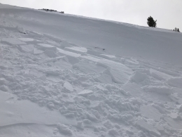
The recent storm was a bit of a letdown, but did drop enough fresh snow to bump up the avalanche danger. Today, instabilities will be confined to the new snow. Dry loose avalanches will move easily on the frozen old snow surface. These won’t pack a Mike Tyson type of punch, but they could be problematic if they catch you off guard. Wind slabs won’t be widespread, but may be encountered below ridgelines loaded by westerly winds (photo). Watch for and avoid any steep slope that appears recently wind loaded, especially those in higher consequence terrain.
If the sun pokes out this afternoon wet loose avalanches will be possible. These will be confined to steep slopes facing south through west (video). Roller balls and small point releases are clues the surface snow is heating up and becoming unstable. Avoid steep sun exposed slopes if these signs are present. I don’t expect wet loose avalanches to be a major concern today. Outside of new snow instabilities the snowpack is generally strong and stable.
Today, human triggered avalanches are possible and the avalanche danger is rated MODERATE.

Big hype is the best way to kill a storm. The mountains near West Yellowstone and Cooke City picked up the low end with only 1-2” of new snow. This dust on crust will do little to heighten the avalanche danger. A skier or rider might find an isolated wind slab below an upper elevation ridgeline, but these will be small and relatively harmless. Yesterday, Alex was in Cooke City and found the new snow to be his primary concern (video).
Aside from isolated new snow instabilities, the snowpack is generally stable. On all but high north facing slopes, a thick crust exists beneath the skiff of new snow (photo). This crust will likely stay intact today producing stable but teeth rattling conditions. Select areas on upper elevation-north facing slopes will provide decent skiing and riding conditions on dry snow.
Today, natural and human triggered avalanches are unlikely and the avalanche danger is rated LOW.
If you get out and have any avalanche or snowpack observations to share, contact us via our website, email (mtavalanche@gmail.com), phone (406-587-6984), or Instagram (#gnfacobs).
Spring is here and wet snow avalanches are becoming a daily concern. Anticipate decreasing stability while forming a travel plan. This article from Backcountry Magazine highlights some things look for that indicate when it is time to turn around.