Good Morning. This is Doug Chabot with the Gallatin National Forest Avalanche Forecast on Wednesday, March 3rd at 7:15 a.m. Today’s forecast is in memory of Ben Richards. Ben was killed in an avalanche on Yellow Mountain near Big Sky 14 years ago today. He will be forever missed and remembered. This forecast does not apply to operating ski areas.
This morning under clear skies, temperatures are 20F with west to southwest wind at 15-30 mph. Skies will stay clear, wind will remain the same and mountain temperatures will rise to 40F. There is no snow forecasted in the next 5 days, just sun and a taste of spring, so lather on SPF50 as Baz Luhrmann recommends in his classic song, Everybody’s Free to Wear Sunscreen.

In the mountains around Bozeman, Big Sky and West Yellowstone our biggest avalanche concern remains weak, sugary snow at the ground. This layer is found on almost all slopes and it is still weak and capable of avalanching. On Buck Ridge, Sunday, a skier triggered two avalanches on this layer when he landed a big jump on a steep slope (skiers IG video; details and photos). He skied away unharmed. The slide broke 2-3’ deep and 100 feet wide and simultaneously triggered another slope 2-300 feet away. Two avalanches from one trigger is uncommon and illustrates how the weak layer is connected across slopes. Ian and I visited the site yesterday and made a video.
With facets/depth hoar at the ground all bets are off. Even without recent avalanches or other signs of instability be aware that facets at the ground have a long history of fooling us. Slopes avalanche when we do not expect it. That's why we carry rescue gear, travel one at a time and watch one another; sometimes our assessment is wrong and we need a safety net. Be skeptical in the coming days of calm, sunny, spring weather. All is not well under the snow surface and triggering an avalanche is still possible. A snowmobiler triggered avalanche in Red Canyon on Sunday is another example of weak snow at the ground breaking, which Dave talks about in his video (details and photos). For today, the avalanche danger is rated MODERATE on all slopes.
WET AVALANCHE POTENTIAL: Above freezing temperatures will dampen the snow surface. On slopes getting the full power of the sun I expect wet snow to loosen and slide on steep slopes (photos of wet loose slides on Buck Ridge and Bacon Rind) . These will not be deep but they may run far. Sinking ankle deep in wet snow is a warning from Mother Nature to seek shady and cooler slopes.

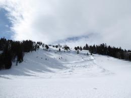
The mountains around Cooke City have a generally stable snowpack. This is not to say there are no problems, but they are isolated. Wind-loaded terrain may still harbor older slabs that could be triggered. On Daisy Pass on Sunday a sledder triggered an avalanche (photo 1, 2) on a wind-loaded slope. Slides like these are becoming more scarce, but steep, wind-drifted terrain is where one could be triggered. Without new snow, wind-loading or recent signs of instability, the danger is rated LOW.
Temperatures are forecasted to be cooler around Cooke City which will keep wet avalanches at bay. However, if the forecast is wrong and temperatures rise far above freezing, a few wet loose avalanches might be naturally triggered.
If you get out, please send us your observations no matter how brief. You can submit them via our website, email (mtavalanche@gmail.com), phone (406-587-6984), or Instagram (#gnfacobs).
The Beacon Park at Beall Park in Bozeman is running!
The Friends of the Avalanche Center in partnership with the City of Bozeman put in a Beacon Park at Beall Park. It is located on the north side of the Beall building between N. Bozeman Ave. and the ice rink. Stop by with your avalanche transceiver and do a few practice rescue drills. Your partner will thank you.
Upcoming Avalanche Education and Events
See our education calendar for an up-to-date list of all local classes. Here are a few select upcoming events and opportunities to check out:
Every Saturday in Cooke City, FREE snowpack update and rescue practice at the Round Lake Warming Hut between 10 a.m. and 3 p.m. Poster with More Info.
The video recording of Dave’s recent talk on “Rethinking Avalanche Terrain from a Strategic Perspective” is now available. It’s worth your time to watch it. There is a little something for everyone.